Download
1 / 44
460 likes | 578 Views
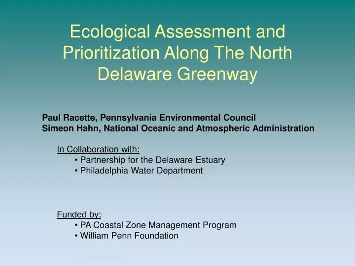
Ecological Assessment and Prioritization Along The North Delaware Greenway. Paul Racette, Pennsylvania Environmental Council Simeon Hahn, National Oceanic and Atmospheric Administration. In Collaboration with: Partnership for the Delaware Estuary Philadelphia Water Department. Funded by:

E N D
Ecological Assessment and Prioritization Along The North Delaware Greenway Paul Racette, Pennsylvania Environmental Council Simeon Hahn, National Oceanic and Atmospheric Administration • In Collaboration with: • Partnership for the Delaware Estuary • Philadelphia Water Department • Funded by: • PA Coastal Zone Management Program • William Penn Foundation
Connections to Greenway and Land/Water Trails Revitalization River recreation Green streets
Ecological Restoration and Enhancement • Ecological values, intrinsic and otherwise, that river provides: • Habitat and living resources • Urban reach stepping stones in regional habitat matrix • Shad, stripped bass, other recreational fishing opportunities. • Wildlife viewing, meditative-relaxing landscapes, boating • Other natural capital values (cultural, regulating and provisioning)
Frank Winfelder’s Birding list for Pennypack Park 146 species including herons, bitterns, sandpipers and other marsh loving birds Restore it and they will come!
Ecological Restoration and Enhancement Integrate with local actions Integrate with regional estuary restoration goals: A Blueprint for a Regional Restoration Initiative in the Delaware Estuary • Identify restoration needs and where project opportunities exist; • Case studies: Urban waterfront. Tidal wetlands. Shellfish. Headwaters. • Upper Estuary sub-workgroup within regional restoration workgroup. • Urban case study connections to regional habitat matrix
Study Area: New Frankford Creek- Betsy Ross Bridge to Poquessing Creek
CZM Ecological Assessment Project • Identify stakeholders • Gather existing data • Identify and fill data gaps • Identify, assess and prioritize restoration opportunities • Contact landowners (including early outreach) • Establish next steps (e.g. design, fund raising, land conservation, land owner agreement).
Current Partnerships DuPont: Financial support Partner network Technical resources Urban eco-restoration Brownfield redevelopment Database and mapping project Natural heritage inventory Delaware shoreline Brownfield's and land revitalization Eco-restoration Contract support (GIS maps) Estuary restoration Technical support Greenway Trail Goal: expand partnership to establish upper estuary ecological restoration work group(s) (address technical, policy, funding, and other issues)
Poquessing • Tidal wetland assessment and watershed registry • Watershed Partnerships • Poquessing • Pennypack • Tookany-Tacony Frankford • Delaware Direct River Conservation Plan Pennypack TTF
Blueprint Project Registry • Protection: • Water quality • Water quantity/flow • Land acquisition • Legal (e.g. regulatory buffer) • Habitat Restoration • Habitat Creation • Fauna enhancement • Fish passage (e.g. shad) • Physical protection • Stocking • Legal/quotas (e.g. ESA critical habitat) • Other
Habitat Restoration Types • Upland and river bank • Planting • Regrade and plant • Off channel aquatic • Wetlands in upland matrix • Floodplains • Backchannels and wetlands • Intertidal shoreline • Enhance wetlands • Soften bank, regrade • Excavate • Marsh sill or breakwater • Subtidal • Enhance structure and diversity
A Summary of Ecological Restoration Approaches • The habitat gradient: • Upland and river bank • Off-channel aquatic habitats • Intertidal high to low marsh • Sub-tidal Biohabitats concepts for Lardner’s Point
Upland and river bank • Intertidal high to low marsh Lardner’s Point and River’s Edge Memorial Newman and Kasper Philly Coke Off-channel aquatic habitats Bradford and Kasper Pennypack Sub-tidal Saint Vincent’s
Red Maple slippery elm Black Willow Sycamore cattails Arrow arum Wild rice spatterdock Pickerel weed White Oak Upland and river bank PDE Key to the Delaware Estuary Ecological Systems & Natural Communities: North Atlantic Coastal Plain Fresh and Oligohaline Tidal Marsh High marsh: vascular plants Photos from: Center for Coastal Resources Management (ccrm.vims.edu/livingshorelines/photo_gallery.html), Virginia Institute of Marine Science. USDA: http://plants.usda.gov Low marsh: succulent plants
Data Collection • Bathymetry and benthic classification • Shoreline type (engineered/natural) • Wetlands (freshwater tidal) • Species and habitat (fish, birds, other) • Vegetation • Site access (for restoration and public) • Contaminant proximity (CSO’s, hazmat, invasive) • Disturbance from wakes and currents • Operation/maintenance issues • Presence of cultural resources • Willing land-owners
Baseline GIS maps(EPA/SRA) • Wetlands • Shoreline • Flood plain • Vegetation communities • Navigation • Species • Slope • Point sources • Land use • Landowners • Proposed greenway buffer • Important Bird Areas (PA)
Data Gaps • Benthic substrate: mud, hard, cobble, … • Bathymetry: depth near shoreline
Prioritizing Restoration Projects • Before and after restoration score • Qualitative score (present or not present) • Habitats • Living resources • Site wide characteristics • Semi-quantitative Score (L, M, H) • Habitats • Living resources • Site wide characteristics • Human Recreational Use • Present use of river (e.g. shore fishing, some birding) • Restored uses: fishing, passive use, birding, and much more • Value Added Restoration Matrix • Quantify increase in ecosystem services
Hickory Shad Shortnose Sturgeon Great Blue Heron
American eel Egrets • Habitat preferences is a data gap. • Will tie specific habitat types to restoration needs.
Site-wide Criteria • Willing Landowner • Proximity to contaminants (CSO’s, brown fields, point sources, trash collection points, outfalls and intakes, and/or invasive plants). • Protection from wakes and currents. • Site accessibility: restoration crew/equipment. • Availability of follow-up O/M and stewardship. • Connectivity to other habitats. • Other?
Qualitative Score • Sites with most habitat and living resource features present (greater diversity) • Site-wide criteria provide green light: • Willing landowner • No adverse contamination
Semi-Quantitative Scores • Before and after scoring • Consider habitat, living resource, and site-wide factors • No opportunity (0) • L (1), M (2), or H (3) • Defining categories • Help from advisors • Most sites at 0 and 1; could go to 1, 2, 3. • Focus is on structure (habitat types)
Proposed Living Resource Scoring Factors • Presence of required habitat characteristics • Spawning, forage, refugia, migratory • Size of area • Quality of habitat • What other scoring factors? • Define L, M, H ranges
Recreational Use Assessment • Present use of river (e.g. shore fishing, some birding) • Restored uses: (e.g., fishing, passive recreation, birding, more boating, picnic, walking/hiking and more)
Add Scores • Wetland: • Non-tidal, high marsh, low marsh, submerged aquatic vegetation • 4 categories x 3 x 2 (scaling factor) = max score of 24 • Habitat diversity/landscape complexity: • Upland (mowed, meadow, scrub-shrub, canopy trees) • Tidal (mud flat, cobble beach, sand beach) • Subtidal (soft bottom, hard bottom-vertical relief) • 9 habitats x 3 = max score of 27 • Birds, mammals, and herps • 6 categories x 3 = max score of 18 • Fish and other aquatics • 5 categories x 3 = max score of 15 • Site wide scores • 5 categories x 3 = max score of 15 Maximum Ecological score = 99 Maximum Recreational score = 3 x 7 (scaling factor) = 21 Maximum total ecological and recreational scores = 99 + 21 = 120
Potential restoration activities Pleasant Hill Park Pennypack Park Saint Vincent’s K&T Trail N of Frankford Launch Bridesburg
Pennypack Park Help from Jessica
Saint Vincent’s Saint Vincent’s Metal Bank
K& T North of Frankford Boat Launch Wissinoming Creek Newman Trail right of way Kasper’s Enhance existing wetland Bradford Enhance river bank forests
Bridesburg Bridesburg (PIDC and Philly Coke) Grade to enhance existing wetland to include high/low marsh. Use existing remnant pier and other measures to protect/build intertidal wetland. Orthodox Street Consider mud flat bird habitat
Next steps • What do you think? • Expand Upper Estuary Restoration workgroup to address technical, policy, and funding issues. • Further develop BRM and VARM matrices to identify, assess, and rank suite of restoration opportunities in case study area. • Review regional habitat connections • Landowner outreach - promote restoration • Design and build projects • Greenway buffer proposals (50 to 100 feet) • Applications outside case study area.
Basic Restoration Matrix- Initial Living Resources & Habitat Scoring