1 / 34

Coasts

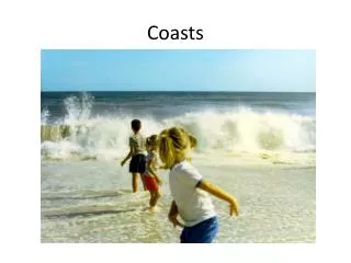
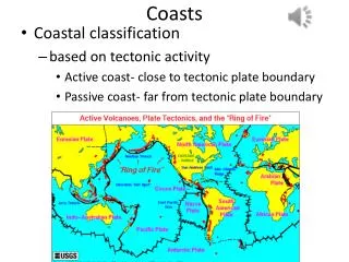
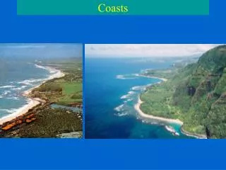
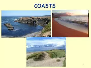
Coasts. Form of sediment is highly dependent on the effect of tides, wave activity and degree of clastic input from rivers.

mystery
Download Presentation

Coasts

An Image/Link below is provided (as is) to download presentation Download Policy: Content on the Website is provided to you AS IS for your information and personal use and may not be sold / licensed / shared on other websites without getting consent from its author. Content is provided to you AS IS for your information and personal use only. Download presentation by click this link. While downloading, if for some reason you are not able to download a presentation, the publisher may have deleted the file from their server. During download, if you can't get a presentation, the file might be deleted by the publisher.

E N D

Presentation Transcript


  1. Coasts Form of sediment is highly dependent on the effect of tides, wave activity and degree of clastic input from rivers. Microtidal coasts: Usually stormed dominated. Coastal areas are dominated by sandy barrier island features, elongate parallel to the coast. Length of island increases with decreasing tide strength. Reworked rapidly during storms that cause breaks in islands and wash over into the tidal lagoon. Storms are capable of washing large volumes of sediments out on the shelf, producing sheets 5-10 cm thick and up to 50 km across. Inlets through island migrate rapidly due to daily current activity, 10s of m per years. Sediments fine rapidly offshore into shelf muds. Modern examples: Dutch coast Texas Gulf Coast, Carolinas.

  2. Irish Atlantic coast, dune fields

  3. Macrotidal coasts: No barrier islands but instead tidal flats. Sandy sediments develop wave ripple lamination, large scale dunes around river estuaries. Mud flat develop sandy ridges (Cheniers) where occasional storms activity sorts and reworks the flat sediment. Reworking by burrowing organisms is common. Current directions vary within the tidal zone resulting in sands with cross bedding showing flow in two opposite directions. “Tidal bundles” are formed in inter-tidal zones, due to settling of mud drapes over sandy dunes and ripples during the high tide. Spring and neap tides of varying strength can be traced through the strength of development of the tidal bundles. Shallow offshore is characterized by sand ridges running parallel to the tidal flow. Modern examples, English Channel, Bay of Fundy Canada, East China Sea.

  4. Coastal zone morphology

  5. Beach erosion or sedimentation?

  6. Makran coast, an uplifting coastline

  7. Coastal sedimentology-only for the dedicated.

  8. Tidal ranges and coastal morphology

  9. Barrier island response to sealevel rise

  10. Tidal inlets, effect of tidal strength

  11. Barrier island response to storm

  12. Barrier island-wash-over fan

  13. Barrier island-inlet migration

  14. Barrier island-sealevel model

  15. Barrier island-differing responses to sealevel change

  16. Barrier island-storm erosion

  17. Galveston Island, map

  18. Galveston Island, barrier island

  19. Beach progradational stratigraphy

  20. Beach seasonal erosion example

  21. Beach seasonal erosion model

  22. Cape Hatteras, Barrier Island system

  23. Chesil beach, England, a classic storm beach

  24. Chesil beach, England, high wave energy coast

  25. Texas coast - sediment fining offshore

  26. Tidal dunes, Eastern England

  27. Sandy tidal flats - North Sea coast of England, macrotidal

  28. Tidal marshes - North Sea coast of England, macrotidal

  29. Tidal flat sediment types - 1

  30. Tidal flat sediment types - 2

  31. Tidal bundles - tidal sedimentation

  32. Tidal bundles - clay drape evidence of tidal sedimentation

  33. Herringbone cross bedding - tidal sedimentation

  34. Wave rippling-tidal flats

More Related