Download
1 / 39
400 likes | 577 Views
Plate tectonics. 5.1 Drifting Continents 1910 Alfred Wegener Hypothesized that all the continents were once joined together in a single landmass call Pangea and have since drifted This became known as CONTINENTAL DRIFT

E N D
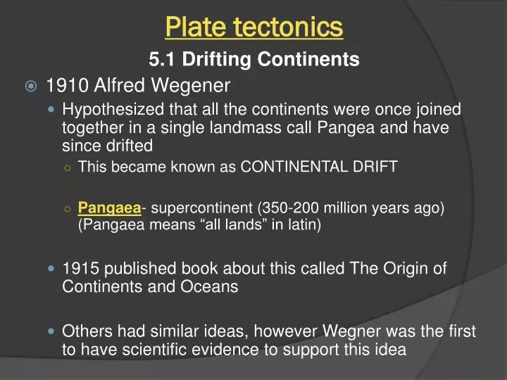
Plate tectonics 5.1 Drifting Continents • 1910 Alfred Wegener • Hypothesized that all the continents were once joined together in a single landmass call Pangeaand have since drifted • This became known as CONTINENTAL DRIFT • Pangaea- supercontinent (350-200 million years ago) (Pangaea means “all lands” in latin) • 1915 published book about this called The Origin of Continents and Oceans • Others had similar ideas, however Wegner was the first to have scientific evidence to support this idea
Plate tectonics Evidence for Continental drift 1.) Land features • Coastlines of some continents seemed to fit together like a jig saw puzzle • Mountain ranges in Africa line up with those in S. America • Coal fields in Europe and North America lined up Piecing It All Together The coastlines of some continents seem to fit together like a jigsaw puzzle.
Plate tectonics 2.) Fossils- any trace of an ancient organism that is preserved in rock • Glossopteris- fern like plant with leaves the shape of a tongue, live 250 million years ago • Found in Africa, South America, Australia, India and Antarctica • These land masses are now separated by oceans indicating that Pangea once existed • Mesosaurus and Lystrosaurus- fresh water reptiles • Fossils found in places separated by oceans • Neither reptile could have swum that great of a distance in salt water • These reptiles lived on a single landmass that split apart
Plate tectonics 3.) Climate • Continents near the equator have a warm climate • Continents near the poles have a colder climate • When these continents move, north or south, they take the fossils and rocks that formed in the past with them • Fossils of tropical plants found on an island in the arctic ocean • Scratches in rocks made by glaciers found in South Africa
Pangaea and Continental Drift Many types of evidence suggest that Earth’s landmasses were once joined together.
Plate tectonics • Continental Drift—REJECTED • Wegner provide supporting evidence to the continental drift theory BUT…. Could not identify the mechanism that cause the plates to move (the force that caused the push or pull) because of this, most geologist rejected his theory
Plate tectonics 5.2 and 5.3 Sea floor Spreading and The theory of Plate Tectonics • Plate- A section of the lithosphere that slowly moves over the asthenosphere, carrying pieces of continental and oceanic crust • Theory of Plate Tectonics- Earth’s plates are in slow, constant motion, driven by convection currents in the mantle. • Explains formation, movement and subduction of Earth’s plates • Subduction-the process by which gravity pulls denser plate edges downward into the mantle. Earth’s Plates Plate boundaries divide the lithosphere into large plates. Faults-breaks in the Earth’s crust where rocks have slipped past each other, form along these boundaries
Plate tectonics Plate motion over time • Satellites are used to measure plate motion precisely. • Plates move very slowly – 1-12 cm per year • North American and Eurasian plate move 2.5 cm/year • This is about the same speed in which your fingernails grow • Although very slow the plates have been moving for hundreds of millions of years, they have moved great distances. • Plate Motion Since the breakup of Pangaea, the continents have taken about 200 million years to move to their present location. 200 Million Years Ago 115 Million Years ago Earth Today • As the plates move, they create earthquakes, volcanoes, mountain rangesanddeep ocean trenches
Plate tectonics Plate Boundaries • Divergent Boundaries-two plate slowly move away from each other • Most occur at mid ocean ridges (divergent boundary in ocean)-new crust is added during sea floor spreading • ex. Mid Atlantic Ridge, Atlantic Ocean • Rift Valley- divergent boundary on land • ex. East African Rift System, Africa • Mid Ocean Ridge (MOR)- An undersea mountain chain where new ocean floor is being produced, created at divergent boundaries • Mid 1900’s sonar was used to map ocean floor • Sonar uses sound waves to measure the distance to an object • MOR lie under thousands of meters of water • MOR extend into all oceans • Steep sided valley, called the Central Valley, splits the top of some MOR • MOR make up the longest mountain ranges on Earth
Plate tectonics Sea Floor Spreading- the process by which molten material adds new oceanic crust to the ocean floor • This occurs at mid-ocean ridges(MOR) • How sea floor spreading works: • MOR form crack in the oceanic crust, called central valley (see pic. on previous slide) • Along the ridge, molten material from inside Earth rises, erupts, cools and hardens to form a solid strip of rock • Sea Floor spreading adds more crust to the ocean floorwhile older strips of rock move outward from either side of the ridge Does the ocean floor just keep growing and growing? NO! On the opposite side, the ocean floor plunges into deep ocean trenches, sinking back into the mantle This is called SUBDUCTION
Plate tectonics Evidence of Sea Floor Spreading • Ocean Material • Pillow Basalt--In central valley of MOR, scientists have found pillow shaped rocks—this happens only when molten material hardens very quickly after erupting under water • Magnetic Strips • As molten material cools, magnetic minerals inside rock line up in direction of the Earth’s magnetic poles • Forms “unseen” magnetic stripes on ocean floor. • Pattern of magnetic stripes is mirror image on opposite side of MOR—this shows that two sides of ridge spread out at the same time and rate • Magnetic Poles reverse themselves—each stripe shows a period when molten material erupted and hardened and magnetic poles did not change
Plate tectonics Evidence (cont.) • Drilling samples • Scientists drilled into the ocean floor • Farther away the sample was taken from the MOR, the older the rock was • Youngest rocks were found at the center of the MOR • The rocks age shows that sea floor spreading occurs
Ocean Floors Mid-ocean ridges rise from the sea floor like stitches on the seams of a baseball. Mid-Ocean Ridges
Plate Tectonics • Convergent Boundary-boundary where two plates collide or come together • Density of plates determine which one comes out on top • Three types of convergent boundaries 1.) Oceanic-Oceanic-the one that is more dense will sink beneath the one that is less dense • often forms island arc-volcanoes which erupt through the overriding plate as the descending plate melts below it • Ex. Aleutian Islands of Alaska 2.) Oceanic-Continental-oceanic crust is more dense so it will sink below continental • Mountains (Andes) and volcanoes can form • Water leaves sinking crust, rises into wedge of mantle above it, the water lowers the melting point of the mantle, mantle partially melts and volcano forms • Ex. Andes Mountains • Deep ocean trenches-A deep valley along the ocean floor beneath which oceanic crust slowly sinks toward the mantle ***Trenches generally run parallel to volcanic island arc’s
Plate tectonics • Subduction-the process by which oceanic crust sinks beneath a deep-ocean trench and back into the mantle at a convergent boundary • New crust is hot—less dense • Old crust is cool—more dense • Cool, dense crust of ocean might collide with edge of continent • Gravity pulls the older, more dense oceanic crust down beneath the trench into the mantle • Sea Floor spreading and subduction: • work together • change the size and shape of the oceans • They move the ocean floor like a large conveyor belt. • Size determined by how fast new crust is being created and old crust being swallowed • Ocean surrounded by many trenches—may shrink • Ocean with few trenches—will probably grow larger (Atlantic p. 173)
Subduction Oceanic crust created along a mid-ocean ridge is destroyed at a deep-ocean trench. During the process of subduction, oceanic crust sinks down beneath the trench into the mantle.
Plate tectonics Convergent Boundaries (cont.) • Continental-Continental-neither is dense enough to sink into mantle, mountains form • Ex Indian Plate and Eurasian plate collide to form Himalayans Transform Boundaries-place where two plates slip past each other, moving in opposite directions. • Plates are rocky and jagged, and get “stuck”, forces inside Earth cause plates to become “unstuck”, sudden release of energy in the form of an earthquake • Crust is neither created nor destroyed. • Ex. San Andreas Fault in California
Plate tectonics Forces in Earth’s Crust Stress- A force that acts on a rock to change its shape
Plate Tectonics Stress in Earth’s Crust Stress can push, pull, or squeeze rock in Earth’s crust. Three kinds of stress can occur in the crust.
Plate Tectonics Fault-A break in Earth’s crust along which rocks move. Types of Faults Normal Fault-due to tensional stress, hanging wall moves down, footwall moves up Reverse Fault-due to compressional stress, hanging wall moves up, footwall moves down Strike Slip Fault-due to shear stress, no hanging wall or footwall, rocks on either side move past each other sideway with little up or down motion **A Thrust Fault is a Reverse Fault with a low angle
Plate Tectonics Folding of Earth’s Crust • Fold = Bends in Earth’s crust due to compression • causes crust to become shorter and thicker • Anticline-fold that bends upward into an arch • Syncline-fold that bends downward to form V-shape • Appalachian Mountains in PA are anticlines and synclines • The collision of two plates causes this folding which creates FOLDED MOUNTAINS such as • Himalayas (Asia), Alps (Europe)
Plate Tectonics Anticlines and Synclines Compression can cause folds in the crust. Two types of folding are anticlines, which arch up, and synclines, which dip down.
Plate Tectonics Stretching Earth’s Crust Fault Block Mountains 1.) Two plates move away from each other 2.) Normal Faults created on either side 3.) Hanging wall on each side drops down 4.) Block in between stands above surrounding valleys. Tension and Normal Faults As tension forces pull the crust apart, two normal faults can form a fault-block mountain range.
Plate Tectonics Tension and Normal Faults What are the hanging wall and the two footwalls in diagram A? What is the new position of the hanging wall after movement occurs in diagram B?
Plate Tectonics Uplifting Earth’s Crust Plateau-A large landform that has high elevation and a more or less level surface above sea level • Cause by the same forces (uplift) that causes mountains **it is wider than it is tall The Kaibab Plateau Look at the sequence of drawings. In your own words, describe what happens in the last two diagrams.
Plate Tectonics Earthquakes (EQ) Earthquake-vibration of Earth produced by the rapid release of energy **caused by a slippage along a fault Focus-The point within the Earth where the EQ starts -energy radiates in all directions in the form of waves Epicenter- location on the surface of the Earth directly above the focus Seismologist-person who studies EQ Seismograph- instrument that records EQ waves
Plate Tectonics Earthquakes produce two types of waves • Surface waves-move along Earth’s surface, move up and down and side to side, most destructive waves • Body waves 1.) P (primary) waves- • Longitudinal or compression waves (or push pull waves) • particles move in the same direction (parallel to) direction the wave is traveling • like slinky • Can travel through solids and liquids 2.) S (shear) waves- • transverse waves move particles at right angles (perpendicular) to material • Like jump rope • CANNOT Travel through liquids or gases, only through solids • Travel time: • In order from fastest to slowest • P wave, S wave, surface wave
Plate Tectonics Locating an Earthquake: 1.) EQ Distance- Compare the difference in speed of P and S wave to find the distance traveled • The greater the difference in arrival time, the greater the distance to the epicenter • Use a travel-time graph to find how far the epicenter is • First, find the time interval between the arrival of the first P and the first S wave • Second, find the time spread between the P and S wave curve • This will tell you distance from the epicenter to the seismograph for that location • BUT we do not know in what direction!
Plate Tectonics • Travel-timegraph can tell you distance to the epicenter but it does not tell us in what direction • To find the exact location, travel-timegraphs from three or more seismographs are needed
Plate Tectonics We now know distance but the EQ could be in any direction from the seismic station. 2.) EQ direction To find the exact location, time-travel graphs from three or more seismographs are needed • Draw a circle around each seismic station • each circle represents the distance of the epicenter to each station • The point where the three circles intersect is the epicenter of quake.
Plate Tectonics Locating the epicenter with data from three seismographs 1st circle – tells you ALL possible epicenters for that city 2nd circle- narrows down possible location of epicenter to TWO locations (where the two circles intersect) 3rd circle- pinpoints the location of the epicenter (where all three circles intersect)
Plate Tectonics Measuring Earthquakes Scientists have used two different types of measurements to describe the size of an earthquake 1.) intensity-(qualitative) measure of amount of shaking based on amount of damage for a given location 2.) magnitude-(quantitative) rely on calculations using seismograms, measures size of seismic waves or amount of energy released. • Richter Scale-size of seismic waves • based amplitude of largest seismic wave recorded on a seismogram • useful for small shallow EQ within 500 km of epicenter • Familiar but outdated-used on news reports but not by scientists • Moment Magnitude-estimates energy released • Based on the amount of displacement that occur along fault zone • The average movement along the fault • The area of the surface break (Surface area of fault) • strength of rock broken (rigidity of rock) Earthquake Hazards- • Damage depends on intensity and duration of vibrations, material on which buildings are constructed, design of the building • Liquefaction-soils and other unconsolidated materials saturated with water are turned into a liquid that is not able to support buildings. • Tsunamis-Japanese word for seismic sea wave • Landslides • Fire
Plate Tectonics Volcanoes and Plate Tectonics Volcano-a weak spot in the crust where magma has come to the surface Magma-molten mixture of rock-forming substances, gases and water from the mantle Lava-liquid magma that reaches the surface • Volcanoes form along boundaries of Earth’s plates • Divergent Boundaries-fractures allow magma to reach Earth’s surface • Convergent Boundary- • Oceanic/oceanic-subduction occurs, water from crust leaves and rises in wedge of mantle causing melting point of mantle to decrease resulting in melting. Melted magma breaks through ocean floor creating volcanoes • Island Arc is formed-string of volcanoes that form as the result of subduction of one oceanic plate beneath another oceanic plate • Aleutian Islands of Alaska • Oceanic/continental- oceanic plates subducts beneath continental plate • Andes Mountains, Mt. St. Helens, Mount Rainer • Hot spots- • A volcano forms above a hot spot when magma erupts through the crust and reaches the surface • Hawaiian Islands
Plate Tectonics The Ring of Fire The Ring of Fire is a belt of volcanoes that circles the Pacific Ocean. As with most of Earth’s volcanoes, these volcanoes form along boundaries of tectonic plates. Hot Spot The Hawaiian Islands have formed one by one as the Pacific plate drifts slowly over a hot spot. This process has taken millions of years. Volcanoes and Converging Boundaries Volcanoes often form where two plates collide.
Plate Tectonics Volcanic Eruptions What happens? • Magma forms in asthenosphere just below lithosphere • Magma is less dense (its hot) so it rises into tiny cracks, if it reaches surface, a volcano can form Inside a volcano • Magma chamber-pocket beneath a volcano where magma collects • Pipe-long tube through which magma moves from the magma chamber to Earth’s surface • Vent-opening where molten rock and gas leave • Lava flow-area covered by lava as it pours out of a volcano’s vent • Crater-bowl shaped area that forms around a volcano’s central opening Inside a Volcano A volcano is made up of many different parts.
Plate Tectonics Volcanic Eruption • When a volcano erupts, the force of the expanding gases pushes the magma from magma chamber pipe vent Two types of eruptions (determined by silica content) Silica-material found in magma, composed of oxygen and silicon, primary substance of crust and mantle • Quiet-magma is hot or low in silica, gases escape slowly, lava oozes quietly from vent, can flow for many Km • Forms two types of rock • Pahoehoe- from fast moving, hot lava that is thin and runny • Aa-from cooler, thicker lava that is slower moving • Quiet eruptions are responsible for building Hawaii • HAZARD—sets fire to and burns everything in its path, can cover large areas with a thick layer of lava • Explosive-thick, sticky magma that is high in silica • Magma can build up in pipe and get stuck like a cork, pressure builds up from gases and eventually there is an explosion, gases push magma out with great force • Lava is thrown powerfully into air, breaks into pieces that cool and harden quickly • Ash- smallest particles, fine, like dust • Cinders-pebble sized particles • Bombs-golf ball to car sized • Pyroclastic flow- The flow of ash, cinders, bombs, and gases down the side of a volcano during an explosive eruption. • HAZARD—landslides of mud, melted snow and rock
Plate Tectonics Types of Volcanoes • Shield • built almost entirely of fluid lava flows • gently sloping cone of flat, domical shape, with a profile much like that of a warrior's shield • They are built up slowly by the accretion of thousands of highly fluid lava flows called basalt lava that spread widely over great distances, and then cool as thin, gently dipping sheets. • Hawaiian Islands are composed of linear chains of these volcanoes including Kilauea and Mauna Loa on the island of Hawaii-- two of the world's most active volcanoes. • Stratovolcano-(strata = layers) • steep-sided, symmetrical cone shape • HUGE- may rise as much as 8,000 feet above their bases • built of alternating layers of lava flows, volcanic ash, cinders, blocks, and bombs • tend to erupt explosively and pose considerable danger to nearby life and property. • Mount Fuji in Japan, Mount Cotopaxi in Ecuador, Mount Shasta in California, Mount Hood in Oregon, and Mount St. Helens and Mount Rainier in Washington. • Cinder Cones- • simplest type of volcano • built from particles and blobs of congealed lava ejected from a single vent • As the gas-charged lava is blown violently into the air, it breaks into small fragments that solidify and fall as cinders around the vent to form a circular or oval cone. • Most have a bowl-shaped crater at the summit and rarely rise more than a thousand feet or so above their surroundings. • western North America
Plate Tectonics Stages of Volcanic Activity • Active-live volcano, is erupting or has shown signs it will erupt in the near future • Dormant- sleeping volcano, not currently active but able to become active • Extinct- dead volcano, no longer active and is unlikely to erupt again • Prediction- not possible butGeologists monitor • Surface changes in elevation and tilt with tiltmeter • Amount of escaping gases • Small earthquakes that occur around volcano • Rising temperatures in ground water