Download
1 / 16
160 likes | 240 Views
Use of Maps for Identifying Regulated Wetlands in Vermont. Comments by Ralph Tiner U.S. Fish & Wildlife Service. Basic Questions. Does the State want to regulate all wetlands or only a subset deemed “significant”?

E N D
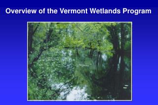
Use of Maps for Identifying Regulated Wetlands in Vermont Comments by Ralph Tiner U.S. Fish & Wildlife Service
Basic Questions • Does the State want to regulate all wetlands or only a subset deemed “significant”? • If latter, what wetlands should really be classified as “significant” from a function and value perspective? • Should size and connectivity be considered? If so, is there any concern about vernal pools and other small wetlands (e.g., bog or fen)?
Comments re: Maps • If the State wants to regulate all wetlands, then maps would be strictly for guidance as it is virtually impossible to map all wetlands. • If regulating the “significant” subset, need to know criteria for determining significance…would help in identifying best approach for mapping them.
Options for Using Maps for Regulatory Purposes • Show “official boundaries” • Show “significant wetlands” with boundaries refined on-the-ground • Use as guidance only to show locations of areas that may be regulated
Option 1 • Maps show official boundaries with minimal changes in the field • Best if only looking to regulate wetlands that can be readily mapped through remote sensing • How does that relate to “significant” criteria? • Best done with large-scale photography (or digital imagery) but expensive (photography, interpretation, and field verification costs) • Still many wetlands will be difficult to delineate with precision
Option 2 • Show “significant” wetlands and refine boundaries on-the-ground • May be current practice • Informs public on where regulatory wetlands are (generally) • Workable, but issues of connectivity and actual boundaries require field resolution • Maps need improvement, probably should be liberal as they serve to target areas where project-specific determinations/delineations would be required • Need to update maps based on field inspections (GPS)
Option 3 • Use maps for guidance only • Basic federal regulatory approach • All mapped wetlands are potentially significant, need to determine “significance” on a case-by-case basis • Will areas not mapped be regulated if they meet “significance” criteria? How and who determines this? • Alerts the public to potential areas of jurisdiction, but questions remain as to whether wetland is significant or not, and whether areas not mapped are regulated • How does one evaluate program effectiveness?
Improved Maps • Regardless of proposed use, maps must be improved • Outdated • Source data limited by scale and image quality and late 1970s knowledge of wetlands • Shallow water wetlands were not transferred in preparing the Vermont significant wetlands maps
Goals for Improving Maps • Reflect current-day conditions • Identify more “significant” wetlands • More accurate boundaries • Produce wetland data in digital form for easy updating in future • Add Vermont stream locations • Make data available online
Option 1 Add hydric soil map units and shallow water wetlands to existing Vermont significant wetland inventory (VSWI) maps • Short-term fix doesn’t bring data up-to-date • Too generalized • Will include many areas where wetlands don’t exist
Option 2 Use updated NWI data when available to improve VSWI maps • Half of state already updated with NWI • Will show more wetlands • What “significant” wetlands are missed? • No schedule for updating NWI maps for rest of state (State can fund remainder) • Can be accomplished in one to two years (if funding is available) • Data could be made available online
Option 3 Use updated NWI + “undeveloped” hydric soil map units to improve VSWI maps • Shows wetlands and potential wetlands (lands with potential for regulation) • Add Vermont stream data (connectivity) • Half of state already updated with NWI • Will show more wetlands • What “significant” wetlands are missed? • No schedule for updating NWI maps for rest of state (State can fund remainder $440K) • Can be accomplished in two years if funding is available • Also can update NWI with Vermont 2003 1-m digital imagery or newer photography (added $s)
Option 4 Prepare town-by-town or county-by-county maps • Most detailed maps depending on source imagery • Town participation (could add to town master plans?) • Costly and time consuming • State project management and oversight • Will take several to many years to complete
Option 5 Update NWI statewide and do detailed mapping in specific areas as needed (combination of Options 3 and 4) • Could have statewide 2003-era mapping finished in two years ($700K) • Produce detailed data where needed as time and funding permits • Can update NWI with newer photography as needed • Should do pilot study to compare detailed vs. NWI to understand the difference (product/$).
Option 6 Produce “zoning” maps showing areas where wetlands may occur and where wetland determinations/delineation will need to be performed • Like Option 3 but can be broader • Shows public where regulations apply • Field evaluations (determinations/delineations) required for any “regulated activity” in the designated zone
Possible Short-term Solution to Improving VSWI Mapping • Within one year: • Combine updated NWI maps with “undeveloped” hydric soil map units and identify “significant” wetlands • For other areas, take original NWI data, add “undeveloped” hydric soil map units and identify “significant” wetlands • Later • Finish updating NWI statewide and bring data up to 2003/4 era and determine if more detailed mapping is required in some areas