Download
1 / 54
650 likes | 1.08k Views
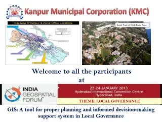
GIS: A tool for proper planning and informed decision-making support system in Local Governance. Kanpur Municipal Corporation (KMC). Areal View of Civil Lines Area. Welcome to all the participants at. THEME: LOCAL GOVERNANCE. Local Government – Local G-Governance.

E N D
GIS: A tool for proper planning and informed decision-making support system in Local Governance Kanpur Municipal Corporation (KMC) Areal View of Civil Lines Area Welcome to all the participantsat THEME: LOCAL GOVERNANCE
Local Government – LocalG-Governance • Kanpur Municipal Corporation- An Introduction • Why use GIS in Local Governance ? • Use of GIS in KMC and it’s Future, • Stimulate ideas, discussion & debate. About me U.N.Tiwari Additional Municipal Commissioner, Kanpur Municipal Corporation, Motijheel, Kanpur-208002, (U.P.), India Phone:+91512-2551416, 2546194Fax: +91512-2531662, Mobile No: 08601833333E-mail: kanpur_nagar.nigam@yahoo.co.inmckanpur@yahoo.comudai_amna@rediffmail.comWebsite: http://kmc.up.nic.in
About Kanpur • Located in the State of Uttar Pradesh. • Situated along the River Ganga. • Leather Capital of India KANPUR
About Kanpur Municipal Corporation Administrative Divisions Zones - 6 (with 18/19 wards) Wards - 110 Population - 27.74 Lakhs. ( 2011 census) Area - 260 Sq.K.m
GISGeographical Information System • Geography – Space (Importance of space) • Information – Data and its meaning • System – Electronic tool to help analyze space and data, thus identifying gaps with ease GIS IS A PLANNING TOOL
Why use GIS in Local government? • 24/7 ready Digital Map, • Planning Tool • Can display the problems and the solutions on maps To Promote – • Transparency/Accuracy/Productivity • Efficiency /Quality • Equality • Revenue • Accountability
An Emotional experience of kmc-geo spatial project KMC Property tax management system using Geospatial technology (GIS Based Revenue Enhancement Project)
Use of GIS and ICT Tools We have read stories of treasure hunt. The TOOLS needed for hunt were:- a PROBABLE target place of treasure, strategic INFORMATION to reach the target either in the form of some script / geographical map or some verbal tips. The treasure hunter had to encounter spider net, the hurdles. This net used to give him hope; that She/he is very near to the hidden treasure An age old practice
Concept of the project…. Conceptualization of this project In a training/ orientation program at INDIAN INSTITUTE OF PUBLIC ADMINISTRTION (IIPA) New Delhi
An integrated concept • Procurement of satellite images • Ground survey based Geo-rectification of the satellite image • Updation and migration of existing GIS data set using QB image • Contact survey to collect details for every property unit • Spatial ground survey • Spatial and non-spatial data link to create spatial property database • Development of web GIS system for online property tax calculation and payment • Development of desktop application for property database repository management and tax assessment • Training KMC Personnel • Renumbering of properties with unique premises no. as prescribed in Modern Municipal law and fixing of house number plates at the cost of owner/occupier
Major Components of the Project GIS Based Property Survey Desk Top Application Central Repository Web Site GIS dataset
the Success of the this project is because of … Continuous stepwise consultation With Various stakeholders State Government Taxpayers Ward-wise Hon. Courts Political leaders Corporation Board Revenue inspectors and municipal officers Ward members
Property Tax ReformIntense Discussion in the Kanpur Municipal Corporation Board
additional revenue generation Property Tax Enhancement After GIS Till 31/03/2012
Already Used GIS in various activities….. • GIS Map used in – • By Kanpur Municipal Corporation (KMC) for planning and revenue generation through Property Tax. • Delimitationof KMC Wards • Ward wise Backward Population Survey • BPL (Below Poverty Line) Survey • For planning, design/implementation of water • supply & sewerage projects under JNNURM. • By Kanpur Electric supply Company (KESCO) for power • distribution planning and revenue generation. • Census -2010-11 For enumerator block boundaries • For Development of City Mobility Plan by U.M.T.C
To Promote –Transparency/Accuracy/Productivity • e.g. GIS Map used By Kanpur Municipal Corporation (KMC) for planning and revenue generation through Property Tax.
To Promote – Efficiency /Quality Delimitation of KMC Wards
To Promote – Efficiency /Quality Ward Status after Delimitation
Improve operations such as vehicle routing for reduced fuel consumption and emissions
GIS used for demarcation of Sewer & Drain Connection • Ward Map- 2012 • Toilet Connection • Drain Connection
Others uses of GIS in Local Governance • As planning and monitoring tool • Engineering- Roads, Drains, Fly Over's, ROB, Under pass • Health & Sanitation- Coverage, Beats, Locations of Bins & Containers, GPS based Vehicle Tracking System, • Parking- Locations • Traffic- Movement & Planning, Marking of Vending activity. • Disaster Management- Map based Information • JalKal- Water & Sewer Lines • Advertisement- Locations, suitability, revenue monitoring,
We can use GIS in Engineering Department • Measurement of road length & width. • Year wise marking of constructed roads and drains & Cost. • Linking of MIS data & picture of the road with spatial data (Map).
We can use GIS for Health & Sanitation Department (Waste container location) SWM Containers Location Map
We can use GIS Map’s for Traffic • We have used GIS Map’ for Development of Comprehensive Mobility Plan by U.M.T.C • We can use GIS Map’s for identify/making • No Vending Zone. • No Tempo Zone. • One way Traffic etc
Plan Of Kanpur Comprehensive Mobility
We can use GIS Map’s for Disaster Management plan MAPPING OF URBAN POOR AREAS
We can use GIS tool for Revenue Enhancement through Advertisement……