Download
1 / 23
230 likes | 320 Views
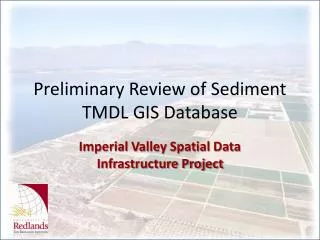
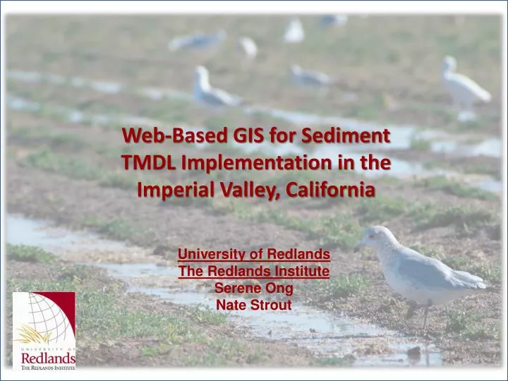
Web-Based GIS for Sediment TMDL Implementation in the Imperial Valley, California. University of Redlands The Redlands Institute Serene Ong Nate Strout. Presentation Overview. Project Objectives and Process Review Preliminary GIS Database Review prototype web-based tools.

E N D
Web-Based GIS for Sediment TMDL Implementation in the Imperial Valley, California University of Redlands The Redlands Institute Serene Ong Nate Strout
Presentation Overview Project Objectives and Process Review Preliminary GIS Database Review prototype web-based tools
Imperial Valley – Geographic Context Arizona Los Angeles California Palm Springs Salton Sea Colorado River San Diego Calexico U.S. Mexicali Mexico Tijuana Pacific Ocean Gulf of California
Watershed Assessment • •6,257 fields • •1,406 miles of drainage • channels • •175 drain discharge • points • •100 miles of river • •500 square miles of • surface area of the Salton • Sea (326,000 acres) • No outlet from the Salton Sea • State implemented TMDL for TSS of 200 mg/L in 2001/02 Whitewater River 7% Other inflow 1% Alamo River 45% Agricultural runoff Rainfall 3% Agricultural Drains 8% New River 32% Groundwater 4% Urban runoff
Stakeholders • State Water Resources Control Board (SWRCB) • Regional Water Quality Control Board (RWQCB) • Imperial Irrigation District (IID) • Imperial County Farm Bureau (ICFB) • Communities and wildlife around Imperial Valley and Salton Sea
Project Objectives Anticipated Outcomes • Support SWRCB, RWQCB, IID and ICFB with sediment TMDL implementation and compliance. • Provide better access to water quality and farm practices data. • Develop GIS database and web map application, custom query and report tools • More efficient use of existing information • Increased use of monitoring and related data for TMDL management/research • Standard methods for collecting, formatting and reporting water quality related data
Database Design Objectives • Incorporate data from various agencies • Comply with the State Water Resources Control Board (SWRCB) Surface Water Ambient Monitoring Program (SWAMP) standards • Support analysis and reporting requirements
Database Development Process Stakeholder Survey • Bureau of Reclamation • Department of Pesticide Regulation • California Department of Water Resources • State Water Resources Control Board • Imperial County Agricultural Commission • Imperial County Farm Bureau • Imperial Irrigation District • International Boundary and Waters Commission • Regional Water Quality Control Boards (3, 5, 7) • Salton Sea Authority • University of California Davis Cooperative Extension
Database Development Process – Data Sources Stakeholder Survey Data Inventory and Assessment Over 300 Unique Datasets Identified
Database Development Process Stakeholder Survey Data Inventory and Assessment Reformatting data for GIS Coding flow direction Data Compilation/ Conversion Fixing errors in spatial data Water quality data index Creating basic metadata
Database Development Process Stakeholder Survey Conceptual Database Schema Data Inventory and Assessment Data Compilation/ Conversion Database Design/ Development
Making a Database Compliant • Obtain the data • Process the data • Code flow direction, map field names and data types to SWAMP standard fields and data types • Crosswalk data from various tables • Include all required SWAMP tables and fields • Create links and relationships among tables
Schema diagram Cadastral - Owner - Operator Hydrology Network Features Water Quality Analysis Agricultural Practices
Database Development Process Stakeholder Survey Data Inventory and Assessment Load Duration Curves Data Compilation/ Conversion Time Series Animations TSS and Turbidity Trends Database Design/ Development GIS Database Poster Analysis and Visualization Products Statistical analysis of BMP-TSS relationships
Hydrology Features • Schema based on NHD • Compilation of Imperial Irrigation District (IID) and NHD linework • Rivers • Canals • Drains • Flow Direction
Agricultural Features • Gates • Inflow point • Tailwater Boxes • Runoff point to drain • Plot delineation • Land fed by a single gate
Monitoring Stations • Location Sources: • RWQCB:Region 7 • SWAMP • Imperial Irrigation District (IID) • USGS (flow)
Drainsheds • Collection of plots monitored by a single RWQCB water quality monitoring station
Agricultural Practice Information • Reported by farmers to Imperial County Farm Bureau under the ICFB Voluntary TMDL Compliance Program • Owner & operator information • Best Management Practices (BMPs) • Crop types • NPS problems • Site conditions For more information on the TMDL Compliance Program please visit http://www.ivtmdl.com/
http://www.institute.redlands.edu/ivsdi • Technical Details: • Application developed using ArcGIS Server.NET Web ADF 9.2 • Data stored in ArcSDE 9.2 on SQL Server 2005 • *This is a Beta application Demo of Web-based GIS and reporting tools
Next Steps Process for data update and maintenance Policies for data sharing/ reporting and security Web-GIS deployment/ testing Web-based GIS and TMDL analysis tools Outreach/ training materials Feedback and refinement of draft GIS Training and hand-over to long-term steward Document future data and analysis needs
Thank youhttp://www.institute.redlands.edu/ivsdi Serene Ong serene_ong@redlands.edu Nathan Strout nathan_strout@redlands.edu