Download
1 / 1
10 likes | 128 Views
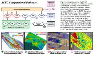
U SE IT Development Team 1 Creation of additional Geographic Information Systems (GIS) capabilities, added support for new earthquake catalogs for the SCEC-Virtual Display of Objects (SCEC-VDO) software and improved functionality of existing SCEC-VDO plugins .

E N D
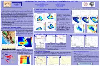
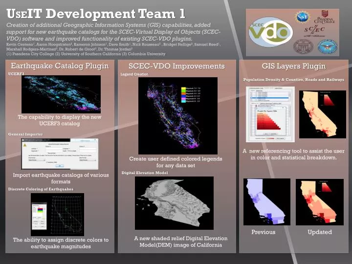
USEIT Development Team 1 Creation of additional Geographic Information Systems (GIS) capabilities, added support for new earthquake catalogs for the SCEC-Virtual Display of Objects (SCEC-VDO) software and improved functionality of existing SCEC-VDO plugins. Kevin Centeno1, Aaron Hoogstraten2, Kameron Johnson1, Dave Smith1, Nick Rousseau2 , Bridget Hellige2, Samuel Reed1, Marshall Rodgers-Martinez3, Dr. Robert de Groot2, Dr. Thomas Jordan2 (1) Pasadena City College (2) University of Southern California (3) Columbia University Earthquake Catalog Plugin UCERF3 General Importer Discrete Coloring of Earthquakes SCEC-VDO Improvements Legend Creation Digital Elevation Model GIS Layers Plugin Population Density & Counties, Roads and Railways The capability to display the new UCERF3 catalog A new referencing tool to assist the user in color and statistical breakdown. Create user defined colored legends for any data set Import earthquake catalogs of various formats Updated Previous A new shaded relief Digital Elevation Model(DEM) image of California The ability to assign discrete colors to earthquake magnitudes