Download
1 / 8
80 likes | 85 Views
When it comes to the maintenance and upkeep of critical infrastructure throughout the United Statesu2014i.e. roads, bridges, highways, rail lines, etc.u2014private and public agencies face huge workloads each day. Recent studies found over 54,000 bridges in need of repair across the U.S. alone. And the fact that there exist approximately 137,000 route miles of rail network and 4,071,000 miles of roads across the country, all of which require consistent maintenance and upkeep, further highlights the importance of this work. <br><br>

E N D
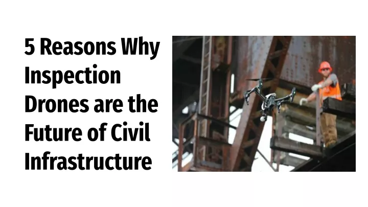
5 Reasons Why Inspection Drones are the Future of Civil Infrastructure
When it comes to the maintenance and upkeep of critical infrastructure throughout the United States—i.e. roads, bridges, highways, rail lines, etc.—private and public agencies face huge workloads each day. Recent studies found over 54,000 bridges in need of repair across the U.S. alone. And the fact that there exist approximately 137,000 route miles of rail network and 4,071,000 miles of roads across the country, all of which require consistent maintenance and upkeep, further highlights the importance of this work. But the emergence of drone technology has helped many Departments of Transportation (DOTs) tackle the ever-increasing demands of infrastructure maintenance. Here are five reasons why infrastructure inspection drones are the future of civil infrastructure.
DOTs Use Drones To Improve Workplace Safety and Efficiency A recent survey conducted by the American Association of State Highway and Transportation Officials (AASHTO) found that seventeen state DOTs had conducted studies on drone use in their transportation sectors. Their research showcased the ways in which drones assisted with things from accident clearance to bridge inspections, and even the surveying, identifying, and monitoring of risks posed by flooding and rockslides. After the studies yielded such promising results, sixteen of the state agencies decided to further pursue exploration into the technology. The Kansas Department of Transportation, for example, has begun testing drones for tower and bridge inspections. Elsewhere, DriveOhio and the Ohio UAS Center are developing new strategies to support unmanned aircraft systems research and development. Such developments have also spurred eleven offices within the Georgia Department of Transportation to consider adopting drone technology into their maintenance strategies. And as more DOTs across the country follow this trend, the widespread adoption of this technology will only become easier and more lucrative.
The NTSB Considers Drone Adoption Essential for Infrastructure An independent, federal agency in its own right, the National Transportation Safety Board (NTSB) investigates accidents ranging across many aspects of transportation, including highway, aviation, rail, pipeline, hazardous material, and marine. They work outside of the FAA and DOT, and yet have come to the same conclusion regarding the necessity of drones for infrastructure inspection. According to Bill English, Investigator in Charge in the Office of Aviation Safety at NTSB, “[Wreckage surveyors] are now able to use the drone to make very accurate and complete wreckage diagrams of aviation accidents that might have parts of an aircraft strewn about in difficult terrain… [And] when we can map the runway in half the time, that means we can give that runway back to the airport authorities, and they can get it fixed, open, and airline traffic operating off that runway more quickly.”
Data Collected by Drones Can Be Analyzed Automatically It’s difficult to fully picture the scope of this country’s infrastructure. Several million miles of roads, remember; along with over 100,000 miles of rail network. Overseeing such a massive area from the ground seems daunting. But now, with infrastructure inspection drones, the process of collecting widespread data and compiling it into meaningful models is both simplified and accelerated. Ardenna, a new venture from Bihrle Applied Research, does specifically this. In collaboration with BNSF Railway, which operates one of North America’s largest freight railroad networks, Ardenna utilizes the computer vision and machine learning of drone technology to automatically process terabytes of imagery collected from the sky. By doing so, the detection, classification, and reporting of anomalies found during railway inspections is automated, cutting countless hours of labor in the process.
Union Pacific Uses Drones to Ensure Safe Work Environments Founded in 1862, Union Pacific is one of America’s longest-standing transportation companies. But in 2016, when the company first began to utilize drones for railway inspections, Union Pacific achieved a new milestone: its best annual employee safety performance in 154 years. With imagery provided by Perceptive Navigation Technology (PNT), which enables remote fliers to operate drones in places without GPS coverage, workers are saved from having to dangle over 800-foot-tall bridges in order to inspect railroad repairs. Since their implementation of drones infrastructure inspection, Union Pacific has held its reputation as the safest U.S. Class 1 railroad for employees.
DroneDeploy Reduced Roadway Inspection Time by 60% When Engineering and Consulting firm Bolton & Menk undertook the task of evaluating the deterioration of pavement across twenty-six miles of Minnesota roadway, they turned to the cloud-based platform, DroneDeploy, for assistance. Boots on the ground were replaced by cameras in the sky. And just like that, Bolton & Menk saw their workflow efficiency increase by 60%. With data collected via drone survey, engineering teams like this are able to recommend quicker timetables for construction and maintenance that are based on real-time road conditions.
For more information on ways drone technology has improved public safety and infrastructure, visit NOAR Technologies.