Download
1 / 40
400 likes | 516 Views
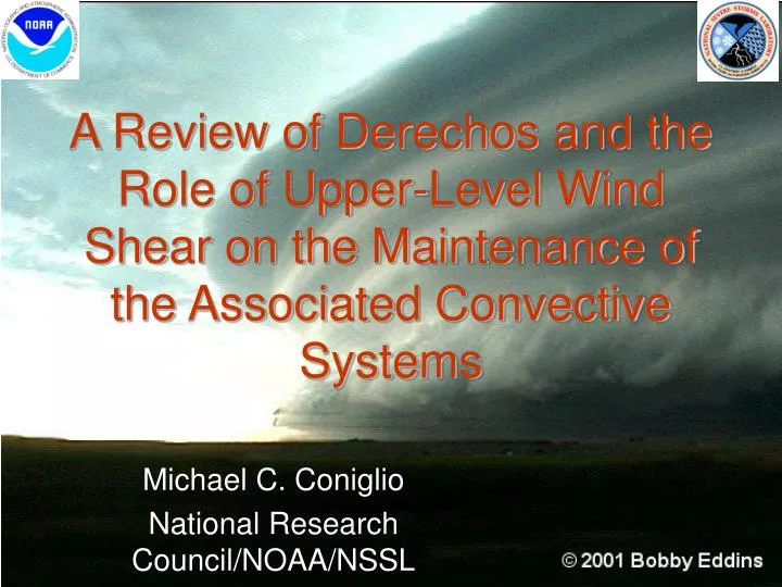
A Review of Derechos and the Role of Upper-Level Wind Shear on the Maintenance of the Associated Convective Systems. Michael C. Coniglio National Research Council/NOAA/NSSL. Outline. Derecho Overview Definition, climatology, environments, forecasting issues

E N D
A Review of Derechos and the Role of Upper-Level Wind Shear on the Maintenance of the Associated Convective Systems Michael C. Coniglio National Research Council/NOAA/NSSL
Outline • Derecho Overview • Definition, climatology, environments, forecasting issues • Theories for strength and longevity of strong, linear MCSs • Some issues with “RKW Theory” (Rotunno et al. 1988 & 2004 JAS) • Alternative Idea • Numerical simulations • connection to observations
What is a Derecho? • In general, a long swath (> 400 km) of widespread severe wind gusts (> 26 m s-1) produced by an extratropical Mesoscale Convective System (MCS) • Johns and Hirt (1987 WAF) • Need occasional stronger wind gusts • Bentley and Mote (1998 BAMS) • Include other convective structures • Coniglio and Stensrud (2004 WAF) • Compromise between above two definitions
Derecho Characteristics • Derecho-producing MCSs often contain “bow echoes” • Occur on wide range of scales (10-400 km and 20 minutes to several hours) • Generally reflect forward advancement of convectively cooled outflow (larger scale outflow termed “cold pool”) Fujita (1978)
Derecho Characteristics • Some derecho-producing MCSs contain embedded supercells and/or cyclonic circulations • Most severe wind damage often observed with these circulations NORTH of the bow-echo apex Atkins et al. (2004) AMS 22nd Conference on Severe Local Storms
Example Progressive Derecho: 27-28 May 2001 see Miller et al. (2002) AMS 21st Conference on Severe Local Storms
Example Serial Derecho: 13 May 2002
Why do we care? • Propensity for extreme winds Bob Johns, SPC Norman, OK
Why do we care? • “Boundary-Waters” Derecho July 4, 1999 • 477,000 acres blown down • Sustained winds > 58 mph for 30-40 minutes • Peak gusts > 100 mph 100 km USDA Forest Service, Superior National Forest
Why do we care? • “Boundary-Waters” Derecho July 4, 1999 Minnesota Department of Natural Resources
Why do we care? • 1986-2003 fatalities due to: • Derechos – 154 • Hurricanes – 254 • F0 & F1 Tornadoes – 71 • F0, F1 & F2 Tornadoes – 229 • Insured Losses: • July 16, 1980 event - $1.3 billion • (Isabel ~ $1.6 billion) • May 31, 1998 event - $431 million • (Bonnie ~ $394 million) Ashley and Mote (2004) AMS 22nd Conference on Severe Local Storms
When do derechos occur? • 270 events from 1980-2001 ~70% occur in May-Aug (“Warm Season”) Coniglio and Stensrud (2004) WAF
Where do derechos occur? • 171 events, all months, 1986-2001 Coniglio and Stensrud (2004) WAF
Where do derechos occur? • 113 events, May-Aug, 1986-2001 Coniglio and Stensrud (2004) WAF
Where do derechos occur? • 58 events, Sep-Apr, 1986-2001 Coniglio and Stensrud (2004) WAF
Can we forecast them? • Short term (~0-4 h) forecasts: • Aided greatly by WSR-88D Radar Network • Bow echoes and persistent embedded circulations • Longer term forecasts (6-24 h)? • Not there yet • Continued poor performance of operational models in predicting warm-season precip (see June 2004 BAMS) • Timing and location of convective initiation • ETA model with parameterized convection has difficulty with realistic MCS propagation* *Bukovsky et al. (2004) AMS 22nd Conference on Severe Local Storms
Can we forecast them? • Cloud-resolving forecast models? • Develops convective motions on the grid scale • Weather Research and Forecasting (WRF) model holds promise • 4-km resolution 36-h WRF simulations initialized at 00Z run during BAMEX project • often develops bowed-MCS structures and does reasonably well at 2-6 h lead times (www.joss.ucar.edu/bamex/meetings/weisman_wrf/), but… • Predictability and reliability at longer lead times (> 6 h) is poor • Ensemble approach?
Can we forecast them? • Pattern recognition of synoptic-scale environments – Warm season vs. dynamic • Zonal Pattern and many hybrids exist – near continuum of flow-pattern types “Warm Season” Pattern “Dynamic” Pattern Johns (1993) WAF Coniglio et al. (2004) WAF
Can we forecast them? • Ingredients-based techniques • Used for predicting convective mode and intensity • Broad similarity between derecho and supercell environments • Morphology of initiating process and the distribution of initial convective cells may be important • Discrete vs. linear propagation • Growth of the convectively generated cold pool • Renders pre-convective forecasts of derechos difficult Doswell and Evans (2003) Atms. Res.
Can we forecast them? • Ingredients-based techniques lead to parameter clues for MCS strength and longevity • Persistence of external forcing • Depth and stability of low-level inflow • Strength and distribution of vertical wind shear • Strength and distribution of cold thunderstorm outflow • What are the physical connections between the environments and MCS strength and longevity • Idealized numerical simulations useful Evans and Doswell (2001) WAF Coniglio et al. (2004) WAF
Model Environments X • Organized bow echoes like moderate to strong low-level shear in idealized numerical simulations • Likelihood of bow echoes as depth of shear-layer • Organized bow echoes do not occur if the shear layer extends above 5 km (Weisman and Rotunno 2004 JAS) X Modified from Weisman (1993) JAS
Physical Connection? Based on vorticity balance between cold pool and low-level vertical wind shear (“RKW Theory”)* • Upright convection (deepest lifting) favored when circulations balance • RIJ forms between sloping updraft and cold pool • Vorticity associated with elevated RIJs help to “prop-up” the updrafts to promote further vigorous convection and mesoconvective organization • Process is greatly favored with strong low-level shear and weak shear above the cold pool Weisman (1993) JAS *Weisman and Rotunno (2004) JAS
What about Observations? 91 derechos sampled during initial or early mature stages Coniglio et al. (2004) WAF
What about Observations? 91 derechos sampled during initial or early mature stages X mean Coniglio et al. (2004) WAF
What about Observations? 0000 UTC 28 MAY 2001 OUN CAPE ~ 3800-4800 J/kg CIN ~ 0 J/kg LI ~ -10 0-2.5-km shear ~ 11 m/s 5-10-km shear ~30 m/s see Miller et al. (2002) AMS 21st Conference on Severe Local Storms
Models vs. Reality • Cooler-season events often do have strong low-level wind shear and weaker shear aloft, but • Conundrum: Idealized numerical models probably most relevant to warm-season environments • Many warm-season cases have relatively weak low-level shear and significant shear above the cold pool • RKW mechanism (cold pool/low-level shear balance) may not be the primary controlling mechanism • Alternative Ideas? • Is there some basic dynamical importance to the existence of deep unidirectional vertical wind shear above the cold pool? Coniglio et al. (2004) WAF
Alternative Ideas? • Guided by the observations, what is the role of the upper-level shear in idealized simulations on • the basic 2D lifting of environmental air above a cold pool • the 3D evolution of simulated convective systems?
2D Simulations • Use NCOMMAS (Wicker and Wilhelmson 1995) to produce a set of dry 2D density current runs in neutral stability • Use Dx=Dz=250 m, x=240 km, z=16 km • Introduce a “cold pool” through a cooling function • Run out to 1.5 h • Use trajectories to calculate vertical parcel displacements after 0.5 h • 7 runs: 0 to 30 m s-1 of 5-10 km shear in 5 m s-1 increments 20 m s-1 over 0-5 km 12 m s-1 over 0-2.5 km Cold pool motions
Results: Maximum vertical velocity Strongest upward motion occurs for case with no upper-level shear
Results: Maximum low-level (0-2 km) parcel displacements Lifting is enhanced for weak to moderate upper-level shear
Conclusion: 2D simulations • Upper-level shear (above moderate low-level shear) increases vertical parcel displacementsthrough an overturning updraft (Moncrieff 1981), despite lower w along interface (Shapiro 1992, Moncrieff and Liu 1999) • Shear entirely above cold pool can accomplish this • What happens in 3-D?
Results: 3D simulations, 2 - 4 hSurface precipitation mixing ratio, gust front, winds 0 m s-15-10 km shear 15 m s-15-10 km shear
Results: 3D simulationsstorm-relative wind profiles at 3.5 h
Results: 3-D simulationsTrajectories 3- 4 h 0 m s-1 shear: 15 m s-1 shear: 30 m s-1 shear:
Observations:108 derechos sampled in weak/moderate forcing 29 35 44 Large differences in 5-10 km shear between beg./mature & decay Note absence of critical Level for decay soundings Coniglio et al. (2004) WAF
Applications • Can provide nowcast for demise of strong, linear MCSs – lifting of critical layer • Requires forecast of cold pool motion (Corfidi 2003 WAF) & storm-relative wind profile • Probabilistic forecasts of linear MCSs structure/longevity at longer lead times? • Forecast “experiment” to take place in Summer 2005 at Storm Prediction Center • May help explain how strong MCSs can persist after dark in situations not forced by a LLJ • Overturning of residual-layer parcels may not care about nocturnal inversion (as long as cold pool is replenished)
Final Thoughts • While low-level shear is important, upper-level shear also is important - existence and location of critical layer with upper-level shear important component of MCS structure and maintenance • Systems are maintained for longer periods in 3D and are substantially larger (not shown) • Observations suggests importance of upper-level shear • Role of 3D convective structures on maintenance unresolved