Download
1 / 42
420 likes | 922 Views
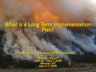
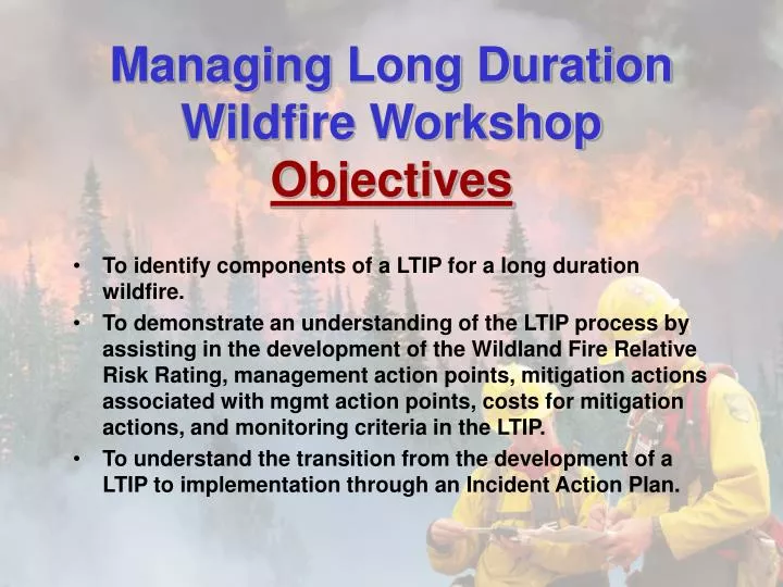
Managing Long Duration Wildfire Workshop Objectives To identify components of a LTIP for a long duration wildfire.

E N D
Managing Long Duration Wildfire Workshop Objectives • To identify components of a LTIP for a long duration wildfire. • To demonstrate an understanding of the LTIP process by assisting in the development of the Wildland Fire Relative Risk Rating, management action points, mitigation actions associated with mgmt action points, costs for mitigation actions, and monitoring criteria in the LTIP. • To understand the transition from the development of a LTIP to implementation through an Incident Action Plan.
Long Term Implementation Plan Workshop - Exercise • Bridge Fire • Region One – Northern Rockies • Clearwater National Forest • Powell Ranger District
Initial Discovery • Discovered 7/26 @ 1315 hours • Initial recon – 1/2 acre in size • This photo taken during recon flight
Idaho/Montana State Line Old Fire Areas To Powell/Hwy 12 Bridge Fire Origin Road #360 to Elk Summit
Hwy 12 -L ochsa River WFSA Boundary – 180,000 Acres Idaho/Montana State Line Elk Summit G. S.
Initial Attack Actions • Due to extreme fire behavior managers decided to: • Aerial Attack with water drops & retardant where reasonable and effective to slow/delay fire spread toward the west to Road #360. • After these actions were accomplished, aerial attack ceased.
2 Hours Later – 7/26 Bridge Creek Drainage Looking East from Road #360
Now What??? • WFSA • District/Forest • Long Term Implementation Plan (LTIP) • Call in a LTIP Team utilizing district experience/knowledge
Group Assignments • Complete Wildland Fire Relative Risk Rating Assessment • Develop Mgmt Action Points and Mitigation Actions by completing MAP tables • Develop costs for each MAP • Develop monitoring criteria • Develop Division Assignments for next operational period
Handouts-Information Provided • 44x34 Group Work Map • 44x34 FSPro Map on Mylar • LTIP with all info except you need to provide through your assignments • Blank MAP tables • Resources Assigned and Available • Resource Cost guidelines • Blank Division Assignment Sheets
Bridge Fire Map • This will be your work map. • WFSA Boundary • Values At Risk • Past Fire History • Current Fire Perimeter • Wilderness Boundary • National Forest Boundary • Private Land • Road Systems
LTIP Info Provided • WFSA Objectives & Selected Alt. • Summary of Risk Assessment • Validation of WFSA Boundary/description • Fire Protection Responsibilities • Values at Risk • Blank MAP Tables • Resource Cost Information • Structure Protection responsibility • Monitoring Criteria • Signature Page
WFSA-Selected Alternative • Alt. B – Point Protection (Protect Values at Risk) • Develop a LTIP with Mgmt Action Pts (MAPs) for mgmt during the remainder of the fire season. • Develop costs by MAP • Manage as a Type III incident initially but will expand/contract based on: • Current & expected fire behavior • Complexity • Threats (as dictated by MAP’s)
Why Alt. B? • Safety • Wilderness Resource • Limited tactical option in wilderness • Cost – • Full perimeter control estimated at $8 million+ requiring a large # of Type 1 resources at a time when the Nation was at PL5 • Point Protection for all Values at Risk within final projected fire perimeter estimated about $1.8 million.
Risk Assessment Summary • ERC Tables, Temp/Precip Outlook, Wind Rose Chart, Drought Summary • Past Large Fire History Analysis • Relative Risk Assessment Chart • FSPro Model Run • Probability of Season-Ending Event • RERAP Analysis
Validation of the WFSA Boundary • Base on Objectives in WFSA • Utilize Risk Assessment to validate • Coordinate with other protection agencies and counties • Social, political, and environmental concerns
WFSA Boundary Description Segment I Length of Segment: Approximately 17 miles Natural Defensibility: Moderate (areas of logging units), Low in timbered areas Potential to Cross WFSA area boundary in 14 days: Shows 0% probability Potential Consequences of Crossing WFSA area boundary: High – private land, private land structures, high value timber lands, reforestation investments. General Description: From the junction of Beaver Creek and Colt Killed Creek east up the Beaver Creek road #368 to Beaver Ridge Lookout then east on the main ridge ½ mile to the wilderness boundary.
Bridge Fire Map • WFSA Boundary segments are Roman Numeral numbers outside BLUE line.
Fire Protection Responsibility U. S. Forest Service Clearwater N.F. Powell R.D.
Values At Risk within WFSA area boundary • Lookouts • Trailheads • Campgrounds • Bridges • Administrative Sites-structures • RNA • Snotel Site • RAWS
Resources Available & Assigned • Type 3 helicopter with Crew • 3 – Type 6 District Engines • 15 person District Fire Crew • 1 – Type I IHC • 8 – Smokejumpers • 1 – District LEO • 4 – Other District/Forest Personnel
Mitigation Actions – Management Action Points • To protect WFSA boundary and values at risk • Utilize MAP table to record information
Private Property Protection There is NO Private Land within the WFSA Boundary
Monitoring You will be responsible for developing criteria for monitoring your plan over the long-term and when it will be updated. How often will you update the Relative Risk Assessment?
August 2, 2007 • Fire approached MAP #2 • Action – Consider Type 2 IMT • Minimum – Type 3 organization • Fire Staff pushed ordering T2 IMT • Forest Supervisor/District Ranger favored T3 organization • T3 organization ordered • Addendum to LTIP beefing up FBAN/ LTAN skills
August 15, 2007 • Bridge Fire reaches the Idaho/Montana State Line. • Bitterroot Forest Supervisor requests briefing on expected fire behavior and spread down canyon out of wilderness toward private land. • Bitterroot requests helicopter water drops on fire that is on the Bitterroot NF. • Addendum to LTIP adding MAP with consideration of water drops to slow/check spread of fire, order new FSPro model run, evaluate fire behavior & spread. • WFSA boundary changed.
August 20, 2007 • Bridge Fire spots onto the Bitterroot NF August 29, 2007 • Amendment to WFSA & LTIP • Three additional MAP’s added to LTIP • Utilize additional Aerial resources • Recon areas to take a stand – order crew • Add MAP’s as needed addressing further actions • Type I Helicopter used to slow/check spread of fire on the Bitterroot NF - $36,000 - effective
Summary • Bridge Fire was Managed from July 25, 2007 until the snow flew in October 2007 (90+ Days of managing an Incident) • Final Perimeter = 44,100 Acres • Final Cost = $390,000 (Cost / Acre = $8.84)