Download
1 / 14
140 likes | 270 Views
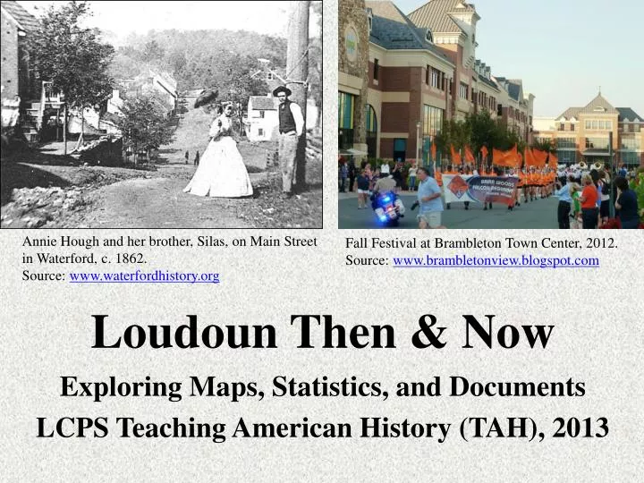
Loudoun Then & Now. Annie Hough and her brother, Silas, on Main Street in Waterford, c. 1862. Source: www.waterfordhistory.org. Fall Festival at Brambleton Town Center, 2012. Source: www.brambletonview.blogspot.com. Exploring Maps, Statistics, and Documents

E N D
Loudoun Then & Now Annie Hough and her brother, Silas, on Main Street in Waterford, c. 1862. Source: www.waterfordhistory.org Fall Festival at Brambleton Town Center, 2012. Source: www.brambletonview.blogspot.com Exploring Maps, Statistics, and Documents LCPS Teaching American History (TAH), 2013
Essential Questions: • How has Loudoun County changed from its founding until today? • How can maps, statistics, documents and other primary sources help us to identify and better understand those changes? • What major factors have contributed to Loudoun’s transformation from a rural agricultural area to a diverse, suburban area? • How have the changes in Loudoun County reflected broader changes in Northern Virginia and in the nation as a whole?
Mapping Loudoun: 1853 The Yardley Taylor map is available online and can be purchased from the Loudoun County Government Mapping Office for $15. There are two excellent online versions that offer “zoomable” versions of the map: http://www.loudounhistory.org/map-yardley-taylor-1854.htm and… http://logis.loudoun.gov/archive/ which includes historic map and aerial images of Loudoun County from 1853 to 2012. The top right corner of Yardley Taylor’s 1853 map of Loudoun County. Source: www.loudounhistory.org The map is one of the most detailed maps of Loudoun County from the 19th century. The “History of Loudoun County” website provides an article by historian Eugene Scheel, himself a mapmaker, on the development and history of the map. http://www.loudounhistory.org/history/yardley-taylor-1853-map.htm The image to the right is a map inset depicting the center of Leesburg, including the old court house.
Mapping Loudoun: 1860s • http://www.loc.gov/resource/g3883l.cwh00044/ (Loudoun County map, c. 1860s). Follow the link to a “zoomable” version on the Library of Congress website.
Mapping Loudoun Today The Loudoun County Government Mapping Office offers a wealth of county maps that have a variety of themes. The 2011 planning map to the left shows the county’s master development plan. Other map types include election districts, census areas, and a series of environmental maps. All of these can be found on the “Loudoun Mapping Websites” page: http://logis.loudoun.gov/ Perhaps the most interesting feature of the site is “Aerial Archive” which allows a user to investigate historic and recent maps of the county and compare and contrast them to each other.
Loudoun’s Historic Preservation • The Loudoun County Government website also features an interactive map that identifies and provides images and interviews related to Loudoun’s historic preservation districts: http://www.loudoun.gov/index.aspx?NID=1864 • Three of Loudoun’s best-known historic districts – Waterford, Oatlands, and Aldie – are pictured below. Historic Aldie Mill operated from 1809 to 1971. Source: http://www.nvrpa.org/park/aldie_mill_historic_park Historic Waterford. Source: http://www.nps.gov/nr/travel/journey/wat.htm The Carter Mansion at Oatlands. Source: http://www.oatlands.org
Loudoun’s Population, 1790-1920 Source: U.S. Census Statistics printed in An Economic and Social Survey of Loudoun by Deck and Heaton in Charles P. Poland Jr.’s From Frontier to Suburbia, 1976.
Loudoun’s Growth, 1930-2010 Sources: U.S. Census Bureau, Decennial Census 1930 to 2000 Loudoun County Government, http://testbiz.loudoun.gov/Portals/0/a_1.pdf
Loudoun’s Growth Transportation & Development Built along the Loudoun-Fairfax border, Dulles International Airport opened in 1962. Source: http://www.metwashairports.com/dulles/661.htm Brambleton (pictured below) is one of many planned communities built in Loudoun since the 1960s, when Sterling Park was developed.
Map of the Washington, D.C. Metropolitan Statistical Area (MSA)
Loudoun’s Diverse Population, 2010 Source: U.S. Census Bureau How does Loudoun County’s population compare with that of the United States overall? How is the county more or less diverse?
Loudoun’s Wealthy Population *How does Loudoun County’s per capita and median household income compare to that of the Washington, D.C. metropolitan statistical area (MSA), the state of Virginia, and the United States as a whole? *What are some of the most important sources of Loudoun County’s wealth?
From Slavery… Excerpts from Ann Tyler’s will, 1769: “In the name of God Amen I Ann Tyler of Cameron Parish and County of Loudoun Widow being weake in body but of sound & perfect memory do make and ordain this my last will and testament in manner and form following,…” “I give and devise to my Daughter Susanna Tyler & to the heirs of her body Lawfully begotten One Negro woman named Lettice & her increase excep the first child she shall bear hereafter which shall live to be eighteen months of age which I shall otherweys dispose of, and one featherbed which I have acquired in my widowhood.” Poster advertising a slave sale in Waterford, March 1830. The image can be found on a page devoted to a chronicle of African American history in Loudoun: http://www.loudounhistory.org/history/african-american-chronology.htm
… to Civil Rights for All Excerpt from Leesburg Today letter to the editor, May 2009, written by Gertrude Evans: “Thank you Town of Leesburg for the opportunity for all to benefit from this much needed recreational opportunity [opening of Symington Aquatic Center], an opportunity which was denied to “all” of the Leesburg citizens back in the sixties, when the Fireman’s Pool was closed, because of my skin color and the skin color of my friends.” Pictured above: Photo of 1960 Douglass High School and Loudoun County High School yearbooks displayed side by side. The Washington Post website includes an article and video about 1960 graduates recalling segregated schooling in Loudoun County: http://www.washingtonpost.com/wp-dyn/content/gallery/2010/10/26/GA2010102607658.html Pictured Left: Symington Aquatic Center at Ida Lee Park in Leesburg opened in 2009, the first such integrated pool facility in Leesburg.