Download
1 / 18
180 likes | 264 Views
Population level information management for crop wild relatives (PLIS) C.U. Germeier, J.M. Iriondo, L. Frese, C. Höhne, M. Enders, S.Kell. Tasks. Population level information systems for model crops ( Avena , Beta , Brassica , Prunus ).

E N D
Population level information management for crop wild relatives (PLIS) C.U. Germeier, J.M. Iriondo, L. Frese, C. Höhne, M. Enders, S.Kell
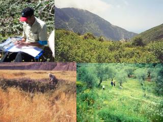
Tasks Population level information systems for model crops (Avena, Beta, Brassica, Prunus) • Development of information models for in situ management of plant genetic resources field work on the population level. • Integration of historical occurrence (distribution) data. • Development of a web application for information on already known sites and additional tools supporting in situ field work. • Propose concepts for data exchange and the integration of project results in existing information systems (e.g. the European Central Crop Databases).
In Situ Ex Situ is collected Accession is within a Characterisation Evaluation n 1 n 1 Population Level Information in the world of genetic resources documentation Occurrence Site definition: geographically described or referenced locality, but without explicit extension. Site Area definition: geographically described with explicit extension. Site in ex situ PGR databases: - mostly rough description (locality string) like: Cabo de Gata, 2 km E of. - if geographic coordinates are available, it is only point coordinates, no extension. (Protected) Area
In Situ Ex Situ is collected Accession is within a is within a is within a Characterisation Evaluation Monitoring Ecogeography: Climate Soil Habitat Vegetation n 1 n n 1 1 n 1 n 1 n 1 n 1 Population Level Information in the world of genetic resources documentation Population? Occurrence Individual Patch Site Natural Environment (Protected) Area Location (administrative unit) Political Environment
Implementations: CWR CyberTracker (Mobile) CWRIS-PLIS (Web)
Techologies Mobile Web • JBoss Web Development Suite • Object oriented • PL: Java – JEE5 Frameworks (Java Server Faces (JSF) – Seam – Hibernate) • GMaps4Jsf: an Interface for the use of Google Maps Services with JSF • CyberTracker Software • Workflow oriented • Graphical configuration of workflows
Data Sources / Downloads Occurrence and genetic resources data: The Global Biodiversity Information Facility (GBIF) The European Internet Search Catalogue (EURISCO) The USDA Germplasm Resources Information Network (GRIN). Data downloadable from PCGRIN The European Central Crop Databases (IDBB, EADB) EUROSTAT administrative geographic units: NUTS (Nomenclature of territorial units), LAU (Local Administrative Units) Protected areas: NATURA 2000 sites database Taxonomic reference: CWRIS - Euro + Med, IDBB, EADB
Web Search Searching through a geographic hierarchy Data acquisition with Cybertracker
Web Search Searching through a taxonomic hierarchy Data acquisition with Cybertracker
Working with Historical Data: Suggestions for a Data Harmonisation Landscape Protected Area Service Taxonomy Service(s) NUTS - LAU Service e.g. GBIF Occurrence Valid name Synonyms Taxon name System Coordinate „Locality String“ NUTS-LAU Unit Coordinate Transformer Site Interpreter Taxon Interpreter Protected Area Location Interpreter GBIF Taxon OccurrenceService Occurrence Protected Area Site Location Taxon CWRIS Portal(s) (Crop, Management)
Individual Example: B. patellaris: Cabo de Gata, 2 km E of Population definition: Individuals with sexual recombination. -> defined genetically, not geographically -> in the field we can record only individuals and patches -> aggregation to populations needs genetic analysis CWR Field Data: Levels of Aggregation Reference point (Site):geogr. described or referenced without explicit extension. Population? Individual: Plant found at a certain time on a certain place. Can be revisited, if marked. Patch Patch:Agglomeration of individuals of the same species: on revisiting, if a recorded patch area overlaps with a previous recorded one, they are considered the same patch. After fusion one of them is considered successor of both.
Levels of aggregation in the CyberTracker Application - natural structuration
Levels of aggregation in the CyberTracker Application – experimental designs