Download
1 / 17
170 likes | 171 Views
This analysis examines the consistency between model simulations and observations of snowfall profiles using ground and space assets. The study compares observed and simulated snow profiles directly in radar and radiometric measurement space, considering different environments and microwave surface emissivities.

E N D
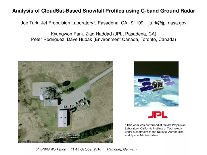
Analysis of CloudSat-Based Snowfall Profiles using C-band Ground Radar Joe Turk, Jet Propulsion Laboratory1, Pasadena, CA 91109 jturk@jpl.nasa.gov Kyungwon Park, Ziad Haddad (JPL, Pasadena, CA) Peter Rodriguez, Dave Hudak (Environment Canada, Toronto, Canada) 1 This work was performed at the Jet Propulsion Laboratory, California Institute of Technology, under a contract with the National Aeronautics and Space Administration. 5th IPWG Workshop 11-14 October 2010 Hamburg, Germany
Motivation Model simulations of winter storms using cloud resolving models are commonly used to construct a-priori databases for Bayesian-based radar and/or radiometric snow retrievals Best assumptions are made (e.g, snow shape, size distribution) How realistically do model simulations replicate observations? Utilizes collection of ground/space assets, e.g GPM Ground Validation approach In this presentation Examine time-coincident CloudSat (94 GHz W-band), EC radar (5-GHz C-band), AMSR-E (10-85 GHz) and AMSU Microwave Humidity Sounder (89-183 GHz) Compare observed-vs-simulated snow profiles directly in radar/radiometric measurement space (avoiding Z-S relations, etc) Examine different environments (ECMWF, AIRS) and MW surface emissivities 5th IPWG Workshop 11-14 October 2010 Hamburg, Germany
Physical Modeling Since many of the physical variables that affect microwave radar/radiometric observations are correlated, it is unreasonable to change one constituent or property without changing one or more of the others Use multi-frequency radar data to narrow down the range of the correlated “cloud” of assumptions…..or, in some cases, expand the range…… Establish level of consistency between satellite observations and the models Use high-quality ground radar as the focal point of a “superset” of time/space coincident observations, collected from ground and space Cloud fraction Particle type Size distribution Microwave Surface Emissivity Temperature/Humidity Environment Antecedent Precipitation Vertical air motion Haddad, Z., J. Meagher, S.L. Durden, E.A. Smith, E. Im, 2006: Drop size ambiguities in the retrieval of precipitation profiles from dual-frequency radar measurements. J. Atmos. Sci., 63, 204-217. Large scale meteorology (this graphic is not meant to be all-inclusive)
Environment Canada C-band Meteorological Radar Network WKR location provides coverage over partially frozen lakes and snow cover – the most challenging surfaces for passive microwave precipitation retrievals Typical one-day CloudSat ground tracks King City (WKR) Hudak, D., P. Rodriguez, and N. Donaldson (2008), Validation of the CloudSat precipitation occurrence algorithm using the Canadian C band radar network, J. Geophys. Res., 113, 12 pp.
CloudSat/Aqua track Data Collection CloudSat track within 200 km of WKR and NOAA-18 within 300 km and 15 minutes of CloudSat and During a DJF frozen precipitation event NOAA-18 track 2200 km swath (AMSU/MHS, MODIS) 1400 km swath (AMSR-E) CloudSat (nadir) cloud King City, Ontario (WKR) C-band dual-pol radar operated by Environment Canada Tbase < -2 C 10-minute PPI volume scans (not to scale)
Case 5 2009/02/21 Ascending over Lake Ontario and Lake Huron CloudSat WKR profile reconstructed under CloudSat track Case 6 2010/02/17 Ascending over Lake Ontario
Snow Particle Habits, Shapes and Sizes m shape parameter Λ slope, related to mass-weighted mean diameter Dm by Assume snow DSD follows a gamma distribution: G. Liu, “A database of microwave single scattering properties for nonspherical ice particles”, Bull. AMS, 1563-1570, October 2008.
Snow-Cloud Partitioning Weight LUT entries based on their distance to the observed Z Assume a set of realistic assumptons for cloud fraction f at each of the N range gates, i=1,2…N 2nd frequency C-band qs = snow LWC (g m-3) qc = cloud LWC Profile of means and std deviations Would like to find qc and qs profiles using a set of assumptions for snow crystal N(D), habit (e.g, dendrites), and cloud fraction Simple top-down procedure: Lookup tables (LUT) spanning a wide range of DSD and associated radar and radiative parameters at CloudSat, WKR and MHS frequencies snow Top of profile (eg, 20 km) Accumulate PIA from vapor cloud If cloud detected, add qc until f reaches desired fi Next bin N Surface flag? Accumulate PIA from vapor and any cloud, snow Y surface bins Extend vapor profile PIA to surface (for radiative transfer calculations) CloudSat profile (not drawn to scale) surface
Simulated W-band Profiles under the CloudSat track (Case 6) (1-freq, attenuation-corrected) Dendrites ECMWF environment Increasing gamma shape m Increasing mass-weighted mean diameter Dm Observed CloudSat cross section
Simulated C-band Profiles under the CloudSat track (Case 6) (1-freq, assuming no attenuation) Dendrites ECMWF environment Increasing gamma shape m Increasing mass-weighted mean diameter Dm Observed WKR cross section
Increasing gamma shape m m=0 m=2 m=5 Simulated C-band Cumulative Contour Frequency by Altitude (CCFAD) diagrams under the CloudSat track All 6 Cases Together Intervals of 10% 1-km and higher (CloudSat has no cloud data below 1-km) __________________________ Near the surface, observed CCFADS cover a 25 dB range, but simulated only about 15 dB Near the surface, lower reflectivities better replicated(black ellipses) than the higher reflectivities (red ellipses) Consistent with aggregation of biggest particles and larger D6 Dendrites ECMWF Increasing mass-weighted mean diameter Dm Observed WKR CCFADS Near surface: 10% at -5 dbZ, 95% at 20 dBZ= 25 dB range
Mean Snow LWC Profiles under the CloudSat track (Case 6) (1-freq) Dendrites ECMWF environment Increasing gamma shape m Increasing mass-weighted mean diameter Dm Each profile is a candidate solution in the 1-frequency (94 GHz only) retrieval space Bring in second frequency to better constrain
Case 1 2007/02/14 07:40:02 (2-freq ECMWF dendrites) Partially frozen Lake Huron Weak sensitivity (coarse AMSU) Higher sensitivity (finer AMSR-E) ? spikes are artifacts
Case 5 2009/02/21 18:39:13 (2-freq ECMWF dendrites) Nearly frozen lake
Case 6 2010/02/17 18:30:47 (2-freq ECMWF dendrites) observed simulated Open water observed simulated modeled snow profile larger Dm near surface Dm/q0.2
Case 6 No restriction on Dm/q0.2 Enforce Dm/q0.2 < 0.65 Reconstructed C-band Z more realistic Same snow profile (by design) In 1-freq area, Dm constant throughout the column (unrealistic)
Summary Combination of C-band ground radar and the 94-GHz CloudSat radar provides a useful dual-frequency view of cold season precipitation Comparison of CCFAD variability from CloudSat simulated snow profiles and WKR appear to be consistent with snow aggregation near the surface Relations between parameters more important than the parameters alone However, properties (crystal shape, melting, supercooled liquid, etc) are much more complex than assumed in this first-order study GPM Land Surface Working Group (LSWG) developing methods to characterize microwave surface emissivity, or reduce its dimensionality to a few key variables CloudSat is still orbiting….more intersections being gathered each day….. 5th IPWG Workshop 11-14 October 2010 Hamburg, Germany