Download
1 / 12
380 likes | 1.24k Views
The Gambia. A Photo Journal Copyright of photographs: Riitta Leinonen. The arrival. After a 10-hour-flight from Helsinki via Las Palmas , we finally arrived at Banjul international airport . We were quite exhausted , but the sunny and warm weather welcomed us.

E N D
The Gambia A Photo Journal Copyright of photographs: Riitta Leinonen
The arrival • After a 10-hour-flight from Helsinki via Las Palmas, wefinallyarrived at Banjul international airport. Wewerequiteexhausted, but the sunny and warm weatherwelcomed us. • Carrier boyssurrounded us immediately outside the terminal, and unsuspectinglyweletthemcarryourluggage. Weshouldn’thavedonethat, becausetheyinsisted for a vastamount of money for their services. Thiswasactually the one and onlybadexperienceduringouroneweekstay in the country. • Checkhowmuchyouknowabout the Gambia in advance! Pleaseuse the followinglink: The Gambia quiz
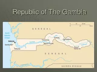
The main facts about the Gambia • 1,6 million inhabitants • Area: 11.300 square kilometres • Capital: Banjul (about 45.000 citizens) • Biggest town: Serrekunda (about 370.000 citizens) • The only neighbouring country: Senegal. • Time zone: Greenwich Zone (- 2 hrs from Finland) http://www.wordtravels.com/images/map/Gambia_map.jpg http://www.mapshop.com/Travel_Maps/Africa/African-Country-maps/Gambia-9780921463696.jpg
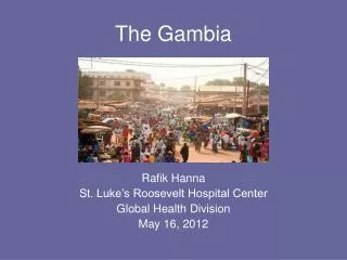
People • About 90% of Gambians are Muslims. The remaining 10% are Christians and followers of tribal religions. • The most important ethnic groups and simultaneously local languages are Mandinka (42 %), Fula, Wolof, Jola and Serahuli. • The official language, English, is spoken widely as a second language, as well as French. • The average life expectancy is 56 years for women and 52 for men. Women at Albert Market in Banjul
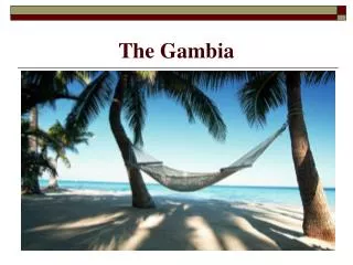
Geography , climate, plants • The Gambia is characterized by the Atlantic ocean, and the 1200-kilometre-long River Gambia, 487 kilometres of which are inside the the area of the Gambia. • The climate is sub-tropical. Dry, sunny season extends from November till May. • The landscape is fairly flat. The vegetation cover of The Gambia is savanna on the uplands, various kinds of inland swamp in the low-lying areas, and mangrove swamp along the brackish lower Gambia River (www.britannica.com). The Banjul harbour
Economy • The main sources of income are agriculture (peanuts, cotton), fishing, and tourism. • The river has been an important trade route between the interior of the country and the coast for centuries. • The currency is Gambian Dalasi. • GNP per capita: 290 USD in 2004 (www.britannica.com). Fishermen on Sanuyang Beach Our tourist guide in the “brand jungle”
Education • Schoolsystem: total 12 years of education. However, school attendance is not compulsory. • Annual fee is 50 Dalasis (appr. 2 euros), but even this sum is too high for many families; they may allow only one or two of their children to go to school. • Illiteracy rate is still high in the Gambia: 63% for women and 42% for men. • Travel agents arrange visits to local schools, during which tourists can sponsor the schools. • All the children wanted to have a Finnish penfriend!
History • This part of West Africa has been inhabited since around 2000 BC. • The Portuguese, French, Dutch and British started to trade slaves and gold from the River Gambia area from the 16th century onwards. There were constant fights over trading rights and territory. • In 1765 the Gambia became the colony of the British Empire. Still after that the fights continued between British and French forces. • In 1965 the Gambia became independent, and President Kairaba was finally able to hoise the Gambian flag. The colours of the Gambian flag: red = sun white = freedom blue = the River Gambia green = nature and agriculture
Slave trade • Fort James on James Island thatwasbuilt in 1651 was a British tradingpost for over a century. Slavesstayedthere in captivitybeforetheywereloaded to shipsheading for British colonies in the American continents and in Jamaica. • Estimated 12 millionAfricansweretaken as slavesbetween 1510-1886. Circumstances in the slaveshipswerehorrendous. Even 9 out of 10 slavesdiedbeforeentering their new ”home-countries”. • The ancestralvillage of Kunta Kinteh (Alex Haley – Roots) is situatednearby the James Island, on the bank of the River Gambia. There are still some ruins left on James Island.
Animals African long-tailed monkeys love peanuts! • Few wild animals are native to the region, and those that survive are under pressure from the human and domestic animal populations. In the middle and upper river areas there are warthogs, monkeys, baboons, antelopes, pygmy hippopotamuses, and crocodiles.(www.britannica.com) A warthog http://www.sa-venues.com/wildlife/wildlife_warthog.htm A monitor in the hotel garden
Birdlife • We saw several wonderful birds during the week, most of them in our hotel garden. Birds (as well as monkeys) love these well-kept gardens where they have enough water and plenty of food available . • In Abuko Nature Reserve there are more than 200 bird species, and if you are lucky, you can see some of them when walking along the footpaths. A Barbary Shrike A Red-beaked Hornbill A vulture having a sip of tap water.
References • Gambia. A tourist brochure. Tjäreborg. • The Gambia Traveller’s map. Macmillan. • www.britannica.com