Download
1 / 11
110 likes | 200 Views
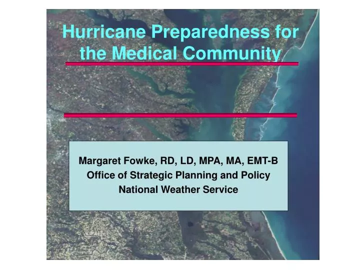
Margaret Fowke, RD, LD, MPA, MA, EMT-B Office of Strategic Planning and Policy National Weather Service. Hurricane Preparedness for the Medical Community. NWS Background. The National Weather Service is: A Federal Government Agency Part of the Dept. of Commerce

E N D
Margaret Fowke, RD, LD, MPA, MA, EMT-B Office of Strategic Planning and Policy National Weather Service Hurricane Preparedness for the Medical Community
NWS Background • The National Weather Service is: • A Federal Government Agency • Part of the Dept. of Commerce • Nat’l Oceanic and Atmospheric Admin. (NOAA) is our Parent Agency • A 5000 Employee Agency Dedicated to Saving Lives and Protecting Property • 122 local offices nationwide (including Puerto Rico & Guam)
Coastal Hurricane Threats Storm Surge Factors • Storm Intensity and Size • Stronger = Higher Surge • Larger = Larger Area Affected • Storm Speed • Slower Often Means Higher Surge • Angle to Coast at Landfall • Perpendicular Maximizes Surge (Katrina)
NHC Graphic Products http://www.nhc.noaa.gov/ 5 Day Forecast/Error Cone 3 Day Forecast/Error Cone
NHC Graphic Products http://www.nhc.noaa.gov/ 50 Knot Wind Prob. Hurricane Wind Prob. 34 Knot Wind Prob. Note: SMALL Probabilities can be SIGNIFICANT!!!
Weather Forecast Office (WFO)Local Forecast StatementTropical Cyclone Forecast Discussion URGENT - IMMEDIATE BROADCAST REQUESTEDTROPICAL STORM LOCAL STATEMENTNATIONAL WEATHER SERVICE CORPUS CHRISTI TX437 PM CDT WED AUG 15 2007...A TROPICAL STORM WARNING IS IN EFFECT FOR THE LOWER AND MIDDLETEXAS COAST......AN INLAND TROPICAL STORM WARNING IS IN EFFECT FROM 5 AM UNTIL400 PM CDT THURSDAY......NEW INFORMATION...TROPICAL STORM ERIN WILL MAKE LANDFALL ALONG THE MIDDLE TEXASCOAST EARLY THURSDAY AFTERNOON....AREAS AFFECTED...THIS STATEMENT RECOMMENDS ACTION TO BE TAKEN BY THE RESIDENTS OFARANSAS...CALHOUN...KLEBERG...NUECES...REFUGIO AND SAN PATRICIOCOUNTIES....WATCHES/WARNINGS...A TROPICAL STORM WARNING IS IN EFFECT FOR THE ENTIRE LOWER AND MIDDLETEXAS COAST FROM BAFFIN BAY TO PORT OCONNOR. THE TROPICAL STORMWARNING IS IN EFFECT THROUGH THURSDAY. AN INLAND TROPICAL STORMWARNING IS IN EFFECT FROM 500 AM UNTIL 400 PM CDT THURSDAY....STORM INFORMATION...AT 400 PM CDT...THE CENTER OF TROPICAL STORM ERIN WAS LOCATED ATLATITUDE 26.3 NORTH AND LONGITUDE 94.4 WEST OR ABOUT 195 MILESEAST OF BROWNSVILLE. THE STORM WAS MOVING TO THE NORTHWEST AT 13 MPH.THE STORM IS FORECAST TO MAKE LANDFALL BY EARLY THURSDAY AFTERNOON NEAR CORPUS CHRISTI....INLAND FLOODING...STORM TOTAL RAINFALL AMOUNTS BETWEEN 3 AND 6 INCHES WITH ISOLATEDTOTALS UP TO 8 INCHES WILL BE POSSIBLE. THE HEAVIEST RAINFALL ISEXPECTED TO OCCUR ACROSS THE COASTAL BEND AND VICTORIA REGIONBEGINNING AFTER MIDNIGHT. A FLASH FLOOD WATCH IS IN EFFECT FROMLATE TONIGHT THROUGH THURSDAY EVENING FOR COASTAL COUNTIES AS WELLAS WEBB...LA SALLE...DUVAL...MCMULLEN...LIVE OAK...JIM WELLS...BEE...GOLIAD AND VICTORIA COUNTIES....STORM SURGE AND STORM TIDE...TIDES ARE EXPECTED TO AVERAGE BETWEEN ONE FOOT TO AS HIGH AS 2FEET ABOVE NORMAL AT THE TIME OF LANDFALL ON THURSDAY. THIS WILLPRODUCE MINOR TIDAL OVERFLOW BEGINNING TONIGHT AND CONTINUING INTOTHURSDAY. THE TIMES OF HIGH TIDE AT PORT ARANSAS ARE TONIGHT AT525 PM AND THURSDAY MORNING AT 643 AM. THE TIMES OF HIGH TIDE ATPORT OCONNOR ARE TONIGHT AT 703 PM AND THURSDAY MORNING AT 1004AM.
Coastal Flooding Impact Examples of New Graphics and How They Can Be Utilized A B C J.R. Ewing http://www.weather.gov/os/tropical
Examples of New Graphics and How They Can Be Utilized Inland Flooding Impact A B C J.R. Ewing http://www.weather.gov/os/tropical
Triage: Corpus Christi WFO Text Definitions Coastal Flooding Impacts • Low Prepare for the likelihood of minor flooding of low lying areas, with little or no damage. High waves may cause water to reach the dunes and immediate waterfront roads to close. Minor erosion possible. • Moderate Prepare for the likelihood of some coastal flooding of immediate beachfront property and structures. Significant erosion, high waves, and inundation may cause waterfront and coastal access roads to close. Moderate inundation of coastal, and bayside tributaries is possible. • High Prepare for the likelihood of significant, possibly life-threatening storm surge flooding. Widespread inundation and damage to roads, infrastructure, and buildings is possible. Surge flooding will also affect bays and rivers. Many waterfront and coastal access roads will be closed, some potentially for an extended period of time. Significant inundation of coastal, and bayside tributaries is likely. • Extreme Prepare for the likelihood of severe, life-threatening storm surge. Complete coastal inundation and severe damage to roads, infrastructure, and buildings is likely. Nearly all waterfront and coastal access roads will be closed. Many coastal road closures will last days or weeks. Severe, possibly unprecedented inundation of coastal and bayside tributaries is likely. http://www.weather.gov/os/tropical
Triage: Corpus Christi WFO Text Definitions Inland Flooding • Low - Prepare for the likelihood of minor flooding of low lying areas, with little or no property damage. Some flood prone-roads may be closed for brief periods of time. • Moderate- Prepare for the likelihood of moderate flooding and flash flooding, resulting in some road closures. Some low lying structures may be flooded. • High- Prepare for the likelihood of widespread flooding and flash flooding. Extensive damage to buildings and some transportation systems from high water and debris is likely, resulting in many short-term road closures. Some secondary roads may experience long-term road closures. • Extreme -Prepare for the likelihood of widespread record or near record flooding and flash flooding. Extreme and long-lasting damage to buildings and transportation systems from high water and debris is likely, resulting in many long-term road closures. http://www.weather.gov/os/tropical
Summary Doctor’s Orders: • Diagnosis: You have been diagnosed with a predicted forecast that is dynamic and changes. • Consultation: Schedule follow up appointment with your WCM well in advance. WCM may assist in practice drill with fictional forecasts. • Lab work: Labs indicates you need to review your plan, practice in advance. You need to know your location and situational awareness. You should learn about applications in preparedness for other weather events. • Prognosis: It’s not over when you think it’s over. Even in the aftermath when downgraded to Tropical Storm, still be aware of inland flooding, lightning and tornadoes as it moves over land. • Medication: Prior to storm arrival, add one trend mixed to the forecast q 12 H to the IV at your location, KVO. Take more trends PRN as new forecasts are available.