
Raknehaugen
This report details an in-depth study conducted at Raknehaugen, a significant archaeological mound in Ullensaker, Norway. With a height of 15 meters and a diameter of 80 meters, the site has been excavated multiple times over the last 150 years. The investigation focuses on identifying archaeological features through Ground Penetrating Radar (GPR), magnetometry, and EM-31 methods. The survey encompasses various analyses to ensure accurate mapping of subsurface structures. Despite extensive investigation, no archaeological features were identified, but the data suggests promising methodologies for future studies.

Raknehaugen
E N D
Presentation Transcript
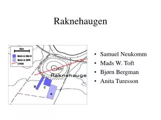
Raknehaugen • Samuel Neukomm • Mads W. Toft • Bjørn Bergman • Anita Turesson
Purpose looking for archaeological features near the mound Investigation site flat area on southern side of the mound meadow with few trees and bushes no geophysical investigation before Mound 15m high, 80m across several excavations within last 150 years consists of varying types of soil, sand and layers of timber Methods GPR, Magnetics EM 31 CVES information about mound mapping shallow targets
A C B General Picture of Field A, B & C
Laser theodolite Recording unit Antennas Laser beam 50 X /m/ Optical signal cables 0 196° N N 8,75 Laser beam reflector 22,50 Y Sledge Recording system setup for the 3D radar measurements at Raknehaugen, Ullensaker, Norway.
Data Acquisition Parameters for GPR’ Sysyem: Pulsekko 100, Sensors & Software Antenna: 200 MHz centre frequency Antenna: 0.80 m Profile seperation: 0.25 m Trace interval: 0.20 m Measured area: 50 x 22 m
P ro c es si ng st eps fo r no rt h t o sou t h t es t pro fil e w i t h a 100 M H z no mi na l f r equen c y an t enn a . 1 Z ero tim e s e t t o 3,33 ns 2 B a nd pa s s f ilt e r c orne r f r eq. 15 - 30-60 - 120 M Hz 3 E nergy decay ga i n , f ac t o r 1 Unprocessed data from the test profile with a 100 Mhz antenna Processed data from the test profile with a 100 Mhz antenna Test profile using a 100 MHz antenna
P ro c es si ng st eps fo r s ou t h t o nor t h t es t pro fil e w i t h a 200 M H z no mi na l f r equen c y an t enn a . 1 Z ero tim e s e t t o 2,67 ns r 20 - 170 M Hz 2 B a nd pa s s bu t t e rwo rt h filt e 3 C r os s c or r e l a ti on, de fi n i ng s ign al , 3-4 m , 43 t o 52 ns 4 E nergy decay ga i n , f ac t o r 1 Unprocessed data from the test profile with a 200 Mhz antenna Processed data from the test profile with a 200 Mhz antenna Test profile using a 200 MHz antenna
P ro c es si ng st eps fo r 3 D m ea s ur em en t s w i th a 200 M Hz no mi na l f r equen c y an t enn a . 1 Z ero tim e s e t t o 2,67 ns 2 B a nd pa s s f ilt e r c orne r f r eq. 10 - 20-120 - 240 M Hz 3 Deconvo l u ti on t i me w i ndow 15-30 ns 4 E nergy decay ga i n , f ac t o r 1 No m ig r a ti on was done, howeve r, s om e ve l oc iti e s w e re i den ti f ie d us i ng t he d iff ra ct ing hype r bo l as i n t he t es t pro fil e us i ng 200 MH z an t enn a . T he ve l o c i t y p i cked was c . 0 , 059 – 0,062 nm /s . S ee fi gu r e b e lo w . A l so i d e nt ifi ed i s t h e r ef le c ti on f ro m nea r by tr ee s w it h ar e a s s i gned t he v e lo ci ty o f li gh t i n a i r c . 0 , 298 n s / m . Processing step for the 3D radar data
Y= 0 Y= 1,5 Y= 3,0 Y= 4,5
Y= 6,0 Y= 7,5 Y= 8,75
Data Acquisition Parameters for Mag. and EM-31 mearurements • MAGNETICS Line spacing: 50 cm Sampling rate: 5 sampels/sec • EM-31 • Line spacing: 1 m • Inline sampling density: 1 m • Operating frequency: 9.8 kHz
CVES profile across Raknehaugen mound • 1 profile across the mound, 160m long • profile direction approximately SW - NE • electrode spacing 1m • data acquisition with Wenner configuration • aMIN=1m, aMAX=48m
Conclusions • Good correlation between GPR and Mag. • Good correlation between EM-31 and Mag. • No archeological features identified.