Download
1 / 54
540 likes | 562 Views
Explore the concept of air pressure and its effects on weather patterns. Learn about the factors that influence wind, the Coriolis effect, and the role of friction. Discover the formation and characteristics of cyclones and anticyclones.

E N D
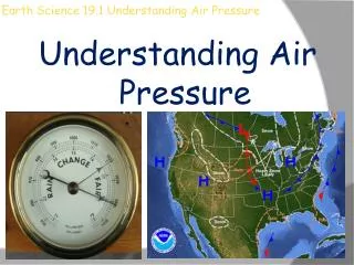
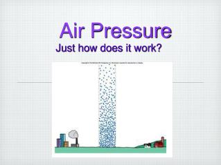
Air Pressure Defined Understanding Air Pressure Air pressure is the pressure exerted by the weight of air. Air pressure is exerted in all directions— down, up, and sideways. The air pressure pushing down on an object exactly balances the air pressure pushing up on the object.
Air pressure • Think back to what you learned about convection cells. • Warm air rises, creating an upward-flowing limb of a convection cell. • Upward flowing air lowers the air pressure of the area, forming a low pressure zone. • The rising air sucks in air from the surrounding area, creating wind.
At the top of the troposphere, the air travels horizontally from a high pressure zone to a low pressure zone. • Where the sinking air strikes the ground, air pressure is relatively high. This creates a high pressure zone. • Air that moves between high and low pressure zones creates global winds.
Low and High Pressure: https://www.youtube.com/watch?v=rjODDPznqNM
Global Winds Pressure Centers and Winds The atmosphere balances these differences by acting as a giant heat-transfer system. This system moves warm air toward high latitudes and cool air toward the equator. Non-Rotating Earth Model • On a hypothetical non-rotating planet with a smooth surface of either all land or all water, two large thermally produced cells would form.
Global Winds 19.2 Pressure Centers and Winds Rotating Earth Model • If the effect of rotation were added to the global circulation model, the two-cell convection system would break down into smaller cells. • Trade winds are two belts of winds that blow almost constantly from easterly directions and are located on the north and south sides of the subtropical highs. • Westerlies are the dominant west-to-east motion of the atmosphere that characterizes the regions on the poleward side of the subtropical highs.
Global Winds 19.2 Pressure Centers and Winds Rotating Earth Model • Polar easterlies are winds that blow from the polar high toward the subpolar low. These winds are not constant like the trade winds. • A polar front is a stormy frontal zone separating cold air masses of polar origin from warm air masses of tropical origin.
Circulation on a Rotating Earth https://www.youtube.com/watch?v=Ye45DGkqUkE
Global Winds 19.2 Pressure Centers and Winds Influence of Continents • The only truly continuous pressure belt is the subpolar low in the Southern Hemisphere. In the Northern Hemisphere, where land masses break up the ocean surface, large seasonal temperature differences disrupt the pressure pattern. • Monsoons are the seasonal reversal of wind direction associated with large continents, especially Asia. In winter, the wind blows from land to sea. In summer, the wind blows from sea to land.
Understanding Air Pressure • Wind is the result of horizontal differences in air pressure. • Air flows from areas of higher pressure to areas of lower pressure. • The unequal heating of Earth’s surface generates pressure differences. • Solar radiation is the ultimate energy source for most wind. • Three factors combine to control wind: • 1.pressure differences • 2. the Coriolis effect • 3. friction
Understanding Air Pressure Pressure Differences • A pressure gradient is the amount of pressure change occurring over a given distance. • Closely spaced isobars—lines on a map that connect places of equal air pressure—indicate a steep pressure gradient and high winds. Widely spaced isobars indicate a weak pressure gradient and light winds.
Factors Affecting Wind Understanding Air Pressure Coriolis Effect • The Coriolis effect describes how Earth’s rotation affects moving objects. In the Northern Hemisphere, all free-moving objects or fluids, including the wind, are deflected to the right of their path of motion. In the Southern Hemisphere, they are deflected to the left.
Understanding Air Pressure Friction • Friction acts to slow air movement, which changes wind direction. • Jet streams are fast-moving rivers of air that travel between 120 and 240 kilometers per hour in a west-to-east direction.
Highs and Lows Pressure Centers and Winds Cyclones are centers of low pressure. Anticyclones are centers of high pressure. In cyclones, the pressure decreases from the outer isobars toward the center. In anticyclones, just the opposite is the case—the values of the isobars increase from the outside toward the center.
Mid-Latitude Cyclones • These are the main weather producers in the United States. Middle-Latitude cyclones are large centers of low pressure that generally travel from west to east and cause stormy weather. • Air moves counterclockwise and in toward the low. • Most middle-latitude cyclones have a cold front and a warm from, extending from a central area. • Forceful lifting causes the formation of clouds that drop heavy precipitation.
Cyclone • A middle-latitude low-pressure system, complete with fronts and precipitation • Polar front theory of mid-latitude cyclone life cycle (birth, growth, and decay) provides a conceptual way to describe weather
Vertical Structure and Development of Cyclones When upper-level divergence of air around low-pressure center is stronger than surface convergence, the cyclone will intensify, and vice versa • When upper-level convergence of air around high-pressure center is weaker than surface divergence, the anticyclone will intensify, and vice versa
Anticyclones So what's happening? What will this mean for the weather? Cold air is descending Anticyclones Whilst moving in a clockwise direction
Convergence and Divergence Convergence The piling up of air above some region Divergence The spreading out air above some region
Airflow Patterns, Surface and Aloft https://www.youtube.com/watch?v=aiYyCurh_SU
Cyclogenesis • Development and strengthening of a mid-latitude storm system • The cyclone is said to be deepening when the surface low pressure in the storm system keeps decreasing • The anticyclone is said to be building when the surface high pressure keeps increasing.
Cyclogenesis Continued • Building anticyclones are associated with upper-air convergence being weaker than surface-air divergence • Deepening cyclones are associated with upper-air divergence overwhelming the surface-air convergence • Upper-layer convergence and divergence primarily occur along Polar Front jet stream
Factors that interact to form a cyclone Draw this diagram on the back side of your notes Upper level (jet stream)Surface Convergence and Divergence High and Low Pressure Systems Cold and warm advection Cold and warm fronts Latent heat and associated Precipitation energy release Straightened-out jet stream Occluded front
Cyclone Development How do the cyclone develop and form? • The front forms as two air masses with different temperatures move in opposite directions. • Over time, the front takes on a wave shape. • As the wave develops, warm air moves towards the poles invading an area formerly occupied by colder air. • Meanwhile, cold air moves toward the equator. • This changes the airflow near the surface.
Cyclone Development • Since cold fronts move faster than warm fronts, the cold front closes in and lifts the warm air producing an occlusion. • As the occlusion begins, the storm often gets stronger. • Pressure at the storm’s center drops and wind speed increases. • In winter, these conditions produce heavy snowfalls and/or blizzards.
Cyclone Development • As more warm is forced to rise, the amount of pressure change weakens. • In a day or two, the entire warm area is displaced. • Only cold air surrounds the cyclone at low levels. • The horizontal temperature difference that existed between the two fronts is gone. • The cyclone has exhausted its energy. • Friction slows the air near the surface.
A rare mother ship cloud formation hovers over Childress, Texas. Tornado chasers there spent seven hours and 150 miles (240 kilometers) tracking the supercell thunderstorm that produced this cloud formation. Supercell thunderstorms are known to spawn tornadoes with winds exceeding 200 miles an hour (322 kilometers an hour).
Curved Tornado • A thin funnel cloud touches down in a field in northwest Iowa. Funnel clouds become tornadoes once they touch the ground.
A category F3 tornado swirls across a South Dakota prairie. The F (Fujita) scale was used to measure wind speeds based on damage left behind after a tornado, and an F3 tornado had wind speeds between 158 and 206 miles an hour (254 to 332 kilometers an hour).
Jet StreamsRole of Winds Aloft • Airflow aloft plays an important role in maintaining and steering cyclonic and anticyclonic circulation. • In fact, these rotating surface wind systems are actually generated by upper level flow. • At times a jet stream will remain nearly stationary for weeks, resulting in nearly unchanging surface weather during the period.
Role of Air Aloft • Cyclones can often last for a week or longer. • Surface convergence must be offset by outflow somewhere higher in the atmosphere. • As long as the spreading out air higher up is equal to or greater than the surface inflow, the low-pressure system can be sustained. • There is a close relationship between cyclones and anticyclones. Generally, they occur together.
Summary of Polar Front Theory In the middle latitudes (where we are!), cyclones form along Polar Front jet stream, the boundary between cold arctic air and warmer subtropical air masses. Major feedback processes: • Convergence and divergence (surface and upper air) • Upper-level temperature advection and fronts ! Feedback processes work in both directions
Jet Stream Affect on Seasonal Climate • When jet streams prevent Gulf air from penetrating into the plains and midwest states or the southeastern states, causing drought (a frequent occurrence), or by funnel moisture and energy into those same areas to produce violent storms, flooding, etc., as has happened the past two days in the southeast. • When jet streams move eastward over the U.S. in a more regular pattern, all areas tend to benefit from more consistent rainfall, resulting in improved crop yields in most parts of the country.
Hurricanes • Hurricanes are whirling tropical cyclones that produce winds of at least 119 kilometers per hour (75 mph). • Hurricanes are considered the most powerful storms on Earth. • Hurricanes bring tremendous amounts of rainfall. • Strong winds produce a storm surge flooding coastal areas. • They are becoming more of a threat as more people move into and live in coastal areas. • Hurricanes develop most often in the late summer when water temperatures are warm enough to provide the necessary heat and moisture to the air.
Development of Hurricanes • The tropical disturbances resulting over this warm ocean water are disorganized. • Their low pressures have little or no rotation. • A hurricane is a heat engine that is fueled by the energy given off when huge quantities of water vapor condense.
Hurricanes • An organized storm occurs when an inward rush of warm, moist air moves toward the core of the storm. • The air then turns upward and rises in a ring of cumulonimbus clouds. • This doughnut-shaped wall that surrounds the center of the storm is called the eye wall. • Here the greatest wind speeds and heaviest rains occur.
Meet The Hurricane, NASA footage. - YouTube Hurricanes
• A hurricane releases the bulk of its energy through cloud and rain formation. An average storm's daily cloud and rain energy output is equal to 200 times of the world's electricity-generating capacity.
Hurricane Katrina Katrina was a large scale Hurricane in comparison to Sandy: • Winds at one point were 175 mph (cat5) • At landfall in Louisiana winds were @ 125mph • It had a storm surge of 28 feet • On land 33 hours • Storm destruction was 415 miles wide • Winds stretched 400 miles wide
Hurricane Sandy • Sandy was a post-tropical cyclone 94 mph Cat1 • Sandy was a wide hurricane; b/c of that it was destructive • On land 32 hours • Storm destruction was 1000 miles wide • Sandy was more powerful than Hiroshima atomic bomb • Winds stretched 940 miles wide • It is because it sat for days, churning, that it was so destructive