Download
1 / 41
410 likes | 555 Views
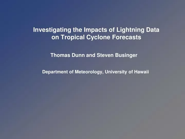
Investigating the Impacts of Lightning Data on Tropical Cyclone Forecasts. Thomas Dunn and Steven Businger Department of Meteorology, University of Hawaii. Introduction. A tropical cyclone’s intensity change can be inferred from knowledge of the convective structure of its eyewall.

E N D
Investigating the Impacts of Lightning Data on Tropical Cyclone Forecasts Thomas Dunn and Steven Businger Department of Meteorology, University of Hawaii
Introduction A tropical cyclone’s intensity change can be inferred from knowledge of the convective structure of its eyewall • Embedded cores • Jorgensen (1984) • Eyewall replacement cycles • Willoughby et al. (1982) • Eyewall Asymmetries • Sitkowski and Barnes (2009) • Convective bursts, hot towers • Heymsfield et al. (2001) Sitkowski and Barnes (2009)
Introduction The convective structure of the eyewall may be inferred from an examination of continuous observations of its eyewall lightning activity • Radial distribution of flash density • Episodic eyewall lightning • Outbreaks accompanied intensification and MI • Molinari et al. (1999) • Outbreaks accompanied RI, MI, and ERCs • Nearly symmetrical during MI • Squires and Businger (2008) Squires and Businger (2008)
Goal and Preliminary Objectives Goal: Use observed lightning data and eyewall-resolving numerical model simulations to improve tropical cyclone intensity forecasts and understand how eyewall lightning relates to intensity Objectives: Evaluate whether lightning data improves the final intensity Evaluate whether lightning data changes the intensity rate Investigate the generation and redistribution of charge by the parent vortex Determine whether lightning outbreaks are governed by convective-scale perturbations or mesoscale organization
Lightning Data Assimilation • Nudge the model fields toward grid point observations • Nudging coefficients added to prognostic equations • Alexander et al. (1999), Chang et al. (2001) • Use the model’s convective parameterization to control trigger mechanisms for deep, moist convection • Adjust moisture profiles • Papadopoulos et al. (2005) • Mansell et al. (2007) • Adjust latent heating (and moisture) profiles • Pessi and Businger (2009) • Techniques are at odds with the fine grid spacing required to resolve convective processes in the eyewall that influence intensity
Alternative Approach • Interpret lightning observations as perturbation quantities in time and space • Mass, momentum, energy • State variables • Derived variables • Use a Lagrangian tracer capability to add perturbations to the grid point prognostic equations • An embedded calculation, spatial and temporal interaction with model variables (dynamics, thermodynamics, microphysics, and charge density) • Use a dynamically adapting grid atmospheric model to resolve the local environment where/when the perturbation takes place
Operational Multiscale Environment modelwith Grid Adaptivity (OMEGA) • A numerical weather prediction model based on unstructured, adaptive grids (Bacon et al. 2000) • Conceived to advance the operational prediction of hazardous atmospheric aerosols and gases • Implemented by linking CFD gridding capabilities with the physics of numerical weather prediction and atmospheric dispersion • Developed as an operational model that supports research calculations
OMEGA System OverviewPhysics and Numerics Governing Equations 3-D, nonhydrostatic Coordinate System Cartesian Numerics Finite volume Advection 2nd order, upwind corrective scheme(Smolarkiewicz MPDATA) Radiation SW absorption by water vapor, LW emissivities of water vapor and CO2 Convective Kain-Fritsch, Kuo Microphysics Bulk water Initialization OI scheme Lateral Boundaries Radiative and large scale nudging Upper Boundary Rigid, free-slip surface Lower Boundary Monin-Obukhov similarity theory
OMEGA System OverviewPhysics and Numerics Boundary Layer Viscous sublayer, surface layer, and transition layer Turbulence Closure Based on turbulence kinetic energy and itsdissipation, 1.5 order closure (Mellor-Yamada level 2.5) Surface Roughness Specified over land, predicted over water Surface Datasets Terrain elevation, land-water, soil type,land use/cover, SST, soil temperatureand moisture Dispersion Model Embedded, Eulerian and Lagrangian (Monte Carlo particle and probabilistic puff) Ocean Model 1-way and 2-way coupling with POM
OMEGA System OverviewGrid Structure • Coordinate system is Cartesian with the origin placed at the center of the earth • Computational cells are triangular prisms • Grid is unstructured in the horizontal, structured in the vertical direction, terrain-following • Grid adapts to surface features, tracers, evolving weather
Perturbation Example • Interpret lightning observations as perturbation quantities in time and space • Use a Lagrangian tracer capability to add perturbations to the grid point prognostic equations • Use a dynamically adapting grid atmospheric model to resolve the local environment where/when the perturbation takes place • Domain: 8 deg X 8 deg • Resolution: 1 – 7 km • Initialization: Homogeneous, from sounding + vortex • Configuration: 110,000 cells, 34 levels, 30m surface layer • Perturbation: Lightning (time and location), 3K warm bubble • Grid adaptation: Dynamic, to lightning location
Perturbation ExampleGrid adapted to lightning observations Initialization
Perturbation ExampleGrid adapted to lightning observations T0 + 3 minutes
Perturbation ExampleGrid adapted to lightning observations T0 + 5 minutes
Perturbation ExampleGrid adapted to lightning observations T0 + 5 minutes
Perturbation ExamplePotential temperature field + lightning perturbations T0 + 5 minutes
Perturbation ExamplePotential temperature field + lightning perturbations T0 + 10 minutes
Perturbation ExamplePotential temperature field + lightning perturbations T0 + 20 minutes
Preliminary Perturbation Methodology • Adapt the grid to the cyclone location in order to resolve the eyewall and core circulation • Add lightning observations as perturbations to the resolved core
Preliminary Perturbation Methodology • Scaled surface fluxes of energy, moisture, and momentum by varying transfer coefficients in the bulk aerodynamic equations (5 km) • Craig and Gray (1996) • Prescribed large scale eddy forcing on model momentum equations (7.5 km) • Nong and Emanuel (2003) • Created local velocity perturbations (2 km) • Nascimento and Droegemeier (2006)
Preliminary Approach Idealized Vortex Benchmarks Idealized Thunderstorm Mixed-Phase Electrification Idealized Vortex + Electrification Idealized Thunderstorm + Electrification Perturbation Methodology Idealized Vortex + Electrification + Perturbation Real Case Tropical Cyclone
Idealized Thunderstorm(Kuhlman et al. 2006) • A model validation case from the Severe Thunderstorm Electrification and Precipitation Study (STEPS) • Simulated first three hours of the 29 June 2000 NE Kansas supercell • Study examined consequences of using four different charge separation mechanisms on simulated electrification and charge distribution • A model validation case from the 2008 WMO International Cloud Modeling Workshop, Cancun, Mexico • Goal was to simulate the first three hours of the 29 June 2000 NE Kansas supercell with prescribed initial conditions: 3K warm bubble; surface fluxes, radiative transfer, and Coriolis neglected • Goal was to examine sensitivities of microphysics to observed storm features and evolution
Idealized Vortex(Fierro et al. 2007) • A seminal work exploring the electrification and microphysics of an idealized hurricane-like vortex • 12-class bulk microphysics • Non-inductive, riming graupel and cloud ice • Parameterized lightning • Evolution of charge structure and lightning distribution • Highest flash rates in the eyewall • Normal tripole
Summary • A tropical cyclone’s intensity change can be inferred from knowledge of the convective structure of its eyewall • Compelling evidence that the eyewall structure can be inferred from an examination of continuous observations of eyewall lightning • A promising avenue to improve intensity forecasts may hinge on the judicious use of observed lightning data and eyewall-resolving numerical model simulations • Lightning data has been assimilated by nudging prognostic variables to observations or through the effects of parameterized convection • However, fine grid spacing is required to resolve convective processes in the eyewall that influence intensity
Summary • An alternative approach was presented, aimed at localizing perturbations and their impacts • Goal is to use lightning data and eyewall-resolving numerical model simulations to improve intensity and understand how eyewall lightning relates to intensity • Evaluate whether lightning data changes the intensity rate and improves the final intensity • Investigate the generation and redistribution of charge by the parent vortex • Determine whether lightning outbreaks are governed by convective-scale perturbations or mesoscale organization
References • Alexander, G.D., J.A. Weinman, V.M. Karyampudi, W.S. Olson, and A.C.L. Lee, 1999: The Effect of Assimilating Rain Rates Derived from Satellites and Lightning on Forecasts of the 1993 Superstorm. Mon. Wea. Rev., 127, 1433–1457. • Bacon, D.P., N.N. Ahmad, Z. Boybeyi, T.J. Dunn, M.S. Hall, P.C.S. Lee, R.A. Sarma, M.D. Turner, K.T. Waight, S.H. Young, and J.W. Zack, 2000: A Dynamically Adapting Weather and Dispersion Model: The Operational Multiscale Environment Model with Grid Adaptivity (OMEGA). Mon. Wea. Rev., 128, 2044–2076. • Chang, D.E., J.A. Weinman, C.A. Morales, and W.S. Olson, 2001: The Effect of Spaceborne Microwave and Ground-Based Continuous Lightning Measurements on Forecasts of the 1998 Groundhog Day Storm. Mon. Wea. Rev., 129, 1809–1833. • Craig, G.C., and S.L. Gray, 1996: CISK or WISHE as the Mechanism for Tropical Cyclone Intensification. J. Atmos. Sci., 53, 3528–3540. • Fierro, A. O., L. Leslie, E. Mansell, J. Straka, D. MacGorman, and C. Ziegler, 2007: A High-Resolution Simulation of Microphysics and Electrification in an Idealized Hurricane-like Vortex. Meteorol. Atmos. Phys., 98, 13–33.
References • Heymsfield, G.M., J.B. Halverson, J. Simpson, L. Tian, and T.P. Bui, 2001: ER-2 Doppler Radar Investigations of the Eyewall of Hurricane Bonnie during the Convection and Moisture Experiment-3. J. Appl. Meteor., 40, 1310–1330. • Jorgensen, D.P., 1984: Mesoscale and Convective-Scale Characteristics of Mature Hurricanes. Part II. Inner Core Structure of Hurricane Allen (1980). J. Atmos. Sci., 41, 1287–1311. • Kuhlman, K. M., C. L. Ziegler, E. R. Mansell, D. R. MacGorman, and J. Straka, 2006: Numerically Simulated Electrification and Lightning of the 29 June 2000 STEPS Supercell Storm. Mon. Wea. Rev., 134, 2734–2757. • Mansell, E.R., C.L. Ziegler, and D.R. MacGorman, 2007: A Lightning Data Assimilation Technique for Mesoscale Forecast Models. Mon. Wea. Rev., 135, 1732–1748. • Molinari, J., P. Moore, and V. Idone, 1999: Convective Structure of Hurricanes as Revealed by Lightning Locations. Mon. Wea. Rev., 127, 520–534.
References • Nascimento, E.d.L., and K.K. Droegemeier, 2006: Dynamic Adjustment in a Numerically Simulated Mesoscale Convective System: Impact of the Velocity Field. J. Atmos. Sci., 63, 2246–2268. • Nong, S., and K. Emanuel, 2003: A Numerical Study of the Genesis of Concentric Eyewalls in Hurricanes. Q. J. R. Meteorol. Soc., 129, 3323–3338. • Papadopoulos, A., T.G. Chronis, and E.N. Anagnostou, 2005: Improving Convective Precipitation Forecasting through Assimilation of Regional Lightning Measurements in a Mesoscale Model. Mon. Wea. Rev., 133, 1961–1977. • Pessi, A.T., and S. Businger, 2009: The impact of Lightning Data Assimilation on a Winter Storm Simulation over the North Pacific Ocean. Mon. Wea. Rev., (Submitted). • Sitkowski, M., and G.M. Barnes, 2009: Low-Level Thermodynamic, Kinematic, and Reflectivity Fields of Hurricane Guillermo (1997) during Rapid Intensification. Mon. Wea. Rev., 137, 645–663. • Smith, R.K., 2006: Accurate Determination of a Balanced Axisymmetric Vortex in a Compressible Atmosphere. Tellus, 58A, 785–786.
References • Smith, R.K., 2007: Corrigendum and Addendum: A Axisymmetric Vortex in a Compressible Atmosphere. Tellus, 59A, 98–103. • Squires, K., and S. Businger, 2008: The Morphology of Eyewall Lightning Outbreaks in Two Category 5 Hurricanes. Mon. Wea. Rev., 136, 1706–1726. • Willoughby, H.E, J.A. Clos, and M.G. Shoreibah, 1982: Concentric Eyewalls, Secondary Wind Maxima, and the Evolution of the Hurricane Vortex. J. Atmos. Sci., 39, 395–411.
Benchmark References • Carpenter, R. L., Jr., K. K. Droegemeier, P. R. Woodward, and C. E. Hane, 1990: Application of the piecewise parabolic method (PPM) to meteorological modeling. Mon. Wea. Rev., 118, 586–612. • Bryan, G.H., and J.M. Fritsch, 2002: A Benchmark Simulation for Moist Nonhydrostatic Numerical Models. Mon. Wea. Rev., 130, 2917–2928. • Straka, J.M., R.B. Wilhelmson, L.J. Wicker, J.R. Anderson, and K.K. Droegemeier, 1993: Numerical Solutions of a Non-linear Density Current: A benchmark solution and comparisons. Int. J. Numer. Methods Fluids., 17, 1–22. • Wicker, L.J., and W.C. Skamarock, 1998: A Time-Splitting Scheme for the Elastic Equations Incorporating Second-Order Runge–Kutta Time Differencing. Mon. Wea. Rev., 126, 1992–1999.