Download
1 / 55
570 likes | 639 Views
Explore the hows and whys of physical and cultural differences on Earth, from observed patterns to human interactions shaping the landscape. Delve into historical and modern geography concepts, focusing on human geography, physical geography, and spatial distribution. Learn about location, direction, distance, landscapes, and the process of change over time. Discover the significance of spatial interaction, spatial distribution, globalization, cartography, and the global grid system.

E N D
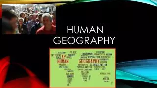
what is geography? • “description of the earth” • a study of spatial variation • the how and why of physical & cultural differences • location, location, location • observable patterns that have evolved through time
interaction of physical environment and human activity -cultural landscape can alter the natural environment
evolution of the discipline - mapping/human interpretation • Aristotle (384-322 BC)-earth is spherical • Erathosthenes (276 BC)-Greek scholar-”geo”=earth “graphy”=to write • Strabos (63BC-24AD)/Herodotus (484-423BC)
outside the western world • Chinese Scholars • Muslim Scholars
human geography • Where are people? • What are they like? • What is their interaction over space? • What kinds of landscapes do they erect?
physical geography • attention towards natural landscape • landforms and their distribution • atmospheric conditions and climatic patterns • soils / vegetation associations
modern geography….. • 1. Climates, patterns, processes of physical environment • 2. Rapid development of natural sciences • 3. Accurate mapping • 4. Data collection / statistics
academic geography • Earth science • Man-land relations • Areal differentiation • Spatial organization • location • processes • patterns • interactions/relations • distributions
three concepts about space • Location • Direction • Distance
absolute location • Mathematical location • Latitude & Longitude • degrees, minutes, seconds • Township & Range (1785 Land Ordinance) • Subdivision: parallels & meridians • Topographic quadrangle, US Geological Survey • Metes & Bounds
latitude & longitude (22° 15' N, 114° 10‘ E)
relative location • “place” in relationship to surroundings
Site • absolute location concept • physical & cultural characteristics • Topography, vegetation, water, physical characteristic
Situation • external relations of locale • relative location concept • dynamic
absolute directions • Based on cardinal systems • north, south, east, west • from solar system
relative directions • Based on cultural & local perceptions • no absolute boundaries or definitions • “down south”, “out west”, “up north”, “down south”, “Near East”, “Far East”
absolute distance • Absolute mathematical mileage, or measurement of distance
relative distance • Refers to a more regional spatial relationship • how distance is described $$$ & TIME MILES MINUTES
psychological distance • Distance lengthened / shortened • first time traveled • night / day travel • safety / danger / excitement
size & scale • Size of unit studied • Scale implies degree of generalization • broad or narrow • Varying sizes • local • regional • global
landscapes • Natural • Cultural • Dynamic
process of change Before 1970 After development Long Island, New York
spatial interaction • Accessibility • how easy/difficult to overcome time & space separation • Connectivity • how places are connected • Spatial diffusion • process of dispersion of ideas or items from a center of origin to more distant points • Globalization • Increasing interconnection of peoples and societies worldwide
globalization • Standardization • $$$$, EU, time, United Nations • Containerization • movement of products • outsourcing • Intersection of the ‘haves’ & ‘have nots’ • cell phones, internet
spatial distribution • Arrangement of items on Earth’s surface • Three concepts
1. density • Measure of the number/quantity within a defined unit of areas • proportion • arithmetic • physiological density
2. dispersion (concentration) • Amount of spread of phenomenon over an area • 1. clustered, agglomerated • 2. dispersed, scattered, random
3. pattern • Emphasizes design rather than spacing • linear (a) – road, river, rail line • centralized (b) – city & suburbs • random (c) • Rectangular system of land survey - U.S. • rural: checkerboard, 1 mile squares • cities: grid system
regional concepts • 1. formal or uniform regions • Areas of essential uniformity • Physical or cultural • Sahara Desert, “Bible Belt”
2. functional region • spatial system defined by interactions/ connections Glendale Galleria Newspaper Route
3. perceptual regions • Less structured & more culturally based China Town The “Valley’
cartography –the science of making maps • Maps provide a visual tool • Maps are subjective • Map projections transfer locations on a round surface to a flat surface • some form of distortion always occurs • greater distortion results from larger areas depicted
mathematics of the Earth • Aristotle (384-322 BC) discovered the earth to be an oblate spheroid • Equatorial bulge 7926.38 (7924) • Polar shortening 7899.80 (7922) • 23.5° axis (tilt)
seasons and climate • Earth’s rotation & movement around the sun • Tilt of the earth’s axis (23.5°) • Receipt of solar radiation • Re-radiation of energy in the form of heat
the Earth’s divisions • Latitude lines • Equal distance between lines • Lines become increasingly smaller descending from the equator to poles • Longitude lines • Each line is the same exact length • All lines become increasingly close together as they descend to the poles
important lines of latitude • Equator: 0 degrees • Tropic of Cancer: 23.5 degrees North • Tropic of Capricorn: 23.5 degrees South • Arctic Circle: 66.5 degrees North • Antarctic Circle: 66.5 degrees South
important lines of longitude • Prime Meridian: 0 degrees (runs through Greenwich, England) • International Dateline: 180 degrees • Time Zones: every 15 degrees of longitude equals one hour
maps • Scale • the smaller the scale the greater the detail - for example one inch = one mile is more detailed than one inch = one hundred miles 1:1 or 1:100 • Legend • interprets map information
map projections & distortion • Shape • Distance • Relative size • Direction