Download
1 / 35
350 likes | 475 Views
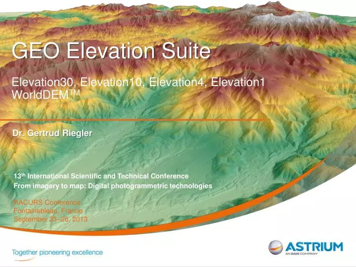
GEO Elevation Suite Elevation30, Elevation10, Elevation4, Elevation1 WorldDEM TM. Dr. Gertrud Riegler. 13 th International Scientific and Technical Conference From imagery to map: Digital photogrammetric technologies RACURS Conference Fontainebleau, France September 23–26, 2013. Agenda.

E N D
GEO Elevation SuiteElevation30, Elevation10, Elevation4, Elevation1WorldDEMTM Dr. Gertrud Riegler 13th International Scientific and Technical Conference From imagery to map: Digital photogrammetric technologies RACURS Conference Fontainebleau, France September 23–26, 2013
Agenda • What is GEO Elevation? • What can you use elevation models for? • GEO Elevation Suite • Target Markets • Competitive Offer • WorldDEMTM • Annex: • Case Studies
What is GEO Elevation? GEO Elevationis a comprehensive suite of accurate Elevation products. GEO Elevationoffers elevation information everywhere in the world, whatever the relief & weather conditions. GEO Elevationconsists of three core levels based on Astrium’s unique satellite constellation.
What can you use elevation models for? • High-quality image ortho-rectification • Multi-scale mapping • Defence mission preparation & rehearsal • Terrain knowledge for flight guidance • Register intelligence and ease target identification • Water body identification • Infrastructure & networks planning, feasibility studies • Flood modelling • 3D visualisation defence risk & emergency oil & gas national mapping civil engineering
GEO Elevation Suite The right Elevation Model for your needs Elevation30 Elevation10 Elevation4 &1 High precision DEM generated from Pléiades stereo or tri-stereo data. Regional 10m elevation models everywhere in the world whatever the relief and weather conditions Unique worldwide 3D geographic reference database for all global coverage needs
Elevation30 Unique worldwide 3D geographic reference database for all global coverage needs, especially suited for large area coverage for mapping, GIS and military needs. • Available for more than 70 million sqkm worldwide • Up to 5m horizontal and 8m vertical accuracy at 30m grid spacing • Based on DTED level 2 standards • Excellent accuracy data • 3 layers: DTED-2 DEM, Ortho image, Quality masks • Derived from both optical (SPOT) and radar (TerraSAR-X) spaceborne technologies, allowing a greater coverage independent of terrain characteristics and weather conditions.
Elevation30 Coverage & Availability Overall: 122M sqkmavailable 70M sqkm of Elevation30 available off-the-shelf Production and delivery take a few hours 40M sqkm of geo-ready HRS coverage for production Areas included in Elevation30 production schedule: 3 months 12M sqkm of validated HRS data Bespoke production tailored to the customer – need to realise a feasibility study
DSM/ DEM DTM Elevation10 10m elevation modeling service for regional area coverage, whatever the relief and weather conditions. • Up to 5m abs. height accuracy at 10m grid spacing • Regional coverage available from a min. of 500 km² • Customised to your area of interest; specifications adaptable to customer requirements • Based on HRTE3 (DTED level 3) standards • Solid data: based on TerraSAR-X StripMap stereo pairs • Three different product variants: • DSMbasic • DSM – editing of water bodies • DTM – representation of the bare earth • Additional Products: Quality Layers, Ortho-rectified Radar Image
Elevation10 Products DSM DTM DSM(basic) City area City area City area Ocean Ocean Ocean Digital Surface Model • Remove artefacts • Void fill Digital Surface Model • Water body editing (flattening) Digital Terrain Model • Trees, forests and man-made objects are removed revealing small-scaled terrain structures
Elevation4 & Elevation1 • Product Description Elevation4: Pléiades Stereo or Tristereo automatic matching for DEM production at 4m grid spacing. Processing includes manual editions. DEM delivered with the original Stereo or Tristereo data source and orthomosaic as an option Accuracy Elevation1: Pléiades Stereo or Tristereo automatic matching for DEM production at 1m grid spacing. Processing includes manual editions. Elevation1 is a package including the DEM, a 50cm orthomosaic and the Stereo pair. Available over mineral / open areas with few vegetation and buildings. Perfect for micro-relief in arid areas.
Elevation4 & Elevation1 Stereo or Tri-stereo? Illustration of Tri-stereo benefits over Melbourne Difficult urban area - concentration of skyscrapers In red: hidden items Merge of the 3 stereo DEMs Stereo 1: Image 1 + 2 DEM 4m Stereo 3: Image 2 + 3 DEM 4m Stereo 2: Image 1 + 3 DEM 4m
Elevation4 & Elevation1 - Sample Elevation1, Stereo Pléiades Saudi Arabia Elevation4, Tristereo Pléiades Tasmania, Hobart
Elevation1 – Sample Mashhad Ortho Image
Elevation1 – Sample Mashhad Elevation1
Elevation1 – Sample Mashhad Ortho Image Elevation1
Elevation1 – Sample Mashhad Ortho Image Elevation1
Elevation1 DSM & DTM - Sample Ortho Image
GEO Elevation Product Suite DSM / DEM DTM Elevation 1 & 4 accuracy dependent upon ground control points (GCPs). Status: Jan 2013
What is WorldDEMTM • WorldDEMTMwill be part of GEOElevation Product Suite • First worldwide available DEM product at HRTE3 level (former DTED-3) • Homogeneous, seamless DEM covering entire Earth’s land mass (150 Mkm²) • Data acquisition within 3 years only (one source) • Acquired by TerraSAR-X and TanDEM-X flying in a very close and precise formation • WorldDEMTM will be available from 2014
WorldDEMTM - Products Digital Surface Model (DSM) representing the surface of earth • DSM basic – no editing of objects • DSM hydro – editing of water bodies Digital Terrain Model (DTM) representing the elevation of bare earth Accuracy
WorldDEMTM - USPs • Coverage A standardizedDEM for any spot on Earth at the same quality • Quality Allows you to close gaps in areas where no adequate DEM exists to date and extend to areas missing so far (cf. SRTM) with high accuracy • Accuracy Improve the performance of today’s globally operatingnavigation systems and applications • Availability Offers you easy and instant access to DSM basic due to an automatic order process and the global dataset being available, ensuring immediate delivery • The unique and unrivaled combination setting a • new standard • in global elevation modeling
WorldDEMTM – Visual Comparison SRTM 3“ SRTM 1“ WorldDEM 0.4“ Minnesota TanDEM-X SAR amplitude
Case Studies Infrastructure Development Mapping Flood Hazard Maps Defense Terrain Analysis Geological Prospection Pipeline Route Assessment
Case Study: Planning & conductingmilitaryoperations GEO Elevation isthe perfect foundation layer for all intelligence data and products. • Aircraft and cruise missile mission planning and navigation • Training and simulation operations (flight simulation) • Accurate geo-referenced base for ‘’Intelligence Dossier’’ • Quickly gain a 3D picture of terrain • Plan and assess operations on the field: threat evaluation, target detection and location and damage assessment • Mass production of ortho images and mapping: accurate and uniform geospatial reference data for headquarters and joint forces. Precise and consistent registration for exogenous data.
Orthorectified Image Shaded Color Relief Topographic map 1 : 50 000 • Sungai Siput Utara (Malaysia) • Elevation10 and 1m TerraSAR-X imagery • Stereo Interpretation of topographic features • Contour generation • Topographic Mapping (2D/3D) Case Study: Map creation Precise height information for topographic mapping & map updates. • Multi-scale mapping: topographic maps 1:25,000, 1:50,000, 1:100,000 • One Stop Shop: imagery, elevation & maps - perfect matching of DEM and image • Mass production of ortho images • Reliable position accuracy of ortho-rectified VHR optical data • Cloud-independence due to radar characteristics • Sustainable update schemes PROJECT REFERENCE
Case Study: Infrastructure development Without the need to send surveying teams to the site or request authorizations from local authorities: • Determine the best routes • Calculate cubic volumes of earth to be evacuated • Locate structures • Evaluate global investments and operating costs Feasibility studies are completed more quickly with accurate and up-to-date geo-information that speed up the decision-making process. PROJECT REFERENCE • Elevation30 for Systra, Algeria national rail transport operator • DEM and 2.5m SPOT5 imagery for a complete picture • Linear mosaic for evaluating earthworks • Visualisation in 3D to determine the future railway corridor Elevation30
Flood Modeling Slope Case Study: Hydrological / Hydraulic Modeling Precise elevation information needed over hazard areas: usually cloud covered areas and within short time period • DSM/DTM is the basis of estimation of slope and aspect flow-path and direction • Detection of flooded areas beneath vegetation using DTM PROJECT REFERENCE • Australian Government • Flood Extent map • Fitzroy River, Queensland Australia • Automated flood extraction using TerraSAR-X ScanSAR acquisition • Astrium water management study • Consortium: Astrium GEO (Germany and UK), geomer • Deliverables: Flood hazard maps
Case Study: Terrain Analysis Unique reference 3D map database providing quick access to accurate information about areas of interest, saving considerable time and money on field surveys in remote or poorly mapped regions. • Current and comprehensive geology terrain features • Analysis of land cover, slopes and drainage using imagery yields • Seismic surveying • 3D subsurface modelling • Optimise field survey planning • Better assess natural resources potential and simulate extraction from a site • Input layer into geological modelling systems PROJECT REFERENCE • Australia exploration project • Elevation30 and 2.5m SPOT5 imagery
PROJECT REFERENCE • Colombia • Elevation10 DSM & DTM Case Study: Geological Prospection Elevation information even in pathless areas (e.g. rainforest) • Feasibility Studies • Scouting • Exploration • Scouting • Input into geophysical processing / modelling • Orthorectification of multi-source geodata • Integration into topographic mapping • Development • Airport planning (terrain, flight approaches) • Infrastructure Planning regarding • roads, supply units, accommodation • pipelines, • oil- and gas processing facilities • Preparation of seismic measurements
Case Study: Pipeline Assessment Very precise elevation information needed for defining and assessing pipeline routes as well as planning and preparing of the infrastructure for realization of the pipeline • Best route planning • Determine cubic volumes of earth to be evacuated • Infrastructure planning Time and cost saving approach: information is available without sending survey teams to specific sites PROJECT REFERENCE • Elevation 1 for Kazakhstan • DEM of a 1,800 km long corridor for terrain analysis • Linear area of interest for evaluating pipeline route • Visualisation in 3D to determine the future railway corridor