Download
1 / 20
200 likes | 368 Views
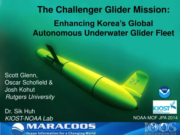
National Science Foundation Ocean Observing Initiative Cyber Infrastructure Implementing Organization Observing System Simulation Experiment NSF OOI CI IO OSSE. Yi Chao, JPL Oscar Schofield, Rutgers Scott Glenn, Rutgers (about 30 people). MACOORA Workshop. Core CI OSSE Teams.

E N D
National Science FoundationOcean Observing InitiativeCyber Infrastructure Implementing OrganizationObserving System Simulation Experiment NSF OOI CI IO OSSE Yi Chao, JPL Oscar Schofield, Rutgers Scott Glenn, Rutgers (about 30 people) MACOORA Workshop
Core CI OSSE Teams • OurOcean data and model integration portal • Yi Chao and Peggy Li, JPL • CASPER/ASPEN mission planning and control • Steve Chien and David Thompson, JPL • MOOSDB/MOOS-IvP autonomous vehicle control • Arjuna Balasuriya, MIT • Glider Simulator, Environment and Field Deployment in Mid-Atlantic Bight • Oscar Schofield, Rutgers MACOORA Workshop
NWS WFOs Std Radar Sites Mesonet Stations LR HF Radar Sites Glider AUV Tracks USCG SLDMB Tracks NDBC Offshore Platforms CODAR Daily Average Currents CI OSSE in the Mid-Atlantic Bight • Five real-time forecasting models • Avijit Gangopadhyay, U. Mass-Dartmouth • Alan Blumberg, Stevens Institute of Technology • John Wilkin, Rutgers • John Warner, USGS/WHOI • Pierre Lermusiaux, MIT MARCOOS MACOORA Workshop
Space, In-Situ (Oceans) Data Assimilation Predictive Models Supercomputing Virtual Space CI OSSE: November 2-13, 2009 • Objective: To provide a real oceanographic test bed in which the designed CI technologies will support field operations of ships and mobile platforms, aggregate data from fixed platforms, shore-based radars, and satellites and offer these data streams to data assimilative forecast models. • Goal: To use multi-model forecasts to guide glider deployment and coordinate satellite observing. Adaptive Sampling Two-way interactions between the sensor web and predictive models. MACOORA Workshop 5
Data/Model Integration Portal: http://ourocean.jpl.nasa.gov/CI Science Community Workshop 1
NAM (12-km) Weather Forecast Science Community Workshop 1
SST Obs. Science Community Workshop 1
Model A Model B Model C Model D Science Community Workshop 1
Observation vs Multi-Model Ensemble SST Obs. Ensemble Model MACOORA Workshop
Model A Model B Model C Model D Science Community Workshop 1
Observation vs Multi-Model Ensemble HF Radar Obs Ensemble Model MACOORA Workshop
Hyperion on EO-1: 7.5kmx100km (30-m) Science Community Workshop 1
Space, In-Situ (Oceans) Data Assimilation Predictive Models Supercomputing Virtual Space CI OSSE Accomplishments • A Closed Loop OSSE/OSE • We integrated in-situ sensors with space-based Earth observation system. • Data gathered locally by a fleet of gliders is fed into a real-time assimilative ocean forecasting system. • Model forecasts are used by scientists to command the gliders and space craft to optimize the spatial coverage over the areas of interests. • Both data and model forecast are available in real-time to aid better decision making. Adaptive Sampling Two-way interactions between the sensor web and predictive models. MACOORA Workshop
Steering CommitteeTommy Dickey (co-chair) - University of California, Santa BarbaraScott Glenn (co-chair) - Rutgers UniversityJim Bellingham - Monterey Bay Aquarium Research InstituteYi Chao - Jet Propulsion Laboratory and California Institute of TechnologyFred Duennebier - University of HawaiiAnn Gargett - Old Dominion UniversityDave Karl - University of HawaiiLauren Mullineaux - Woods Hole Oceanographic InstitutionDave Musgrave - University of AlaskaClare Reimers - Oregon State UniversityBob Weller (ex officio) - Woods Hole Oceanographic InstitutionDon Wright - Virginia Institute of Marine SciencesMark Zumberge - Scripps Institution of Oceanography Glenn, S.M. and T.D. Dickey, eds., 2003, SCOTS: Scientific Cabled Observatories for Time Series, NSF Ocean Observatories Initiative Workshop Report, Portsmouth, VA., 80 pp., www.geoprose.com/projects/scots_rpt.html.
“MARCOOS data increases the explanatory power of habitat models by as much as 50%” – NOAA Fisheries And The Environment MACOORA Mid Atlantic Cold Pool Sampling & Forecasting for Fisheries Fisheries Users Fisheries Councils NMFS Commercial Recreational Glider Ports U Mass Dartmouth SUNY Stony Brook Rutgers U Delaware U Maryland Naval Academy U North Carolina Forecast Centers U Mass Dartmouth Stevens Institute Tech Rutgers MIT USGS Woods Hole Operations Centers Rutgers NASA JPL Five X-Shelf Glider Endurance Lines Subsurface Maps Fisheries Groups DB NYH CB LIS Cold Pool (T < 8C) Dominant Spring-Fall Subsurface Feature In the MAB Data Assimilated into Forecast Models: Spring-Fall OOI CI Tools: Model Feedback to Glider Sampling Combines Infrastructure & Expertise from IOOS MARCOOS, NSF OOI, NOAA NMFS MACOORA Workshop
MACOORA Themes – MARCOOS Products Cross-cut MACOORA Workshop