Download
1 / 20
200 likes | 362 Views
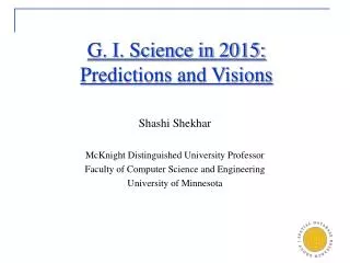
G. I. Science in 2015: Predictions and Visions. Shashi Shekhar McKnight Distinguished University Professor Faculty of Computer Science and Engineering University of Minnesota. Source: http://archive.salon.com/comics/tomo/2001/07/09/tomo/index.html ,

E N D
G. I. Science in 2015: Predictions and Visions Shashi Shekhar McKnight Distinguished University Professor Faculty of Computer Science and Engineering University of Minnesota
Source: http://archive.salon.com/comics/tomo/2001/07/09/tomo/index.html, www.gpsworld.com/gpsworld/article/articleDetail.jsp?id=360842
Consumer Applications • Location-based Services • E.g.: MapPoint, MapQuest, Yahoo/Google Maps, … Courtesy: Microsoft Live Search (http://maps.live.com)
Consumer Applications • Cell-phone, watch, custom • For in-vehicle or portable use
Application Domains • Spatial data mining is used in • NASA Earth Observing System (EOS): Earth science data • National Inst. of Justice: crime mapping • Census Bureau, Dept. of Commerce: census data • Dept. of Transportation (DOT): traffic data • National Inst. of Health (NIH): cancer clusters • Commerce, e.g. Retail Analysis • Sample Global Questions from Earth Science • How is the global Earth system changing • What are the primary forcing of the Earth system • How does the Earth system respond to natural and human included changes • What are the consequences of changes in the Earth system for human civilization • How well can we predict future changes in the Earth system
Example of Application Domains • Sample Local Questions from Epidemiology [TerraSeer] • What’s overall pattern of colorectal cancer • Is there clustering of high colorectal cancer incidence anywhere in the study area • Where is colorectal cancer risk significantly elevated • Where are zones of rapid change in colorectal cancer incidence Geographic distribution of male colorectal cancer in Long Island, New York (Courtesy: TerraSeer)
Planning and Simulation Applications • Evacuation Route Planning
Future of GIS: Related Work • Steven Reader • Has not progressed beyond … mapping, querying, spatial data inventory … • Potential analytical power of technology to help solve complex societal and environmental problems has yet to be realized … • Ron Briggs • future (e.g. traffic when I get there) • UAVs • K. Clark (Textbook on GIS) • Impact of computing trends, • Social issues: geo-privacy, … • Dobson (1983) • Automated geography
Future: Prediction Vs. Vision • Predictions • 640K ought to be enough for anybody. • I think there is a world market for may be five computers. • Everything that can be invented has been invented. • People • Bill Gates, Chairman, Microsoft, 1981, • Thomas Watson, Chairman, IBM, 1943 • Charles Duell, US Office of Patents, 1899. • Hard to predict future • despite tools like induction, deduction • Stochastic nature of natural and social processes • Why engage in futurology ?
Visions are important! • If you do not shape the future, someone else will! • Tim Phillips – • many … are short of really big ideas …focus on immediately (day to quarter) issues, … sometimes they forget that they got to be around in 10, 20, or 30 years. • SCOPE: • The futurologists are not trying to make them happen, they are just considering the implications of them happening. • GIS Implicatons of Societal Needs • GIS Implications of Disrupting technologies and basic research
Societal Needs and Implications for GIS • Is G.I.Science relevant to Global Challenges ? • Next Decade Global Challenges [World Fed. Of United Nations Asso.] • Sustainable development for all • Clean water • Balance population and population growth • Policy making more sensitive to global long-term perspectives • Make information and communication technologies work for all • Reduce threat of new and reemerging diseases … • Shared values and security strategies to reduce conflict, terrorism, WMD • Stop transnational organized crime networks • Meeting growing energy demands safely and efficienly • … (6 more) • What are the implications for GIS ? Ex. Energy • Shortest path Fuel efficient routes, e.g. UPS/DHL reduce left tuens • Vehicle: fuel efficiency vs. luxury • control – increase A/C airflow on sunny side
NGA: The Changing Challenge… Denial and Deception Above Surface Moving Static 0 - 4 Hours 12 - 24 Hours 4 - 12 Hours Traditional NTM Coverage Below Surface Uncharacterized Characterized Source: Greg Smith - NGA
Computing Trends and GIS Implications • 2020 Information Technology [M. Gough, CEO (NCC)] • PC – Terflop CPU, Terabyte memory, Peta-byte disks • Ubiquitous computing and sensing • Spatial Sensors: location + orientation + posture • Web 2.0, social networking, virtual life • … • Q? What is the impact on G.I.Sc. ? • Point and ask in real world (w/ laser pointer ?) • Increase computing capacity • Scale up spatial models (e.g. spatial autoregression, agent based) • Wider use of LIDAR, Global-Hawk UAVs • Will web 2.0 change importance of location ? • Impact on clustering of brainpower and wealth
Technology Trends Beyond Computing • Future Shock [Livewire, Summer 2007], AI Magazine, … • Robotics • Mind-controlled interfaces • Personal networking • Smart Building • Smart Fabric • Nano • Bio-technology • Semantic Web • Q? What is the impact on G.I.Sc. ? • Bio-technology • Neurosurgery – how to locate safe pathways to target in brain ? • Autonomous robots (.g. DARPA grand challenge) • Navigation on dessert terrain => real-time GIS
What do we want G. I. Sc. To be in 2015 ? • Government – An essential part of governance • Juliani effect post 9/11 • Agencies like NGA, Roles like GIO • Spatial Budget processes • Ex. Gas tax Road user charges system • Predict Police budget for new developments • Business • Horizontal – Many Fortune 500 leader considers GIS essential! • Marketing, Logistics, Facility location Strategy • Spatial pricing models for floor cleaning machines, ... • Academia, University • Discipline (department) vs.Interdisciplinary (center, institute) ? • Research Enterprise: Science grand challenges
What may we do to make 2015 vision more likely? • Work together • On hard problems of societal importance • Communicate societal benefits to decision makers • Academia needs support of Business and Government to establish need for new disciplines, departments, centers, institutions • And vice versa • Goodchild, Haining and 12 others (IJGIS, 1992) … if GIS as science is to continue to garner academic recognition and funding, … be able to demonstrate the important and usefulness of its research to GIS applications so that wider GIS industry becomes an advocate and financial partner.
Personal view on interesting research? • Personal view on interesting research • Problem, why is it important? Why is it challenging? • Solution / Approach, Is it novel? Is it better than state of the art? • Role of industry (beyond resources) • Source of problems of societal interest • May help assess state of the art in industry • Contribute new ideas to solution and approach • Expose entrenched academic assumptions
Complicated Hotspots • Complication Dimensions • Spatial Networks • Time • Challenges: Trade-off b/w • Semantic richness and • Scalable algorithms 25
Example Basic Research Needs • Location Prediction and Spatial interest measure: e.g., avg, dist(actual, predicted) Prediction 2. Spatially more accurate than Prediction 1 Actual Sites Pixels with actual sites Prediction 1


![What Is The Future of Content Marketing [Trends and Predictions] #BtoBLive](https://cdn4.slideserve.com/7334473/slide1-dt.jpg)