Download
1 / 17
170 likes | 306 Views
Susquehanna River Basin: A Research Community Hydrologic Observatory Organized for Multi-Agency Funding of Instrumentation Infrastructure and Research In Support of River Basin Hydrologic Sciences. Partner Institutions. Universities Alfred University Clarkson University

E N D
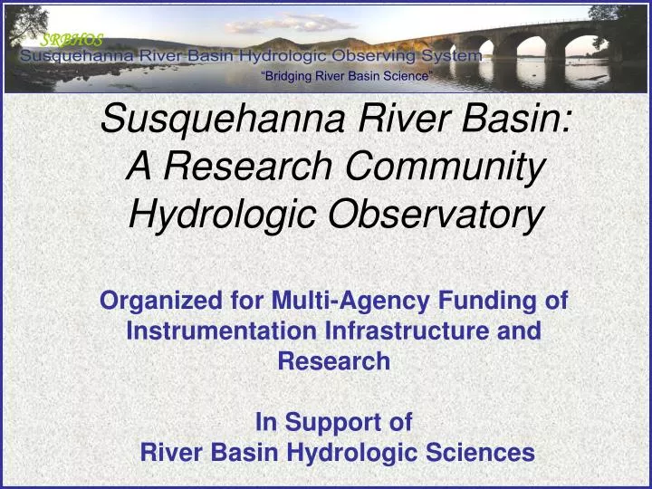
Susquehanna River Basin: A Research CommunityHydrologic Observatory Organized for Multi-Agency Funding of Instrumentation Infrastructure and ResearchIn Support of River Basin Hydrologic Sciences
Partner Institutions Universities Alfred University Clarkson University Colgate University Columbia University Cornell University Drexel University Duke University Frostburg State University Johns Hopkins University Juniata College Lafayette College Massachusetts Institute of Technology Pennsylvania State University Princeton University Rensselaer Polytechnic Institute Rutgers University San Diego Supercomputer Center Stanford University SUNY – Binghamton SUNY – Buffalo SUNY – Cortland SUNY - New Paltz SUNY – Oneonta SUNY – Plattsburgh Syracuse University Temple UniversityUniversity of California, Berkeley University of Maryland University of Nevada Las Vegas University of South Carolina Federal Mid-Atlantic River Forecast Center NASA Goddard, Hydrological Science Branch Northeast Regional Climate Center USACE- Cold Regions Research and Engineering Laboratory USDA Agricultural Research Service USGS State Department of Military and Veterans Affairs Environmental Stewardship PA DCNR PA DEP PA Geological Survey PA State Climatologist Management and Stakeholders Chesapeake Bay Foundation Clearwater Conservancy Crossbow Technologies Pennsylvania Environmental Council Susquehanna Greenway Partnership Susquehanna River Basin Commission Upper Susquehanna Coalition Water Centers New York State Water Resources Institute Center for the Environment Pennsylvania Center for Water Resources Virginia Water Resources Research Center Research Centers Chesapeake Community Model Program Chesapeake Research Consortium Smithsonian Environmental Research Center Stroud Water Research Center
Fundamental Problem How Do Humans and Climate Impact the Sustainability of Water Resources in Large River Basins? Assessment of climate and terrestrial feedbacks across multiple scales and physiographic conditions. Will better define the roles that terrain, ecology, climate, and geology play in partitioning water, energy, and nutrients across the complex environmental systems that make up the river basin.
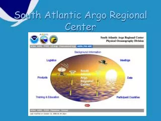
Sediment from the Susquehanna RiverHurricane Ivan moved north over the United States, dumping torrential rain in southeastern and mid-Atlantic states, triggering inland flooding. Major rivers, including the Ohio, Susquehanna, and Delaware Rivers, pushed over their banks and forced evacuations. Muddy run-off has colored the rivers around the Chesapeake Bay a dirty brown in this true-color image on September 21, 2004. The top third of the Chesapeake Bay, normally clear and dark, is now mud colored as sediment-laden flood water drains into the bay. The Susquehanna River flows down from the top left corner of the image into the bay. Susquehanna Input to Chesapeake Bay
Our goal is to improve the scientific basis for forecasting and prediction of water resources such that society can make better choices concerning the impacts of climate and anthropogenic change on local, regional and global water problems.
Our approach: Design and implementation of an integrated observing system from the boundary layer through the water table for water, energy and biogeochemical cycles across the river basin from headwaters to estuary.
Integrated Observations Boundary Layer through Water Table
Appalachian Plateau (G) Canisteo and Cowanesque Appalachian Plateau (G) Catatonk Creek Otsego Lake Appalachian Plateau (G) Young Woman’s Creek Appalachian Plateau (U) Benner Run and Stone Run Valley & Ridge Mahantango Valley & Ridge Shaver Creek Spring Creek Piedmont (K) Conestoga Creek Piedmont (C) Muddy Creek Valley & Ridge (Juniata, Raystown Lake) Proposed Testbeds
Why an Observatory? • Understanding the hydrologic cycle is critical to solving local to regional problems related to global climate change, biogeochemical cycling, ecosystem and landuse effects, and environmental management. • A scientifically designed observing system will address linkages and feedbacks between the global-to-regional hydrologic cycle, the transport of mass and energy, and the evolution of landforms,ecology and landuse. • The observatory will concentrate scientific expertise and infrastructure sufficient to test fundamental scientific hypotheses on process and prediction at each scale of interest.
Design Objectives • Design in association with NOAA & State Climatologists, ETRS Arrays to measure precipitation, evaporation, transpiration, meteorological variables and snow over the SRB & to provide quantitative estimates of forcing in space and time. • Install and operate a network of ETRS Arrays for surface and subsurface measurements to close the water and solute balance. • Implement a preliminary integrated surface-groundwater model of the SRB to design an optimal flow & nutrient observing system network. • Design locations for ~15 state-of-the-art stream gages to add to the USGS network.
ETRS Arrays ETR flux array: Soil moisture, temperature, nutrient concentration and groundwater levels Weather Stations: Atmospheric moisture flux and atmospheric chemistry Snow sensors: Depth, SWE, vapor flux, dialectric properties Sonic Depth Sounder Wireless SCAN/SNOTEL
Funding Outlook for SRBHOS Current: $2.7M (WERF, NSF, NICCR) Pending: $6M (PA DEP, NOAA, NSF, EPA) In Prep:$2.25M (NSF, PA DEP, NOAA, USDA)
SRBHOS Opportunities Example Current Projects ET Modeling (Green Roof Technology) – WERF RTH-Net Technician (Local Watersheds) – NSF Susquehanna Integrated Model – NSF Energy Production, Climate and the Environment – NICCR Example Pending Projects Integrated Water Budgets – PA DEP SRBHOS REU – NSF Ecohydrology and Modeling – EPA STAR Snow Retrieval Optimization – NOAA-NWS RTH-Net Sensors – NSF