Download
1 / 28
280 likes | 509 Views
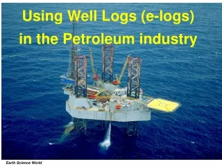
Boring Logs and Databases Using gINT Software. Scott Sochar Engineering Geologist Project Geology / DOE. Sacramento-San Joaquin Delta. Beautiful, inviting, productive, heavily modified, precarious. The Project: DHCCP.

E N D
Boring Logs and DatabasesUsing gINT Software Scott Sochar Engineering Geologist Project Geology / DOE
Sacramento-San Joaquin Delta Beautiful, inviting, productive, heavily modified, precarious
The Project: DHCCP The Delta Habitat Conservation and Conveyance Program investigates potential alternative means of moving water around the Delta to the California Aqueduct rather than pumping from the Delta
Abstract GINT worked for DWR projects (Levee Evaluation and DHCCP). It allows users to: Marry historical data to current data in a single database Add lab data to database and display side by side with visual descriptions Customize boring logs to emphasize properties of greatest concern Present geo-referenced subsurface data in plan and section view (GIS) DHCCP team created map showing elevation of base of Delta peat by combining historical data, gINT, and GIS
From Soil to Log Real-World Soils Soil Logs Simplified, incomplete, but it makes reams of data digestible • Complex, variable, difficult to pigeon-hole
Complex / Simplified Real-World Soil Soil Boring Log (or Model)
Final Product Boring log incorporating field visual descriptions, classifications, and lab test results
GINT is an intermediate step between real soil and log Breaks the process down to recording and entering values for each property.
Geotechnical Exploration DHCCP’s goal is to find the most suitable alternative conveyance option. Understanding the soil that proposed new canals, pipelines, tunnels, and siphons would be built in is key.
Developing Exploration Plan –Use historical logs to guide DHCCP exploration
Time to Gather Our Own Data Much of DHCCP geotechnical exploration has been over-water and focused on what’s known as the Preferred Study Alternative, the Pipeline/Tunnel Option alignment.
Edited and Input Into gINT (displayed by borehole) GINT allows the template to be customized; soil properties DO NOT have to be displayed in this order.
Entered into gINT (all boreholes listed) Each tab leads to another perspective.
Some samples are sent to a geotech lab … … and then the results come back …
Lab Test Results Grain size analyses and Atterberg limits can all be incorporated into gINT.
Lab Test Results Example of Atterberg limits test.
Labs can transmit data directly into gINT Lab test results are stored under another tab for each borehole.
Where It All Comes Together PDF of finalized boring logs including lab data.
New Analyses Having a gINT database allowed DHCCP team to export data that had been harvested from historical logs into GIS. From there, geospatial analysis could produce maps approximating the elevation to the base of peat and organic soils in the Delta.
New Analyses The cooperation of gINT and GIS allows the team to create maps based on varying criteria. This map was produced by contouring for soils that have 50% or greater organics.
New Analyses Having a gINT database and other tools, like Cross-View, allows subsurface cross-sections to be produced.
Conclusions GINT software, particularly when used in conjunction with other tools, is an effective and reasonably efficient way to augment geotechnical analyses. Many thanks to my colleagues Nicholas Hightower and Mark Pagenkopp for help with the cross-section and peat map slides.