Download
1 / 10
100 likes | 108 Views
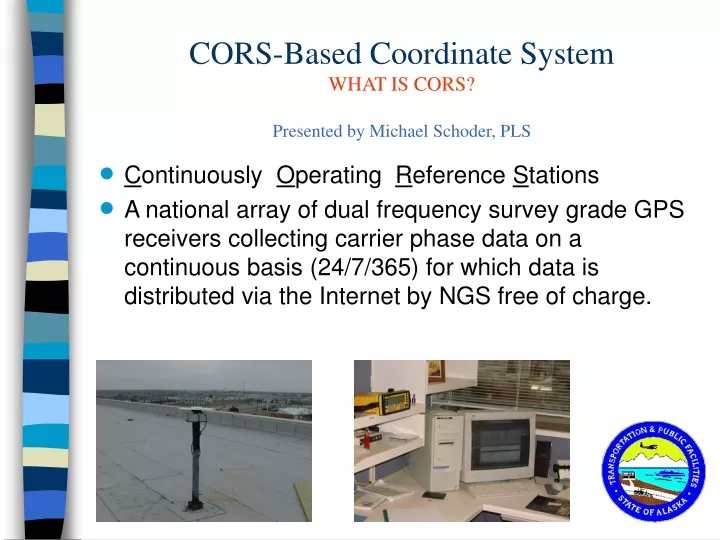
CORS-Based Coordinate System WHAT IS CORS? Presented by Michael Schoder, PLS. C ontinuously O perating R eference S tations

E N D
CORS-Based Coordinate SystemWHAT IS CORS?Presented by Michael Schoder, PLS • Continuously Operating Reference Stations • A national array of dual frequency survey grade GPS receivers collecting carrier phase data on a continuous basis (24/7/365) for which data is distributed via the Internet by NGS free of charge.
CORS-Based Coordinate SystemCORS Overview • CORS system designed to initially provide country wide coverage at 400km level (except Alaska of course due to funding) with ultimate goal of 100km coverage US-wide. • In addition to NGS, a number of participating agencies provide CORS systems such as DOTs, Academia, Scientific organizations & private industry as full CORS or co-operative CORS sites with NGS oversite.
CORS-Based Coordinate SystemCORS Coverage's • Alaska CORS Coverage end 2002
CORS-Based Coordinate SystemCORS Overview Continued • CORS data is monitored daily by NGS automated computation utilities to determine SV orbits and verify system stability. NGS also provide automated geodetic positioning service OPUS dependent on CORS as web-based service. • Future support of geodetic positioning by NGS will be densifying CORS network, not ground networks.
CORS-Based Coordinate SystemCORS Datums • U.S. CORS stations participate in world-wide IGS CORS system as basis of ITRF reference datum, and ITRF positions provided to current ITRF epoch. NGS established NAD83(CORS) datum as country-wide high precision datum not influenced by non-GPS data and to be as compatible as possible to prior geodetic NAD83 data. • NAD83(CORS) found to be consistent with NAD83(92) by GPS survey ties at 10-30cm level in Alaska. • Current NAD83(CORS) epoch 2002.00, updates for crustal motion events & motion predictions for “dynamic positioning” for scientific high accuracy applications.
CORS-Based Coordinate SystemCORS Services • Some CORS stations provide additional services such as providing broadcast code corrections (enables real-time positioning to several meter accuracy) or RTK carrier phase corrections (enables real-time positioning to centimeter accuracy). • OPUS utility is web e-mail based free utility provided by NGS to compute geodetic position for dual-frequency RINEX formatted GPS data sets emailed to OPUS site. Results provided in minutes by email referenced to NAD83(CORS) and ITRF with typical accuracy of sub-decimeter. • HTDP utility is horizontal time-dependent positioning program that allows users to predict horizontal displacements and/or velocities at locations throughout the United States.
CORS-Based Coordinate SystemADVANTAGES of CORS-Based Reference • Current NGS datum most compatible with GPS positioning and free of old data influences. • Supported in future by NGS • Easily available and retrievable. • Positioning results easily repeatable regardless of issues related to monument stability & destruction. • Supported by NGS computation utility to eliminate need for specialized processing. • Consistent with variety of GPS positioning, and prior survey datums. • Easily used for GIS population with resource-grade GPS data. • Consistent with and/or relatable to local, state and National GIS datasets.
CORS-Based Coordinate SystemISSUES concerning CORS-Based Reference • Transformation of existing NAD83, NAD83(92) data must be accounted for for data to be related to highest accuracy. Transformation can be ignored for lower accuracy needs (meter level positioning).
CORS-Based Coordinate SystemISSUES concerning CORS-Based Reference • Attention to changes in CORS stations (updated receivers, antennas, positions) needs to be monitored as the data is used to account for specific CORS site upgrades. • Proper meta-data needs to accompany positioning data to allow documentation and future uses / differing applications of CORS based data.
CORS-Based Coordinate SystemTO FIND OUT MORE ABOUT CORS • CONTACT NGS at http://www.ngs.noaa.gov/CORS/ • Contact ADOT&PF Surveys Michael_Schoder@dot.state.ak.us or 907-269-0560 • This Presentation ftp://chugach.dnr.state.ak.us/dot-cadastral/ Then navigate to Presentations