Download
1 / 27
270 likes | 425 Views
Modeling the hydrologically-relevant features of uncertainty of space-borne high resolution precipitation products. Preliminary Assessment for PhD. LING TANG Tennessee Technological University Department of Civil and Environmental Engineering. Outline. Introduction Research Objectives

E N D
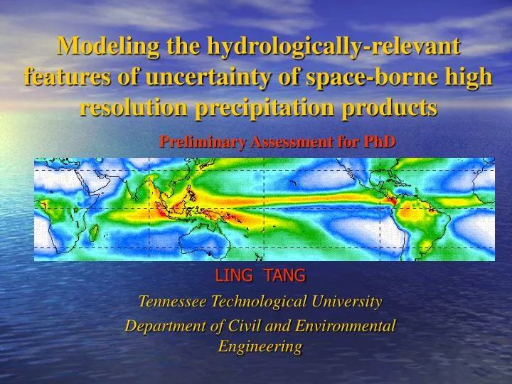
Modeling the hydrologically-relevant features of uncertainty of space-borne high resolution precipitation products Preliminary Assessment for PhD LING TANG Tennessee Technological University Department of Civil and Environmental Engineering
Outline • Introduction • Research Objectives • Fundamental Research Hypothesis • Proposed Research Methodology • Anticipated Broader Impact of the Planned Project • My Research Background and Preparation
Introduction • The Global Precipitation Measurement (GPM) Mission - One of the next generation of satellite-based Earth science missions that will study global precipitation (rain,snow and ice). - Currently scheduled for launch in 2013. (source from: gpm.gsfc.nasa.gov)
Critical Issues • In-situ rainfall measuring networks are on the decline. GPM will be able to demonstrate tangible benefits in hydrologic application over ungauged regions. • Knowledge of satellite rainfall estimation uncertainty is required – the Paradox • Scale mis-match between overland hydrologic processes that evolve at smaller and more dynamic scales (i.e., < 1 hour and < 1 km) and operational satellite precipitation forcing datasets that are available at coarser scales
The Unresolved Paradox • Representing the error structure of satellite rainfall as a function of scale against quality-controlled ground validation (GV) datasets is both a critical research problem and an application need. • Satellite rainfall will be most useful over ungauged (non-GV) regions – so how can we generate uncertainty estimates for satellite data over those regions ?
Research Objectives (Tentative) • 1) To mathematically model the pertinent (hydrologically-relevant) spatio-temporal features of satellite rainfall uncertainty as a function of season and location over the US. • 2) To develop and test a geostatistical mapping scheme for spatial interpolation of error information from small-domain GV regions to the neighboring vast ungauged (non-GV) regions.
MY FUNDAMENTAL RESEARCH HYPOTHESIS • Hydrologists and other users, to varying degrees, need to know the errors of the satellite rainfall datasets across the range of time/space scales over the whole domain of the data set. On the other hand, satellite rainfall datasets are most useful over the vast ungauged regions of the developing world lacking in GV data. If the potential of GPM is to be unleashed over the vast regions of the developing world, then a reconciliation of this paradox is needed before the launch of GPM in 2013.
ProposedResearch Methodology • Study Region and Data • Unites States as the primary study region further divided into six zones (Each zone is governed by distinct rainfall climatology)
Climate of United states ------( Average annual precipitation from 1961-1990 )
Study data • The primary source for GV rainfall data will comprise the National Weather Service (NWS) WSR-88D radar rainfall data. • Satellite rainfall data will comprise all major products of NASA’s TMPA system (Huffman et al., 2007) – i.e., 3B40RT, 3B41RT, 3B42RT and 3B42V6.
Methodology Flowchart Satellite data Ground validation data Error framework Task 1 Task 2 Error metrics and error classification Spatial interpolation of error metrics from sparse GV sites
Proposed Specific Tasks (Tentative) 1) TASK 1 (Years 1 and 2): Mathematical modeling of hydrologically relevant error metrics as a function of regime, season and location. - This task will identify the total number of error metrics that are meaningful for improving the hydrologic potential of GPM and also interpretable by both user and data producing communities. - It will begin with the initial set of nine error metrics that my advisor has already devised for a Two-Dimensional Satellite Rainfall Error Model - SREM2D (see Hossain and Anagnostou, 2006; and Hossain and Huffman, 2007-in press).
Modify error framework using various error combinations NWS Radar data GV Calibration Nine error metrics in SREM2D Simulation Simulated satellite rainfall space/time downscaling Aggregated simulated satellite rainfall data NO? Aggregated actual satellite rainfall data comparison YES?
2) TASK 2 (Years 2 and 3): Development and assessment of a geostatistical-based mapping scheme for spatial interpolation of error metrics from sparse GV sites. - This task will seek answer to if “error is defined on the basis of GV, then how are these metrics estimated for a satellite data product without the need for extensive GV data?”
Surrogate reference Extensive non-GV and non-PR (overpass) location TRMM PR data (2A25) Error metrics derived at finite PR overpass locations Results using NWS Radar reference data(TASK 1) Results comparison YES?
Initial work completed - Currently involved in the creation of a 9-year (1997-2006) mosaic of National Weather Service (NWS) ground radar rainfall data (WSR-88D) over the coterminous United States. (Hydro-NEXRAD) - I am performing statistical analysis of the rainfall distribution to understand how these parameters vary as a function of location. This part of my work is expected to help refine the exact periphery of the five zones in manner analogous to Koppen climate classification.
Proposed Research Publications • From TASK 1 –Two journal quality research papers. First one will be on the identification of distinct satellite rainfall error classification regimes in a manner similar to Koppen Classification in J. Climate. Second will identify the ideal set of error metrics through consistency analysis in J. Hydrometeorology or Water Resources Research. • From TASK 2 – One research paper in J. Hydrometeorology on the effectivesness of spatial mapping of error metrics over ungauged regimes
Anticipated Broader Impact of the Proposed Project - The long-term impact from my proposed project is, therefore, expected to be in laying the foundation for understanding the level to which satellite rainfall products can realistically advance societal applications (such as flood detection) in the developing world.
My Research Background - My undergraduate background is in hyperspectral remote sensing of geophysical parameters such as terrain features and topography. - My masters research focused on ‘artificial immune system’ technique for optimal extraction of features and information from remote sensing datasets.
Prior Research Experience - Ant Colony Algorithm in Image Interpretation (China National Natural Science Fund Project) By simulating ant colony behavior, this project aimed to establish a set of ant colony behavior optimal algorithms and models, and using them to solve image interpretation problems, mainly on aerial and satellite images. - Artificial Immune System in Image Segmentation This research introduced the mechanism of biological immune system into remote sensing image processing, and thus developed a refined optimal algorithm based on artificial immune system for satellite image processing such as segmentation, classification, and feature extraction.
Prior Publications 1. Ling Tang, Zhaobao Zheng. A new approach based on artificial immune system for texture segmentation on satellite imagery. The 15th National Conference on Remote Sensing Technique. Guiyang, China. 2005 2. Ling Tang, Zhaobao Zheng . An image segmentation algorithm based on artificial immune system. Geomatics and Information Science of Wuhan University. Vol.32, No.1, Jun. 2007, 68~70. 3. Xin Yu, Zhaobao Zheng, Ling Tang. Aerial image texture classification based on a new Bayes classifier. Geomatics and Information Science of Wuhan University. Vol.31, No.2, Feb.2006 108~111.
My Current Work on Hydrologic Remote Sensing at TTU - I have familiarized myself with some hydrologic rainfall remote sensing products. - I have also familiarized myself the well-known Global Precipitation Climatology Project (GPCP) and satellite rainfall remote sensing. Six years (1997-2002) of GPCP daily rainfall data (resolution of daily at 10×10) was used to analyze the spatial and temporal patterns of the global precipitation over large river basins.
Knowledge of Analysis and design tools - C++ (programming) - Matlab (programming) - ArcGIS (mapping) - Cygwin (Unix Systems Simulator) - ERDAS (Remote Sensing analysis) - IDL (NASA language)