Download
1 / 21
230 likes | 601 Views
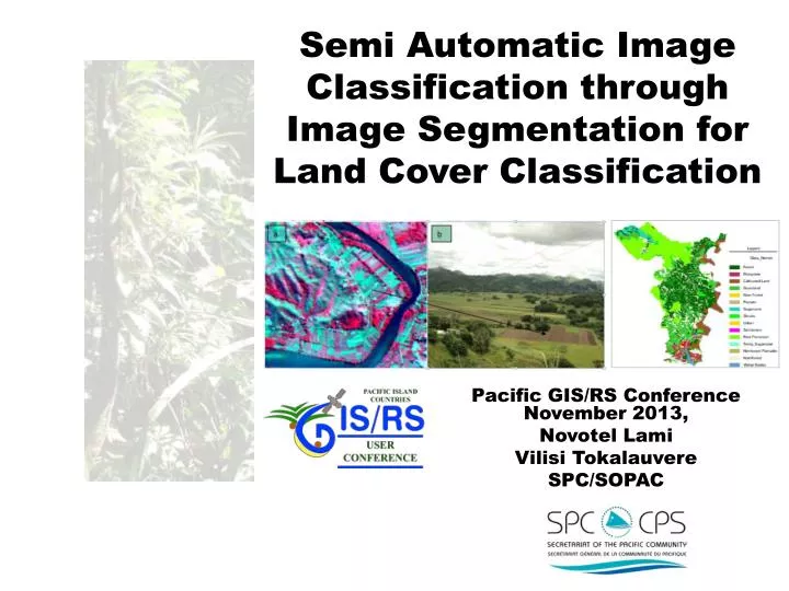
Semi Automatic Image Classification through Image Segmentation for Land Cover Classification. Pacific GIS/RS Conference November 2013, Novotel Lami Vilisi Tokalauvere SPC/SOPAC. Outline. Why Semi-Automatic Image classification? Tool Used Problems Process Framework

E N D
Semi Automatic Image Classification through Image Segmentation for Land Cover Classification Pacific GIS/RS Conference November 2013, NovotelLami Vilisi Tokalauvere SPC/SOPAC
Outline • Why Semi-Automatic Image classification? • Tool Used • Problems • Process Framework • Some Preliminary Results
Land cover Mapping – 1:10,000 • Enhanced Climate Change Resilience of Food Production Systems (SPC/USAID) • WV2 – 8 Spectral bands • Geo-eye 4 band multi-spectral
Imagine Objective • Additional tool – ERDAS Imagine platform • Feature extraction, update & Change Detection • Produces data in a GIS format
IMAGINE Objective • Module for object-oriented geospatial image classification and discrete feature extraction • Single Feature Probability (SFP) Pixel Classification • A novel ERDAS invention applies discriminant analysis to multi-modal training data by distilling samples into Gaussian primitives • Automatic background sampling
Initial Roadblocks • Multi – class classification – Less resources available • Whole satellite scene – time consuming • Raw data 16bit– salt and pepper (8bit pan-sharpened) • Experimentation with parameter values
IMAGINE Objective ArchitectureProcess Framework Pixels Pixels ( training ) ( candidates ) Prob . Pixels Raster Object Pixel Raster Raster To To Pixel Cue Metrics Probability Object Object Raster Object Raster Object Layer Layer Layer Operator Operator Train Query Pixel Inference Engine Vector Object Raster Object Vector Vector To To Object Object Vector Object Vector Object Layer Layer Operator Operator Vector Vector Objects Objects ( training ) ( candidates ) Vector Object Vector Vector To Object Object Vector Object Layer Layer Operator Object Cue Metrics Train Query Object Inference Engine
Methodology • Raster Pixel Processor (RPP) • Performed with Single Feature Probability and Multi – Bayesian Network • System training - Important
Methodology • Raster Object Creators (ROC) • Raster Image Created - segmentation • Result – Thematic image
Methodology • Raster Object Operators (ROO) • Size filter • Probability filter • Eliminating raster objects that do not meet criteria
Methodology • Raster to Vector Conversion (RVC) • Raster object vectorised by ‘polygon trace’ • Polygons or Polylines produced • Vector Object Operators • Reshaping the existing Vector Objects, eliminating vector objects that do not meet some criteria, combining multiple input vector objects into a single vector object, splitting vector objects into multiple new vector objects
Vector Object Classification • The Vector Object Processor (VOP) node performs classification on vector objects. • Vector Cleanup Operators (VCO) allow the user to manipulate the Vector Objects after they have been processed by the Vector Object Processor.