Download
1 / 14
140 likes | 244 Views
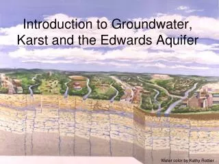
Workshop on DEVELOPING REGIONAL COOPERATION FOR SHARED KARST AQUIFER MANAGEMENT IN SEE 27-28 June 2008 Thessaloniki, Greece. Monitoring data and existing information C ountry P resentation from Turkey. Plan of presentation

E N D
Workshop on DEVELOPING REGIONAL COOPERATION FOR SHARED KARST AQUIFER MANAGEMENT IN SEE 27-28 June 2008 Thessaloniki, Greece Monitoring data and existing information Country Presentation from Turkey
Plan of presentation 1. Brief description of monitoring networks (surface and groundwater) 2. Monitoring data: aquisition, analysis and publication 3. Documentation sources: ministries, institutions, WEB pages
Under the scope of Planning studies, the most important formulations of projects are prepared by using the long term data collections and investigations Data collection activitiesin planning studies are implimented with the coordination of different engineering fields consisting of gauging, observation, survey, soil and drainage, agricultural economy, hydrology, environmental impact assesment, geology, mapping and material science.
The hydrometeorological network of General Directorate of Turkish State Hydraulics Works (DSI) comprises the following stations: • River flow Mesaurement 1153 • Lake level observation 134 • Snow survey station 155 • Meteorlogical observation stations 356 • Water quality observation (sediment) 1000 • Groundwater observation stations monthly 504, • seasonal 2320, 182 wells equipped with water level recorder (Limnigraphs ) • The above figures are those of operating stations. In the past more stations were operated for certain period prior to project start but closed after the completion of the project.
Also General Directorate of Power Resources Survey and Development Administration (EIE) founded in 1935, being governed by the provisions of private law and administrated in accordance with commercial methods, having the status of a juridical person and being bound to the Ministry of Energy and Natural Resources, carrying out engineering service with opportunity of production of electrical energy is an investor public organization.
One of the main tasks of EIE is to make hydrological studies and Geotechnical researches. In this contest River flow Mesaurement 798 (294 open, 504 closed) Channel gaugging stations 23 (8 open, 15 closed) Lake level observations with level recorder 24 (11open, 13 closed) with staff gauge, perodically 64 (37 open 27 closed) Snow survey station 90 (54 open, 36 closed) Water quality observation 270 (225 open,45 closed) Sediment Observations 231 (144 open, 87 closed)
General Directorate of State Meteorological Office (DMI) is responsible for both weather forecast and meteorological data collection. At present the number of operating stations all over Turkey areas follows: Synoptic stations for weather forecast 118 Large Climatological Stations for agricultural purpose 259 Small Climatological Stations (only minimum, maximum temperature precipitation and wind observations) for local agricultural purpose 33 Mobile Meteo. station (AWOS) for aviation purpose 61 Coastal Meteorological station (AWOS)for marines 29
General Directorate of Agriculture Research (TAGEM) (former General Directorate of Rural Service (GDRS)) Operating rainfall stations at 12 Agricultural Research Institutes State farms Forest directorates Highway maintenance units Some University Laboratories They all are operating rainfall observation stations for their projects at some regions, only for a certain period
DSI, EIE and DMI hydrometeorogy network summary table of Turkey
The annual precipitation of earth is about 1000 mm, and in Turkey this figure is 640 mm. So for water security, the amount available is to be used more efficiently. The second problem is areal and time distribution of precipitaion. So a wise regulation is the second must. Annual precipitation in Turkey
DSI level ecorder,current meter and staff gauge by: DSI ,Gurer Meteorological observation station of DSI at Musahacılı Village Photo: İ.Gürer, 2003 Totalizator (Gençer et.all, 2005)
TEFER Project (Turkey Emergency Flood and EarthquakeRecovery Project) Aim of TEFER Project is to forecast the probable flood in Turkey. Real time data which are collected automatically: 1) Flow Data from DSI and EIE hydrometric stations, 2) Rainfall Data from DMI Automatic Weather Observation Stations 3) Radar data from DMI 4) Numerical weather prediction data from DMI One of flood in Turkey (DMI, 2005) All of these data are sent to MIKE-11 flood prediction software. TURKSAT1-C satellite is used for the real time data transfer. MIKE View and MIKE 11 GIS are used for the digital mapping studies (AWOS) of DMI (DMI, 2005