Download
1 / 53
530 likes | 676 Views
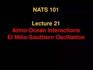
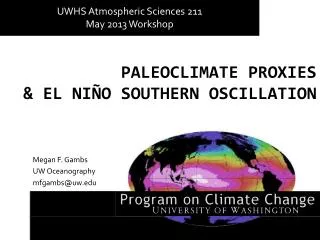
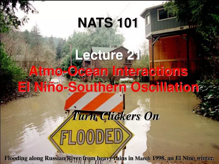
NATS 101 Lecture 21 Atmo-Ocean Interactions El Niño-Southern Oscillation. Turn Clickers On. Flooding along Russian River from heavy rains in March 1998, an El Nino winter. Survey: What did you do over spring break?. Had lots of fun Saw family and old friends back home

E N D
NATS 101Lecture 21Atmo-Ocean InteractionsEl Niño-Southern Oscillation Turn Clickers On Flooding along Russian River from heavy rains in March 1998, an El Nino winter.
Survey: What did you do over spring break? • Had lots of fun • Saw family and old friends back home • Certainly not think about this class • All of the above!
Today we finally get to another one of the course topics that gets a lot of press… El Niño I’m sure you all have heard it mentioned somewhere… butwhat is it really?
In reality, El Niño is an example of an atmosphere-ocean interaction—perhaps the most important one. Such interactions are important for climate variability across the globe, including here in Arizona.
Why is the ocean important? Heat transport Ocean currents transport heat from equator to pole (~40% of the total). A climate regulator Water moderates climate in areas near it. Ocean supplies moisture to the atmosphere which produces clouds, storms and precipitation. A source of “memory” in the climate system Because variability in the ocean occurs on very long timescales (like years to centuries) relative to atmospheric phenomena, it makes climate potentially more predictable (months in advance).
Major Ocean Currents The ocean currents are forced by the prevailing surface winds Giant convective circulations (gyres) transport heat from equator to pole. The warm side of a gyre is typically along the east coast of a continent. The cold side of a gyre is typically along the west coast of a continent. Gulf Stream California Kuroshio Canary Alguhas Bengulas Brazil Humbolt E. Australia
European Climate and the Influence of the Gulf Stream The Gulf Stream current in the North Atlantic transports warm water from the tropics toward Europe. It is an example of a warm current on the eastern side a continent. As a result, Europe is much warmer than it otherwise would be. Aside: note how the current breaks down into a series of eddies as the current proceeds across the Atlantic. COLD COLD EDDY WARM
Upwelling • Now lets turn our attention to a very important ocean concept in terms of atmosphere-ocean interactions: upwelling
Summer SST Along West Coast Sea surface temperatures (SST) along West Coast are quite cold during summer, especially off Northern California. Due to upwelling of cold, nutrient rich water by prevailing N winds. Prevailing Winds Coastal Surface Water Ahrens Fig 7.24
Global Phytoplankton Productivity NASA Image Phytoplankton generally favored in colder water. Productivity peaks along west coasts of most continents.
Ekman Spiral in Northern Hemisphere As wind blows across the water, the water is deflected to the right of the mean wind by the Coriolis force. Each successive layer of water below bends a little more towards the right as it is forced by the layer above. Net result: water is transported at approximately 90° to the wind.
Upwelling from Alongshore Winds Ahrens Fig 7.25 Wind pushes surface water southward. Coriolis force deflects water to the right. Cold water from below rises to surface. Fog persists over the cold water.
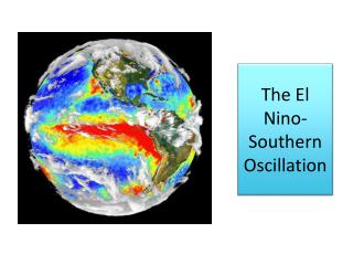
Wind Patterns and Oceans • Now that we understand the concept behind upwelling and ocean circulations, we move to topic with world significance: El Niño/La Niña
Global Average Sea Surface Temperature SOMETHING REALLY IMPORTANT HAPPENS IN EASTERN TROPICAL PACIFIC! Warm near the equator, cold near the poles. Colder on the west coasts of continents due to upwelling.
Something odd happens every 3-5 years off the west coast of South America… - Trades and southerly winds off Peru weaken - Cold upwelling current STOPS off Peru and is replaced by warm water. It typically occurs around Christmas (an El Niño event) and brings heavy rains and massive fish kills. Alters global patterns of wind, temp and rain
Search for causes of Indian Monsoon failure He noted that in some years the Indian monsoon completely failed. In his search of the causal factor, he discovered that surface pressure variability across the Pacific followed a large-scale pattern. Walker called the pattern the Southern Oscillation and hypothesized it was linked to the monsoon failures. The scientific community initially dismissed his idea… Sir Gilbert Walker British naturalist
The Southern Oscillation Index (SOI) DARWIN TAHITI SOI = Surface pressure at TAHITI – Surface pressure at DARWIN What wasn’t figured out till later (1960s): The Southern Oscillation and El Niño both reflect coherent changes with take place in the atmosphere and ocean across the Pacific Basin. The entire phenomenon is called the El Niño-Southern Oscillation (ENSO).
Walker Circulation Pushes water westward LLa NinaH Darwin Tahiti Aguado & Burt, p230 Walker Circulation oscillates with a quasi-period of every few years. Oscillation is very evident in SLP records for Darwin and Tahiti.
Walker Circulation Relaxes westward stress HEl NinoL Darwin Tahiti Aguado & Burt, p230 Walker Circulation oscillates with a quasi-period of every few years. Oscillation is very evident in SLP records for Darwin and Tahiti.
Southern Oscillation Index (SOI) SST SLP
WALKER CIRCULATION Atmosphere Easterly trade winds. Walker circulation arises from asymmetry in ocean temperatures. Rising motion and convection on western side, subsidence on eastern side. Ocean Western side of basin: warm water and downwelling Easterly side of basin: cold water and upwelling.
An El Niño begins when warm surface water starts to surge eastward along the equator due to a Kelvin Wave.
Kelvin wave surge: Sea height analyses from satellite (Topex Poseidon satellite imagery) Higher sea height (warm colors) = warmer water What exactly serves as the trigger (or triggers) for the Kelvin wave surge is still an area of active research!
Eastern Pacific warms. Walker circulation shifts eastward, favoring convection in the central and eastern Pacific instead of the western Pacific. Easterly trade winds weaken. Coastal upwelling along the west coast of South America weakens.
Eastern Pacific is cooler than normal Walker circulation is stronger with enhanced convection in the west Pacific. Easterly trades strengthen Enhanced upwelling along the west coast of South America.
Measures of ENSO Southern Oscillation Index: Walker’s original index based on surface pressure at Darwin minus surface pressure at Tahiti Niño indices: based on sea surface temperature anomalies in specific locations in the central and eastern Pacific Ocean (Niño 1, Niño 2, Niño 3, Niño 3.4, Niño 4). Combined indices: take into account atmospheric conditions and ocean conditions (e.g. multivariate ENSO index, or MEI). All of these indices are readily available over the web...
ENSO does not just affect areas in and around the Pacific—it alters the atmospheric circulation patterns and weather across the globeThese are called teleconnections
How does ENSO impact the United States?Most coherent signal is in winter—but it does impact the summer too.
El Niño Impacts on United States: Winter TEMPERATURE ANOMALY RAINFALL ANOMALY (NOAA CPC) (NOAA CDC)
La Niña Impacts on United States: Winter TEMPERATURE ANOMALY RAINFALL ANOMALY (NOAA CPC) (NOAA CDC)
ENSO vs. U.S. Precipitation AnomaliesLate winter 2007 Seasonal SST Anomaly Corresponding precipitation anomalies for past two and three months (NOAA CDC)
La Nina Precipitation Extremes Earlier onset of monsoon
ENSO is not the only ocean-atmosphere interaction … Pacific Decadal Oscillation (PDO) North Atlantic Oscillation (NAO)
Pacific Decadal Oscillation (PDO) POSITIVE PDO NEGATIVE PDO Shift in Pacific ocean sea surface temperatures and pressure on a timescale of 20 to 30 years Tends to reinforce ENSO impacts over North America and is perhaps important for summer climate. Physical mechanism is still an area of active research!
North Atlantic Oscillation (NAO) POSITIVE NAO NEGATIVE NAO Basically reflects the strength of the Icelandic Low A control on jet stream position and climate over Europe and eastern North America Also a reflection of the strength of the polar vortex (Arctic Oscillation).
Which brings us back to the North American Monsoon… How it varies is related to what happens in the Pacific, specifically ENSO and the PDO.
North American summer climate teleconnection to Pacific SST What happens in the Pacific Ocean controls the position of the monsoon ridge in the early part of the summer. THIS AFFECTS THE ONSET OF THE MONSOON AND EARLY SUMMER RAINFALL IN ARIZONA. (Castro et al. 2001)