Download
1 / 19
280 likes | 471 Views
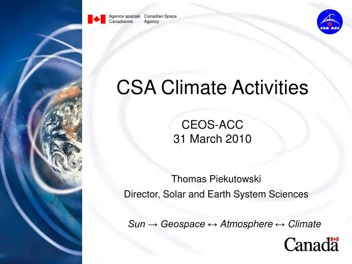
Agence spatiale Canadian Space Canadienne Agency. CSA Climate Activities CEOS-ACC 31 March 2010. Thomas Piekutowski Director, Solar and Earth System Sciences Sun → Geospace ↔ Atmosphere ↔ Climate. Atmospheric Processes of Climate and its Changes (APOCC) RFP-2007.

E N D
Agence spatiale Canadian Space Canadienne Agency CSA Climate ActivitiesCEOS-ACC 31 March 2010 Thomas Piekutowski Director, Solar and Earth System Sciences Sun → Geospace ↔ Atmosphere ↔ Climate
Atmospheric Processes of Climate and its Changes (APOCC) RFP-2007 • We solicited innovative ideas for missions that: • Will lead to new scientific understanding of atmospheric processes that regulate Earth's climate and thereby lead to reduced uncertainty in climate forecasts; • Address questions of particular importance for northern latitudes or that otherwise benefit Canadians; • Build on Canada’s considerable experience and capacity in atmospheric science; • Complement and are synergistic with planned international satellite missions.
Six APOCC Concepts • STEP - Stratosphere-Troposphere Exchange Processes: Three limb-viewing instruments on a small satellite - photochemistry, dynamics and radiative properties associated with the Upper Troposphere and Lower Stratosphere (UTLS). [U Sask, York U, Routes, COM DEV, Sweden] • MCAP - Mission for Climate and Atmospheric Pollution: Five nadir-viewing instruments on a small satellite - atmospheric composition measurements (trace gases and aerosols) for climate process and air quality studies. [U Dalhousie, U Toronto, INO, ABB, COM DEV, NASA, DLR] • SOAR - Solar Occultation for Atmospheric Research: Three instruments in solar occultation (IR-FTS, UV-VIS-NIR spectrophotometer, imager) on a small satellite - vertical profiles of atmospheric composition, both trace gases and aerosols. [U Toronto, ABB, COM DEV] • MEOS - Miniature Earth Observing Satellite: Five miniaturized nadir-viewing instruments on a micro satellite for measurement of greenhouse and other trace gases for study of terrestrial vegetation absorption and emission of tropospheric gases. [U Waterloo, U Toronto, MPB, NGC] • TICFIRE - Thin Ice Clouds in Far IR Experiment: Nadir and limb viewing instrument on a micro satellite - far IR detection and measurements of radiation anomalies induced by thin ice clouds in polar regions and in the upper troposphere. [UQAM, INO, NGC] • SnowSat: Cloud/precipitation radar instrument on a small satellite, or as a contribution to a partner platform, to measure clouds, snowfall and light precipitation. The advanced instrument concept builds on experience of CloudSat and EarthCARE. [McGill, EC, COM DEV]
APOCC Way Forward • Six studies began in 2008: finished autumn 2009. • Concepts were discussed at a CSA workshop 1-3 Dec.’09. Presentations addressed science merit, synergy with other science and operational EO satellites, science and technical readiness, suborbital development activities, cost and partnerships. • The dialogue with the Canadian EO science community and with partner agencies and organizations will continue for several months. It will contribute to CSA planning for technology development, suborbital science, instrument contributions to international space missions, and Canadian science satellites in the coming decade. • It is anticipated that CSA will pursue several instrument and satellite opportunities, in different cost categories, that derive from the APOCC mission concepts.
20 km 15 km 10 km 5 km Stratosphere Troposphere Exchange Processes (STEP) O3 H2O NO2 T CO N2O ClO HNO3 5 Slide # 5
STEP: Three Instruments Spatial Heterodyne Observations of Water Canadian Atmospheric Tomography System Stratosphere Troposphere Exchange And climate Monitor Radiometer SHOW CATS STEAMR 6 Slide # 6
Mission for Climate and Air Pollution: MCAP Science objective: To determine the linkages between climate change effects and air quality through integration of measurements of composition and aerosols. Policy objective: To provide insight into the developing issues of atmospheric change in order to monitor the effectiveness of policy enactment and to provide predictive capability for future generations. 7
Solar Occultation for Atmospheric Research (SOAR) Similar to SCISAT-ACE with advanced capabilities Vertical profiles of atmospheric gases and aerosols 8
MEOS: Miniature Earth Observer Satellite 1500-1700 nm F-P Spectrometer: CO2, CH4 2200-2400 nm F-P Spectrometer: CO, CO2, N2O, H2O 300 to 500 nm Imaging Spectrometer: O3, NO2, SO2, H2CO, C2H2O2,BrO O2 A-band F-P Imaging Spectrometer CMOS VIS Imager 9
Thin Ice Clouds in a Far IR Experiment (TICFIRE) Primary Science Objectives: Monitor the formation of cold-dry anomalies in Polar Regions and near the tropopause. Improve measurements of low water-vapour concentration (< 2 mm columnar) where cold regions are most sensitive. Identify Thin Ice Cloud TIC-1 (non-precipitating) and TIC-2 (precipitating), and cloud top altitude. #1 : 7.9 – 9.5 µm #2 : 10 – 12 µm #3 : 12 – 14 µm #4 : 16 – 18.5 µm #5 : 22.5 – 27.5 µm #6 : 30 – 50 µm 10
TICFIRE Nadir-Limb Views along Track H2O Mean Cloud Top 15 x 1 km x 100 km Narrow Band Radiance FPA Arrays #1 #2 #3 Track #4 #5 #6 #4 #2 20 x 10 km x 10 km Low [H2O] column, TIC-1/2 type, Light PCP initiation [H2O] prof, crystal size (2-30µm), COD, Tsfc IWC, crystalshape, ice/ liquid phase 11
SnowSat Specify the technology that can monitor the occurrence, magnitude, and variation of frozen and light precipitation across Canada with special consideration given to high latitudes Focus on a radar payload to address the precipitation/snowfall component of the problem. Vertical profiles of cloud and precipitation microphysics, and cloud particle vertical velocities to understand aerosol and cloud processes related to precipitation production and mixed phase cloud properties Particle shape, density, distributions Doppler Fall speed, Doppler spectra, Backscatter (wavelength), Sensitivity, Polarimetric, horizontal and vertical resolution, Scanning/Sampling Synergistic/complementary measurements with high frequency radiometers for global measurements 12
SWIFT-DASH Stratospheric Wind Interferometer For Transport studies (SWIFT) Designed to measure stratospheric winds and ozone concentration To improve knowledge of the dynamics of the stratosphere, and the global distribution and transport of ozone. An alternate instrument approach is being evaluated to reduce technical risks and cost: Doppler Assymetric Spatial Heterodyne (DASH) spectrometry. The combination of stratospheric wind and composition measurements would be a powerful boost to stratospheric science. The importance of the stratosphere is growing for weather and climate models. 13
International Review of APOCC • Determine the relationship and priorities of proposed APOCC, CASS and SWIFT measurements with respect to internationally accepted requirements for atmospheric composition data, e.g. IGACO, GCOS, GEO Carbon Strategy; • Evaluate the capability of proposed APOCC, CASS and SWIFT measurement techniques to meet these requirements; • Determine synergy or redundancy of APOCC, CASS and SWIFT with upcoming missions planned by CEOS agencies (US Decadal Survey, ESA Sentinels and Earth Explorers, meteorological satellites, etc); • Evaluate projected readiness of chemical transport models, carbon cycle / ecosystem models and air quality models to analyze proposed measurements in the 2015-2020 timeframe.
Polar Communications and Weather (PCW) Mission Objectives (in Phase A) • Reliable communications and navigations services in the high latitudes (North of 70º) to ensure: • Security • Sustainable Development • Support to Northern Communities • Safety of the Air and Marine Navigation • Arctic Science • Provide high temporal/spatial resolution meteorological data above 50º N in support of: • Numerical Weather Prediction (short to medium range) • Environmental monitoring, emergency response • Climate monitoring
PCW Mission Overview 2 satellites in 1 orbital plane to provide continuous GEO-like imagery 50-90 N Ka-, and X-band 20 VIS & IR bands 0.5-1 km VIS 2 km IR 12-h period 63.4 deg. inclination Apogee: ~39,500 km Perigee: ~600 km
PHEMOS RFP • Polar Highly Elliptical / Molniya Orbit Science Mission onboard the Polar Communication and Weather mission; • Solicit proposals for 3 types of instrument payloads that are complementary to the primary payloads: • In-situ Space Weather Science instruments to observe the electromagnetic and charged particle environments; • GeoSpace Imaging instrument to observe the near-Earth space dominated by plasmas; • Atmospheric Remote Sensing instruments to observe the chemistry, dynamics and other processes of the neutral atmosphere. • Proposals are for Phase 0 studies with an option to continue in Phase A; • RFP Deadline was February 18th.
Support Data and ECV Initiatives CSA supports: • Instrument Operations for MOPITT on Terra, OSIRIS on Odin, and SCISAT (through contracts to universities). • Retrieval, Validation (in collaboration with Environment Canada) and Distribution of Data and Data Products. ECV production and SPARC data initiative will require substantial additional work to establish error budgets, characterization, climatologies and time series. CSA wishes to see the full value of OSIRIS and SCISAT data used in these efforts.
Support for Cal/Val, Algorithm Development, Modeling and Application • CSA supports Canadian university and government scientists : • in performing field campaigns and validation measurements with ground-based instruments (e.g., PEARL at Eureka) for important satellite observations • in modeling (e.g., CMAM) • in performing research and application development SMOS, GOSAT, SMAP, CloudSat, EarthCARE, etc.