Download
1 / 28
280 likes | 433 Views
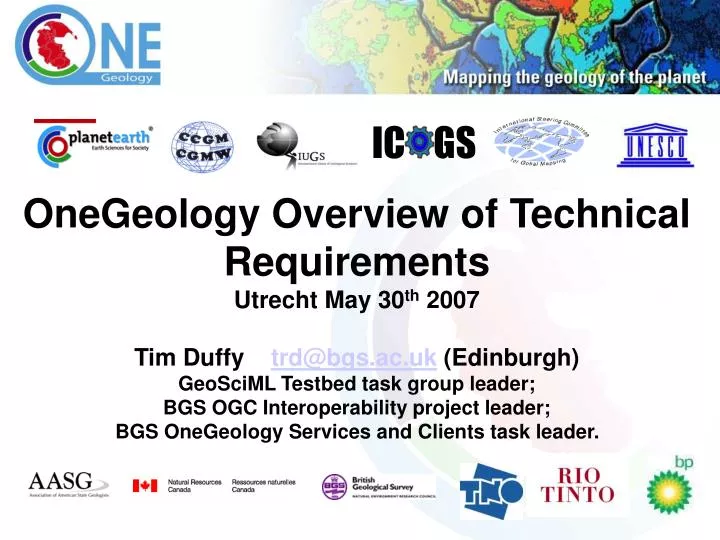
IC GS. OneGeology Overview of Technical Requirements Utrecht May 30 th 2007 Tim Duffy trd@bgs.ac.uk (Edinburgh) GeoSciML Testbed task group leader; BGS OGC Interoperability project leader; BGS OneGeology Services and Clients task leader. 2) Centralised or distributed model?.

E N D
IC GS OneGeology Overview of Technical Requirements Utrecht May 30th 2007 Tim Duffy trd@bgs.ac.uk (Edinburgh) GeoSciML Testbed task group leader; BGS OGC Interoperability project leader; BGS OneGeology Services and Clients task leader.
2) Centralised or distributed model? Recommendations: • A hybrid whereby those that can make their data accessible from their website as an OGC web service do so, and then we have regional data centres that host the web services for for those agencies that do to have the technical capability
OpenGeospatial Consortium (OGC and ISO)web service standards: WMS & WFS • Web Map Service (WMS) • Data Request • getMap(area-of-interest, resolution, layers) • Response • A picture • Web Feature Service (WFS) • Data Request • getFeature(featureType, filter-condition) • Response • An XML document describing features • (Filter≈ SQL “where” clause • Scoped by data-model) • Extra: query picture with getFeatureInfo <?xml version="1.0"?><sa:LocatedSpecimen gml:id="s456dfg" xmlns:sa="http://www.opengis.net/sampling/0.0" xmlns:xsi="http://www.w3.org/2001/XMLSchema-instance" xmlns:xlink="http://www.w3.org/1999/xlink" xmlns:gml="http://www.opengis.net/gml" xsi:schemaLocation="http://www.opengis.net/sampling/0.0 ../sampling.xsd"> <gml:name codeSpace="http://www.ietf.org/rfc/rfc4122">150497c8-d24c-11db-8314-0800200c9a66</gml:name> <gml:name>Sample 456dfg</gml:name> <sa:sampledFeature xlink:href="http://www.oneGeology.org/geologicUnits/xyz123"/> <sa:materialClass codeSpace="http://www.oneGeology.org/def:materialClasses">rock</sa:materialClass> <sa:samplingLocation> <gml:Point> <gml:pos srsName="urn:ogc:def:crs:EPSG:6.12:62836405">115.82 -31.933</gml:pos> </gml:Point> </sa:samplingLocation> <sa:samplingTime> <gml:TimeInstant> <gml:timePosition>2007-03-01T15:15:00.00+09:00</gml:timePosition> </gml:TimeInstant> </sa:samplingTime></sa:LocatedSpecimen>
John Broome compiled these rough numbers from the 71 geology coverages identified through a preliminary consultation with OneGeology participants before Brighton. • Coverages available in paper form: 55/71 = 77% • Coverages available in raster form: 37/71 = 52% • Coverages available in vector form: 51/71 = 72% • Coverages available in paper form only: 8/71 = 11% • Coverages where a fee is charged: 18/71 = 25% • vector data available online: 20/71 = 28% • raster data available online: 25/71 = 35%
Pictures vs data • Pictures are immediately useable • … by someone who understands the content and notation • OneGeology Level 1 = WMS • Data must be transformed to display for human consumption • … but can be used for other purposes as well • OneGeology Level 2 = WFS • (e.g. Community-specific GML applicationlanguage • TigerGML, LandGML, CityGML, NRML, GeoSciML, ADX, GPML, CSML, MarineXML etc) <?xml version="1.0"?><sa:LocatedSpecimen gml:id="s456dfg" xmlns:sa="http://www.opengis.net/sampling/0.0" xmlns:xsi="http://www.w3.org/2001/XMLSchema-instance" xmlns:xlink="http://www.w3.org/1999/xlink" xmlns:gml="http://www.opengis.net/gml" xsi:schemaLocation="http://www.opengis.net/sampling/0.0 ../sampling.xsd"> <gml:name codeSpace="http://www.ietf.org/rfc/rfc4122">150497c8-d24c-11db-8314-0800200c9a66</gml:name> <gml:name>Sample 456dfg</gml:name> <sa:sampledFeature xlink:href="http://www.oneGeology.org/geologicUnits/xyz123"/> <sa:materialClass codeSpace="http://www.oneGeology.org/def:materialClasses">rock</sa:materialClass> <sa:samplingLocation> <gml:Point> <gml:pos srsName="urn:ogc:def:crs:EPSG:6.12:62836405">115.82 -31.933</gml:pos> </gml:Point> </sa:samplingLocation> <sa:samplingTime> <gml:TimeInstant> <gml:timePosition>2007-03-01T15:15:00.00+09:00</gml:timePosition> </gml:TimeInstant> </sa:samplingTime></sa:LocatedSpecimen>
One service – many uses GML-based data can be …. Rendered into a queryable map … … formatted into a report or …. Condition: community-standard data model/encoding … read and used by any WFS/GML enabled application
Consensus of the Geological Specification Breakout 14-03-07 • Target scale is 1:1,000,000 • principles: 1G benefits our agencies and users • web visibility is important • each contributor decides which map(s) to contribute • anticipate the majority are bedrock and/or superficial maps, chrono-lithostratigraphic where possible, but each country decides
3. How will authorship of data be communicated Recommendations: • You can have the logo of each organisation that is serving the data within their piece of the jigsaw • The One Geology specification will require that the web services returning the data will include reference to the data provider and a link back to their home website to allow viewing of other data offerings
Links to common OGC capable client 1G project files e.g. GE, NASA WW, Dapple, OGC Web Map Context file OneGeology conformance rules and specifications and cookbooks Links to Registry of available service URL’s
An example WMS address URL might look like: http://www.ogc.bgs.ac.uk:8082/GBR_625K_BGS_Bedrock_and_Superficial_Geology_for_OneGeology/wms? Will be available from BGS OGC web services server by June 15th 2007
‘Welcome to OneGeology Portal client Index’ Map? (Offshore missing) (jigsaw piece added each time new WMS service registration)
1. How will 1G integrate with topographic data Recommendations: • When we serve the web maps (OGC WMS,WFS), WGS 84 (lat/long) is the default projection and the software offers other options as well e.g. the national projection • That by default a topographic layer can be accessed from the GlobalMap 1:1M or the SRTM base in real time as a web service but a nation can serve its geology with integral topography if it wants to • For bathymetry we can use GEBCO derivatives • For Antarctica we have been offered SCAR
5. Linguistic base of OneGeology project Recommendations: • The legend available with each web map service may by default, be in the nation’s home language, but each nation aims to provide an English (and or other) alternative legend in parallel when it can • Full Multilingual capability (e.g. where returned feature attributes are linked to multilingual concept definitions) is part of semantic interoperability, and therefore part of future goals • Need multilingual initiatives to come together under CGI and to combine with the GeoSciML Concept Definitions Working Group
Map local data structures to GeoSciML data structure Display, query, download France BRGM client (Ionic) GeoSciML GeoSciML GeoSciML GeoSciML GeoSciML GeoSciML Mapserver Cocoon ArcIMS Cocoon ArcIMS Cocoon GSC client (Phoenix) Geoserver Geoserver Ionic Desktop client (eg: Gaia) GA GA client (IMF) GeoSciML Mapserver Web services Web clients Architectures that were used in GeoSciML testbed2 Databases, digital maps with local data structures Sweden USA Canada UK Data sources
Cookbook Topics needed to support OneGeology (and its use of OGC/ISO standards and GeoSciML): A cookbook = a best practice manual ‘containing a straightforward set of already tried and tested recipe or instructions for a specific activity’ (Ref: Wikipedia), a OneGeology Cookbook may include more than one of the topics below: Resource to achieve? Needed for Onegeology Needed for GeoSciML 1). Level 1 Creating a WMS when starting with a scanned paper map No 2). Level 1 Creating a WMS when starting with digital vector or raster data GeoSciML Outreach and technical assistance task group could lead given staff time Yes - identical GeoSciML Design Task group could lead given staff time 3). Level 2 How to map your database onto GeoSciML Yes – nearly identical 4). Level 2 Creating a WFS from a GeoSciML backend datastore mapping GeoSciML Outreach and technical assistance task group could lead given staff time Yes – nearly identical 5). How to map a GeoSciML query on to your database GeoSciML Design Task group could lead given staff time Maybe, long after August 2008 6). How to conform to OneGeology and register web services Not yet
Timelines Ian Jackson - our OneGeology - Secretary has given this Technical Group until 31st December 2006: to produce a prototype OneGeology Portal with ‘a dozen’ WMS maps in it (e.g. all present? plus already existing GeoSciML testbed services) and a few exemplar WFS (again, already available from GeoSciML but by December 31st will be based on a stable documented version of GeoSciML V2.0). In order to allow him to show progress with OneGeology and keep it moving. Launch of a production OneGeology Portal (including functioning Catalogue Registry) by IGC, August 2008, Oslo?
Offers of Help from those present to be inventoried by 1600 today: Action plan produced by 1200 tomorrow! • Who will volunteer to: • 1) Host the prototype Portal/Client? (Query: What level of public use must the portal be capable of handling?) 2). Provide the Catalogue Registry service? 3). Lead the writing of the cookbooks and contribute to their writing? 4). Outreach to individual surveys and ‘regional hubs’?