Download
1 / 14
140 likes | 252 Views
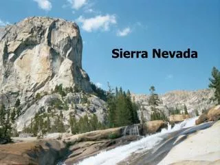
Eastern Sierra Climbs. Eastern Sierra Escape 2014. Date Ride Hotel Location 9/06/2014 Convict Lake Mammoth Lakes 9/07/2014 Devils Postpile & Lake Mary Mammoth Lakes 9/08/2014 Relax, hike, or make-up ride Mammoth Lakes

E N D
Eastern Sierra Escape 2014 DateRideHotel Location 9/06/2014 Convict Lake Mammoth Lakes 9/07/2014 Devils Postpile & Lake Mary Mammoth Lakes 9/08/2014 Relax, hike, or make-up ride Mammoth Lakes 9/09/2014 Pine Creek Bishop 9/10/2014 Rock Creek/Mosquito Flat Bishop 9/11/2014 Relax, hike, or make-up ride Bishop 9/12/2014 South Lake & Lake Sabrina Bishop 9/13/2014 Glacier Lodge Bishop 9/14/2014 Relax, hike, or make-up ride Bishop 9/15/2014 Bristlecone Pine Forest Bishop 9/16/2014 Death Valley Rd./Waucoba Canyon Bishop 9/17/2014 Relax, hike, or make-up ride Bishop 9/18/2014 Onion Valley Lone Pine 9/19/2014 Whitney Portal Lone Pine 9/20/2014 Relax, hike, or make-up ride Lone Pine 9/21/2014 Horseshoe Meadows
Convict Lake 21.5 miles, 1424 feet of climbing start at Best Western High Sierra 3228 Main St, Mammoth Lakes Go Total Turn Road details 0.0 7858 feet elevation 0.0 0.0 east Main St 0.2 0.2 R Old Mammoth Rd 0.9 1.1 L Sherwin Creek Rd 4.3 5.4 R slight right 1.6 7.0 R turn right 1.8 8.8 R Convict Lake Rd 1.9 10.7 S Convict Creek Rd 0.6 11.3 X Convict Lake 7614 feet elevation 0.0 11.3 U Convict Creek Rd 0.6 11.9 L Convict Lake Rd 2.1 14.0 L US-395 North 4.1 18.1 R exit for CA-203 0.2 18.3 L CA-203 to Mammoth Lakes 3.2 21.5 End Best Western Motel http://ridewithgps.com/routes/2638754
Devils Postpile and Lake Mary 37.9 miles, 4480 feet of climbing start at Best Western High Sierra 3228 Main St, Mammoth Lakes Go Total Turn Road details 0.0 7858 feet elevation 0.0 0.0 west Main St 0.7 0.7 R Minaret Rd 3.0 3.7 X 8808 feet elevation 2.5 6.2 X Minaret Summit 9265 feet elevation 0.0 6.2 S Postpile Rd 2.7 8.9 L Minaret Summit Rd 5.4 14.3 X Devils Postpile 7660 feet elevation 0.0 14.3 U Minaret Summit Rd 5.4 19.7 R Postpile Rd 2.6 22.3 X Minaret Summit 9265 feet elevation 0.0 22.3 S Minaret Rd 5.5 27.8 R Lake Mary Rd 8036 feet elevation 3.5 31.3 X Lake Mary 9000 feet elevation 0.1 31.4 R start loop around lake 2.2 33.6 R end loop around lake 3.5 37.1 S Main St 0.8 37.9 End Best Western Motel http://ridewithgps.com/routes/2628023
Pine Creek 42.7 miles, 3611 feet of climbing start at Creekside Inn 725 N Main St, Bishop Go Total Turn Road details 0.0 4148 feet elevation 0.0 0.0 south Main St 0.4 0.4 R West Line St 3.3 3.7 R Red Hill Rd 1.3 5.0 R Ed Powers Rd 4531 feet elevation 1.1 6.1 L Sawmill Rd 1.7 7.8 L Round Valley Rd 0.8 8.6 X 4406 feet elevation 4.9 13.5 L Vanadium Ranch Rd 1.2 14.7 X 5000 feet elevation 0.6 15.3 S Pine Creek Rd 2.2 17.5 X 6000 feet elevation 2.6 20.1 X 7000 feet elevation 1.3 21.4 X turn around point 7425 feet elevation 0.0 21.4 U Pine Creek Rd 6.0 27.4 R Vanadium Ranch Rd 1.8 29.2 R Round Valley Rd 5.7 34.9 R Sawmill Rd 1.7 36.6 R Ed Powers Rd 1.2 37.8 L Red Hill Rd 1.3 39.1 L Line St 3.2 42.3 L Main St 0.4 42.7 End Creekside Inn http://ridewithgps.com/routes/2628137
Rock Creek Rd / Mosquito Flat 41.6 miles, 6098 feet of climbing start at Rock Creek Rd and Boundary Rd Go Total Turn Road details 0.0 4674 feet elevation 0.0 0.0 north Lower Rock Creek Rd 1.5 1.5 X 5000 feet elevation 3.1 4.6 X 6000 feet elevation 1.1 5.7 X 6433 feet elevation 0.8 6.5 X 6128 feet elevation 2.9 9.4 L US-395 North 0.6 10.0 X 7000 feet elevation 0.3 10.3 L Upper Rock Creek Rd 2.5 12.8 X 8000 feet elevation 3.7 16.5 X 9000 feet elevation 4.3 20.8 X Mosquito Flat Trailhead 10220 feet elevation 0.0 20.8 U Upper Rock Creek Rd 10.6 31.4 R US-395 South 0.9 32.3 R Lower Rock Creek Rd 9.3 41.6 End Boundary Rd http://ridewithgps.com/routes/2628231
South Lake and Lake Sabrina 53.0 miles, 7106 feet of climbing start at Creekside Inn 725 N Main St, Bishop Go Total Turn Road details 0.0 4148 feet elevation 0.0 0.0 south Main St 0.4 0.4 R Line St / CA-168 West 4.9 6.3 X 5000 feet elevation 3.2 9.5 X 6000 feet elevation 3.9 13.4 X 7000 feet elevation 2.0 15.4 L South Lake Rd 0.6 16.0 X 8000 feet elevation 4.1 20.1 X 9000 feet elevation 2.4 22.5 X South Lake 9835 feet elevation 0.0 22.5 U South Lake Rd 7.1 29.6 L CA-168 West 7828 feet elevation 0.3 29.9 X 8000 feet elevation 3.0 32.9 S Lake Sabrina Rd 0.6 33.5 X Lake Sabrina 9138 feet elevation 0.0 33.5 U Lake Sabrina Rd 0.6 34.1 S CA-168 East 18.3 52.4 L Main St 0.5 52.9 End Creekside Inn http://ridewithgps.com/routes/2628836
Glacier Lodge 21.3 miles, 3824 feet of climbing start at Mendenhall Park in Big Pine Go Total Turn Road details 0.0 3979 feet elevation 0.0 0.0 west Baker Creek Rd 0.1 0.1 L School Rd 0.3 0.4 R Crocker St 0.2 0.6 S Glacier Lodge Rd 3.1 3.7 X 5000 feet elevation 2.2 5.9 X 6000 feet elevation 2.1 8.0 X 7000 feet elevation 2.6 10.6 L towards the lodge 0.0 10.6 X Glacier Lodge 7800 feet elevation 0.1 10.7 R Glacier Lodge Rd 10.0 20.7 S Crocker St 0.2 20.9 L School Rd 0.3 21.2 R Baker Creek Rd 0.1 21.3 End Mendenhall Park http://ridewithgps.com/routes/2628909
Bristlecone Pine Forest 47.2 miles, 6716 feet of climbing start at Mendenhall Park in Big Pine Go Total Turn Road details 0.0 3979 feet elevation 0.0 0.0 east Baker Creek Rd 0.1 0.1 L US-395 North 0.3 0.4 R CA-168 East 2.9 3.3 X 4000 feet elevation 2.8 6.1 X 5000 feet elevation 2.3 8.4 X 6000 feet elevation 3.1 11.5 X 7000 feet elevation 2.8 13.3 L White Mountain Rd 7278 feet elevation 4.1 17.4 X 8000 feet elevation 3.0 20.4 X 9000 feet elevation 3.0 23.4 R towards visitor center 0.1 23.5 X Visitor Center 10100 feet elevation 0.1 23.6 L White Mountain Rd 10.3 33.9 R CA-168 West 12.9 46.8 L US-395 South 0.3 47.1 R Baker Creek Rd 0.1 47.2 End Mendenhall Park http://ridewithgps.com/routes/2628986
Death Valley / Waucoba Canyon 33.3 miles, 3798 feet of climbing start at Mendenhall Park in Big Pine Go Total Turn Road details 0.0 3979 feet elevation 0.0 0.0 east Baker Creek Rd 0.1 0.1 L US-395 North 0.3 0.4 R CA-168 East 2.3 2.7 R Death Valley/Waucoba Rd 0.6 3.3 X 4000 feet elevation 4.1 7.4 X 5000 feet elevation 3.0 10.4 X 6000 feet elevation 3.4 13.8 X 7000 feet elevation 2.9 16.7 X Summit 7670 feet elevation 0.0 16.7 U Waucoba Rd 13.9 30.6 L CA-168 West 2.3 32.9 L US-395 South 0.3 33.2 R Baker Creek Rd 0.1 33.3 End Mendenhall Park http://ridewithgps.com/routes/2629046
Onion Valley 26.0 miles, 5224 feet of climbing start at US-395 and Market St in Independance Go Total Turn Road details 0.0 3930 feet elevation West on W. Market St 0.2 0.2 S Onion Valley Rd 0.2 0.4 X 4000 feet elevation 3.1 3.5 X 5000 feet elevation 2.4 5.9 X 6000 feet elevation 1.9 7.8 X 7000 feet elevation 2.1 10.2 X 8000 feet elevation 2.3 12.5 X 9000 feet elevation 0.5 13.0 X Onion Valley Campground 9171 feet elevation 0.0 13.0 U Onion Valley Rd 13.0 26.0 End US-395 http://ridewithgps.com/routes/2627583
Whitney Portal 25.6 miles, 4633 feet of climbing start at Best Western Frontier Motel 1008 S. Main St., Lone Pine Go Total Turn Road details 0.0 3716 feet elevation North on Main St 0.8 0.8 L Whitney Portal Rd 1.4 2.2 X 4000 feet elevation 3.2 5.4 X 5000 feet elevation 2.7 8.1 X 6000 feet elevation 1.8 9.9 X 7000 feet elevation 2.1 12.0 X 8000 feet elevation 0.8 12.8 X Whitney Portal 8371 feet elevation 0.0 12.8 U Whitney Portal Rd 12.0 24.8 R US-395 South/Main St 0.8 25.6 End Best Western Motel http://ridewithgps.com/routes/2629185
Horseshoe Meadows 46.2 miles, 6999 feet of climbing start at Best Western Frontier Motel 1008 S. Main St., Lone Pine Go Total Turn Road details 0.0 3716 feet elevation North on Main St 0.2 0.2 L Burkhart Rd 1.1 1.3 L Tuttle Creek Rd 1.4 2.7 X 4000 feet elevation 3.6 6.3 R Lubken Canyon Rd 0.4 6.7 L Horseshoe Meadows Rd 1.0 7.7 X 5000 feet elevation 3.1 10.8 X 6000 feet elevation 2.5 13.3 X 7000 feet elevation 2.5 15.8 X 8000 feet elevation 2.3 18.1 X 9000 feet elevation 1.5 19.6 X 9600 feet elevation 0.7 20.3 X 9341 feet elevation 2.1 22.4 R Cottonwood Lakes Rd 0.6 23.0 X Horseshoe Meadows 10080 feet elevation 0.0 23.0 U Cottonwood Lakes Rd 0.6 23.6 L Horseshoe Meadows Rd 12.6 39.2 R Lubken Canyon Rd 3.6 42.6 L US-395 North 3.6 46.2 End Best Western Motel http://ridewithgps.com/routes/2629302