Download
1 / 26
260 likes | 459 Views
Dose-Response Calculator for ArcGIS. Steven E. Hanser, Cameron L. Aldridge, Matthias Leu , and Scott E. Nielsen. What is a dose-response curve?. A graph Dosage rates on the X-axis Response of interest on the Y-axis. Russell et al. 1982. Why is this helpful?. Visualization tool

E N D
Dose-Response Calculator for ArcGIS Steven E. Hanser, Cameron L. Aldridge, Matthias Leu, and Scott E. Nielsen
What is a dose-response curve? • A graph • Dosage rates on the X-axis • Response of interest on the Y-axis Russell et al. 1982
Why is this helpful? • Visualization tool • Populations • Thresholds Russell et al. 1982
Dose-response curves in ecology • Species-habitat relationships • Multivariate models • Explanatory tool Aldridge et al. 2008
Converting an equation to a dose- response curve • Apply the range of values for variable of interest • Hold all other variables at their mean or median • Persistence = -0.186 * Pop1950 + 0.7124 • Apply the range of values for variable of interest • Hold all other variables at their mean or median • Persistence = -0.186 * Pop1950 - 0.038 * crop% + 0.019 * km_edge - 0.058 * sev1950 + 0.049 * sb%_30 Aldridge et al. 2008
How does this apply to GIS? Greater sage-grouse • Spatially explicit models Problow=1 / (1 + (exp(-(-3.56 + 2.57 * ABIGSAGE1km - 0.07 * TRI270 + 0.002 * ELEV - 1.75 * WELL1km - 2.44 * MjRD1km - 2.12 * POWER500 + 0.04 * Tmin + 0.25 * RIP1km + 0.99 * MIX3km)))) Hanser et al. in press
How does this apply to GIS? • Spatially explicit models • Large array of analysis techniques • Linear models • Multivariate statistics • Mahalanobis distance • MAXENT Phillips 2005
How do we incorporate variation? • Overcome the need to use mean values for variables in the model • Provide dose-response curves with confidence intervals • Provide data that can inform conservation and management actions
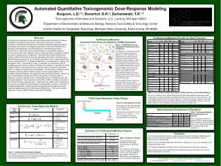
Dose-Response Calculator • Python script tool • ArcToolbox interface Response Raster Dose Raster Multiplier Raster Calculator Zonal Statistics Integer Zone Raster Tabular or Graph Output
Dose-Response Calculator Greater sage-grouse Response Raster Dose Raster Multiplier Raster Calculator Zonal Statistics Integer Zone Raster Tabular or Graph Output
Dose-Response Calculator Sagebrush within 1 km radius Response Raster Dose Raster Multiplier Raster Calculator Zonal Statistics Integer Zone Raster Tabular or Graph Output
Dose-Response Calculator Sagebrush within 1 km radius Response Raster Dose Raster Multiplier Raster Calculator Zonal Statistics Integer Zone Raster Tabular or Graph Output
Dose-Response Calculator Sagebrush within 1 km radius Response Raster Dose Raster Multiplier Raster Calculator Zonal Statistics Integer Zone Raster Tabular or Graph Output
Dose-Response Calculator Sagebrush within 1 km radius Response Raster Dose Raster Multiplier Raster Calculator Zonal Statistics Integer Zone Raster Tabular or Graph Output
Dose-Response Calculator Response Raster Dose Raster • Raster Calculator • int (dose * multiplier) • Convert the dose raster into zones Multiplier Raster Calculator Raster Calculator Zonal Statistics Zonal Statistics Integer Zone Raster Tabular or Graph Output Response Raster Integer Zone Raster Dose Raster
Dose-Response Calculator • Integer conversion 1 = original values 100 = 0-1 to 0-100% 0.001 = meters to km Response Raster Dose Raster Multiplier Raster Calculator Zonal Statistics Integer Zone Raster Tabular or Graph Output
Dose-Response Calculator • MakeGraph • .grf file Response Raster Dose Raster Multiplier Raster Calculator Zonal Statistics Integer Zone Raster Tabular or Graph Output
Dose-Response Calculator Output • Tabular output • Graph output
Linear model example Greater sage-grouse Sagebrush within 1 km radius Problow=1 / (1 + (exp(-(-3.56 + 2.57 * ABIGSAGE1km- 0.07 * TRI270 + 0.002 * ELEV - 1.75 * WELL1km - 2.44 * MjRD1km - 2.12 * POWER500 + 0.04 * Tmin + 0.25 * RIP1km + 0.99 * MIX3km)))) Hanser et al. in press
Linear model example Hanser et al. in press
Complex relationships Density = 1 / (1 + (exp(-(15.90 + -9.46 * ALLSAGE18km - 54.46 * NDVI18km + 48.79 * NDVI18km 2 - 86.06 * MIX5km + 1.22 * RIP1km + 0.055 * CONTAG3km + 9.18 * SALT1km - 0.08 * TRI5km + 1.52 * RDdens18km + 4.68 * WELL250 - 1.49 * GRASS3km)))) * exp(1.29 - 2.32 * ALLSAGE18km + 2.51 * NDVI18km - 11.45 * NDVI18km 2 - 19.58 * MIX5km - 3.63 * RIP1km - 0.0008 * CONTAG3km - 0.97 * SALT1km - 0.01 * TRI5km - 0.31 * RDdens18km + 1.70 * WELL250 - 0.27 * GRASS3km + 2.09) Sage sparrow Sagebrush within 18 km radius Aldridge et al. in press
Complex relationships Aldridge et al. in press
Summary • Facilitates comparisons between 2 raster datasets • Incorporates variation into the dose-response curve • Simple pair wise comparisons • Complex linear or multivariate models
Summary • ArcToolbox interface • Easy to use analysis tool • Tabular and graphic output • Range of applications
Dose-response Calculator for ArcGIS • http://pubs.usgs.gov/ds/631/