Download
1 / 30
300 likes | 495 Views
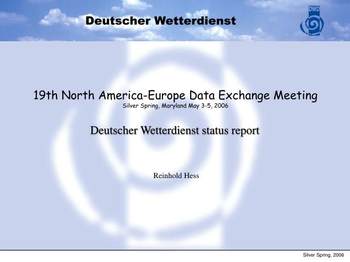
19th North America-Europe Data Exchange Meeting Silver Spring, Maryland May 3-5, 2006. Deutscher Wetterdienst status report. Reinhold Hess. Silver Spring, 2006. Deutscher Wetterdienst status report. Overview: Events in NWP since the last report

E N D
19th North America-Europe Data Exchange Meeting Silver Spring, Maryland May 3-5, 2006 Deutscher Wetterdienst status report Reinhold Hess Silver Spring, 2006
Deutscher Wetterdienst status report Overview: • Events in NWP since the last report • use of satellite radiances with 1D-Var (AMSU-A) • use of AMV of Meteosat 8 (and MTSAT) • Research • AIRS/IASI with 1D-Var • Scatterometer (QuikSCAT) • Radio Occultation • LME: SEVIRI and ATOVS with 1D-Var • LMK: Radar reflectivities with LHN • 3D-Var • Conclusion ReinholdHess, 2 Silver Spring, 2006
Global Model GME 40/40 Model System: GME (Global Model): hydrostatic, icosahedral-hexagonal grid, mesh size ~40km terrain following hyb. coordinate, 40 layers, bottom layer at 10 m, 7 soil layers forecast range: 174h initial dates 00, 12 UTC and 48h for 18 UTC prognostic cloud ice, prognostic sea ice Analysis: OI, 3-hourly intermittent analysis, observation window +/- 1.5h observations: conv., AIREP, AMDAR, ACARS, ATOVS (NOAA-15,16 and AQUA), AMV (GOES E and W, GMS, Meteosat 5 and 7), PAOB MODIS-Winds, PSEUDO-temps cutoff: 2h30 (for forecasts) ReinholdHess, 3 Silver Spring, 2006
Assimilation of IFS Pseudo Temps (operational since Dec 17 2003) Profiles of IFS/4D-Var Analyses (temperature, humidity and wind) as Temps for OI/GME use of humidity profiles only above 700 hpa Assimilation one time per day for 0 UTC into Main Analysis only Data Coverage ReinholdHess, 4 Silver Spring, 2006
Use of ATOVS with 1D-Var ReinholdHess, 5 Silver Spring, 2006 Setup: • Level 1c ATOVS from UKMO (NOAA 15, 16 and AQUA) (NOAA 18 in preparation) • Channel Choice: AMSU-A 5-12 (HIRS deferred) • Bias-Correction: UKMO-Style (scan angle and mass, A4 and A9) • MW Rain/Ice-detection (Kelly and Bauer/ECMWF) • Assimilation as SATEMS in OI (geopotential thicknesses, PWC) (assimilate 1d-var analysis increments only) • Retrieval of temperature only (humidity deferred) • B-Matrix based on GME-Statistics (NMC-Method) • Use of IFS forecasts above GME model top (10hPa)
500 hPa ANOC, 0 UTC, Routine, 1006 (conv. Rou), 1004 (1D-VAR) • Significant improvement of conventional Routine (no Pseodo-Temps) with 1D-Var • 1D-Var (without PT) is comparable to Routine (with PT) for 0 UTC Reinhold Hess, 6 Silver Spring, 2006
500 hPa ANOC, 12 UTC, Routine, 1006 (conv. Rou), 1004 (1D-VAR) • Significant improvement of conventional Routine (no Pseodo-Temps) with 1D-Var • 1D-Var (without PT) is lags behind Routine (with PT) for 12 UTC Reinhold Hess, 7 Silver Spring, 2006
500 hPA ANOC, 0 UTC, for Routine, 4638 (Pseudo+1D-VAR) 1D-Var (with PT) further improves compared to Routine (with PT) for 0 UTC Reinhold Hess, 8 Silver Spring, 2006
500 hPA ANOC, 12 UTC, für Routine, 4638 (Pseudo+1D-VAR) 1D-Var (with PT) is neutral compared to Routine (with PT) for 12 UTC Reinhold Hess, 9 Silver Spring, 2006
Use of ATOVS with 1D-Var Monitoring with routine GME available on Internet: http://www.dwd.de/en/FundE/Analyse/Assimilation/ > Monitoring ReinholdHess, 10 Silver Spring, 2006 diurnal cycles of o-b differences are caused by assimilation of pseudo-temps one time per day because of slightly different inherent model climates of GME and IFS/ECMWF
ReinholdHess, 11 Silver Spring, 2006
Use of AIRS/IASI Status: • monitoring available • cloud detection implemented (S. English) • validation of channel selection (UKMO sample) • bias correction (mass and scan angle correction) • channel-based cloud detection implemented (T. McNally) validation study at ECMWF Next: • trial experiments (just started) • validation of retrievals and forecasts • preparation for IASI ReinholdHess, 12 Silver Spring, 2006
Validation study of channel selection at ECMWF collocation of AIRS-787 departures, MODIS visual cloud product, model clouds, and results of AIRS cloud detection distributions of AIRS-787 first guess departures for visually cloud free and cloudy fovs visually cloud free sample has bias of 0.04 K, visually cloud affected sample has bias of -0.07K inconsitencies detected and clarified, e.g. visual cirrus does not affect lw CO2 band ReinholdHess, 13 Silver Spring, 2006
Analysis and forecast impact of AMVs of Meteosat 8 (generated at EUMETSAT) • Usage • extratropics over oceans; tropics over oceans and land • IR above 1000 hPa • QI > 85 • WVcloudy above 400 hPa (both channels) • QI > 80; tropics > 85 • WVcloudy between 700 and 400 hPa (7.3 μm) • QI > 80 only on the Southern Hemisphere • WVclear is not used • VIS below 700 hPa • QI > 65 ; tropics: QI > 85 • FG check: asymmetric to remove negative OBS-FG bias • Thinning: 1 wind per pre-defined thinning box (200 km;15 vertical layers). Alexander Cress
Difference of the mean RMS increments between an analysis using Meteosat 7 and Meteosat 8 AMV winds • Reduction of RMS by replacing Meteosat 7 AMV winds with Meteosat 8 wind data • Positive impact of Meteosat 8 AMV winds on the global GME analysis Alexander Cress
Anomalie correlation coefficient for 500 hPa geopotential height date: 2005111500 - 2005121500, 30 forecasts Routine with Meteosat 7 AMVs TR NH ancor Experiment with Meteosat 8 AMVs replacing Meteosat 7 Routine Routine Exp. 5344 Exp. 5344 EU SH ancor Routine Routine Exp. 5344 Exp. 5344 forecast time h forecast time h Alexander Cress
Use of QuikSCAT Data QuikSCAT data 25 km resolution date: 2004092709 Used dataJPL Rain Flag Used dataKNMI Rain Flag Silver Spring, 2006
Use of QuikSCAT Data Status: • monitoring available • KNMI rain flag • bias correction • test cases Next: • more trial runs Data with KMNI Rain Flag 0 without outer zone and full bias correction All Data bias: 0.80 rms: 3.21 cor: 0.66 bias: 0.22 rms: 2.06 cor: 0.82 Obs F G ReinholdHess, 18 Silver Spring, 2006 F G
Statistics for QuikSCAT wind speed Dez. 2004 Obs -FG (All data, bcor) Mean: 0.63 Mean: 0.44 STDV Obs -FG (All data, bcor) STDV Obs -FG (OI_data, bcor) Mean: 1.48 • Data selection (KNMI rain flag) reduces Bias and Stdv. • Some rain contamination still present in tropics ? Obs - FG (OI data, bcor) Mean: 1.85
Use of Radio-Occultation Data (CHAMP) Receiving Produkt from MPI-Hamburg (bending angles based on canonical transformation) Monitoring since Jan 2004 bias and stddev of bending angles compared to GME [%] Work deferred until COSMIC data becomes available ReinholdHess, 20 Silver Spring, 2006
Local Model LM (LME) Model System: LM (Local Model): non-hydrostatic, rotated latitude-longitude grid, mesh size 7km terrain following hyb. coordinate, 40 layers forecast range: 78 for initial dates 00, 12 prognostic cloud ice, prognostic rain Analysis: continuous nudging observations: conv., AIREP,AMDAR,ACARS cutoff: 2h30 variational soil moisture analysis ReinholdHess, 21 Silver Spring, 2006
Use of Radiances (SEVIRI/MSG and ATOVS) for LME with 1D-Var • Assimilation of 1D-Var retrievals with nudging analysis • Continuous nudging analysis requires 1D-Var within LM for topical background MW rain/ice detection (Kelly/Bauer) as for GME ReinholdHess, 22 Silver Spring, 2006 NWC-SAF scene analysis for IR/WV cloud detection Status: Trial runs about to start
Model Domain LMK LMK: • x = 2.8 km • 50 levels • t = 30 sec. • Tges = 18 h • Initialised with LME every 3 hours • Explicit simulation of deep convection Silver Spring, 2006
Latent Heat Nudging of Radar Reflectivities for LMK Silver Spring, 2006
Development of PSAS (3D-Var) (physical space assimilation system, dual space, observation space) Minimisation in Observation Space rather than Model Space Conventional 3D-VAR (MSAS, Model Space Assimilation System) solve: PSAS (OSAS, Observation Space Assimilation System) solve: • more flexibility in definition of B • observation space smaller than model space !?! • minimisation costs become quadratic in number of observations ReinholdHess, 25 Silver Spring, 2006
Development of PSAS (3D-Var) Adaptive Vertical Error Correlations for 1D-Var (depending e.g. on vorticity) ReinholdHess, 26 Silver Spring, 2006
ReinholdHess, 27 Silver Spring, 2006
ReinholdHess, 28 Silver Spring, 2006
Status and Plans Conclusion: • Operational: ATOVS/AMSU-A with 1D-Var and OI (substituting SATEMS) • Pre-operational: AMVs of MET-8 (substituting MET-7) • Operational Plans in • ATOVS/AMSU-B • AIRS/IASI • QuikSCAT • Radio Occultation • Prototype of PSAS/3D-Var (direct Assimilation of ATOVS, AIRS) • but also Interest in AIRS/IASI-Retrievals ReinholdHess, 29 Silver Spring, 2006
Deutscher Wetterdienst status report Many thanks for your attention! ReinholdHess, 30 Silver Spring, 2006