Download
1 / 8
80 likes | 430 Views
Google Earth. 地球瀏覽器. 下載與安裝. Google Earth 首頁 http://earth.google.com Google Earth 安裝程式 (9.83MB) http://dl.google.com/earth/client/advanced/previous/GoogleEarthWin.exe. 導覽工具. 平移 滑鼠拖曳 / 方向鍵 縮放 滑鼠滾輪 / +、- 方向 ( 旋轉 ) 拖曳導覽器羅盤 壓住滾輪左右推 視角 按羅盤 ▲▼ 壓住滾輪前後推. 檢視設定.

E N D
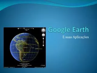
Google Earth 地球瀏覽器
下載與安裝 • Google Earth首頁http://earth.google.com • Google Earth安裝程式 (9.83MB)http://dl.google.com/earth/client/advanced/previous/GoogleEarthWin.exe
導覽工具 • 平移 • 滑鼠拖曳 / 方向鍵 • 縮放 • 滑鼠滾輪 / +、- • 方向(旋轉) • 拖曳導覽器羅盤 • 壓住滾輪左右推 • 視角 • 按羅盤 ▲▼ • 壓住滾輪前後推
檢視設定 • 檢視 /大氣層開啟大氣層顯示,有更擬真的地平線效果。 • 檢視 / SUN可顯示不同的太陽照射角度(時間),在地表上的光影變化。 • 檢視 /歷史圖像 (5版新功能)了解過去一段時間,地表發生什麼樣的變化,如海岸侵蝕、城市建設… • 檢視 / 水面為海底地形加上海面(波浪)效果,並有水面下的虛擬視景。 • 側欄 / 圖層 / 地形顯示3D立體地形,搭配SUN與45。視角旋轉,效果絕佳。
側 欄 - 圖 層 • 3D建築物http://sketchup.google.com/3dwarehouse/ • 街景視圖 • 台北市、日、韓、北美、澳洲、歐洲 • 圖庫 / 360cities • 氣象 • 海洋 (5版新功能) • BBC、國家地理頻道…提供的海洋資訊 • 觀光景點 • 圖庫 / 美國太空總署 / 地球城市夜色 • 圖庫 / You tube
側 欄 - 搜 尋 • 目的地 (定點搜尋) • 全球地點都可使用中文搜尋(搜尋內容不明確,會條列可能地點供選擇) • 可使用地址精確搜尋 • 尋找公司 (目標+地區) • 加油站 & 台南縣永康市 • 誠品書店 & 台北市 • 方向 (路徑規畫) • 起點:輸入地址 或 新增地標→設定從這裡出發 • 目的:輸入地址 或 新增地標→設定到這裡
側 欄 –位 置 • 新增內容 (開啟Google地球相片集)這是網友分享個人開發的圖庫檔,如: • Beijing Olympic Stadiums 3D Tour 北京奧運場館3D之旅 • Major League Baseball Stadiums 3D Tour 美國大聯盟棒球場3D之旅 • 我的位置存放使用者自己建立的地標、路徑、多邊形、資料夾,關閉Google earth時會自動存下。 • 暫存位置[新增內容]所開啟的KMZ檔存放於此,關閉Google earth時,會詢問是否存檔。
工具列 • 新增地標 • 歷史圖像 • 日光(SUN) • 探索:地球、星空、火星、月球 • 尺規 • 線條:測量單一直線距離與方向 • 路徑:測量連續直線距離 • 滑鼠導覽:測距同時,可拖曳滑鼠移動地圖