Download
1 / 33
490 likes | 1.76k Views
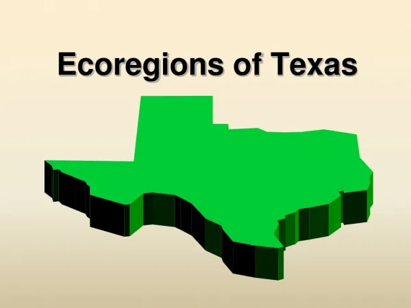
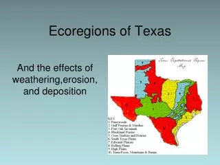
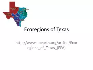
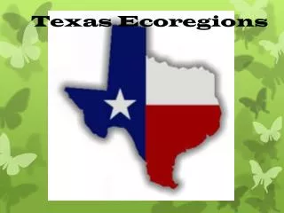
Effects of Weathering, Erosion and Deposition. Texas Ecoregions. Ecoregion - a major ecosystem with distinctive geography, characteristic plants and animals, ecosystems, and receiving uniform solar radiation and moisture Sometimes called an ecological region or bioregion

E N D
Effects of Weathering, Erosion and Deposition Texas Ecoregions
Ecoregion - a major ecosystem with distinctive geography, characteristic plants and animals, ecosystems, and receiving uniform solar radiation and moisture • Sometimes called an ecological region or bioregion • Smaller than a biome What Is An Ecoregion?
Types of soil • Precipitation • Temperature • Land features • Vegetation • Animal wildlife In the natural world, environments are characterized by:
Weathering– chemical and physical break down of rocks into sediment Erosion – the movement of sediment from one place to another Deposition– the placement of sediment after being carried from place of origin Factors Affecting Our Ecoregions:
Due to abundant precipitation and abundant vegetation that holds the soil in place, there is very little erosion. • Thick vegetation near rivers inhibits river erosion. 1. Piney Woods
Has gently rolling hills and lightly wooded plains. • This area generally receives a moderate amount of rainfall that helps shape the land. • Trees and grasses prevent large amounts of soil erosion due to water and wind. 2. Oak Wood & Prairies
These areas have nutrient-rich soils and receive good amounts of rainfall through the year. • If the land is clear-cut of natural vegetation for construction, nutrients can easily be eroded. • If the land is used for farming and it is not managed well, nutrientswill be quickly used up. 3. Blackland Prairie
Wave action, a cause of weathering, erosion and deposition, is constant along the Texas Coastline. • Sediments are weathered and eroded along beaches and carried out into the ocean to form sand bars and islands. • When rivers, like the Brazos enter the Gulf of Mexico sediment being carried by the river stop moving and get deposited causing a delta. 4. Gulf Coast Prairies
Soil in the region is primarily sand-based. • If there isn’t enough vegetation to keep the soil in place, rainfall received can cause severe erosion. • Catastrophic events such as hurricanes can increase wave erosion and deposition. 5. Coastal Sand Plain
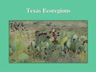
The area is known as “Brush Country” due to the shorter trees and many shrubs. • Overgrazingof the land has allowed nutrient-rich topsoil to erode way. • Rocky, dry soil cannot support grasses, trees can thrive because of their deeperroot system. 6. South texas Brush Country
Erosion has left most of the region with very shallow soils (less than 10 inches) lined with limestone rock layers. • High amounts of rain in a short amount of time can cause flash flooding. • Rainwater mixes with carbon dioxide in the atmosphere and soils to form carbonic acid, which acts to dissolve away limestone. 7. Edwards Plateau
The soil is not as prone to flooding because it allows water to infiltrate very easily. • The region is described as rough, hilly terrain. • Enchanted Rock-Exfoliation has caused the rock to “peel” in sheets. This was caused by contracting and expanding during heating and cooling in the temperature. • The weathering of sedimentary rock has exposed the granite dome underneath • Other types of mechanical weathering present – plant roots 8. Llano Uplift
Soils in this area are most fertile and sought after for crop production. • Periods of drought and then sudden increase in rainfall causes large amounts of erosion and deplete the soil of nutrients. 9. Rolling Plains
“Texas Panhandle”-Largest and most completely flat areas of it size in the world! • The region extends to the Palo Duro Canyon-the nation’s 2nd largest canyon. • Palo Duro Canyon was formed by water erosionfrom the Prairie Dog Town Fork of the Red River. • The water deepens the canyon by moving sediment downstream. Wind and water erosion gradually widen the canyon 10. High Plains
Rain does not fall evenly over the area. “Desert portion” of Texas. • The weatheredbedrock in this area have a large amount of calcium. Erosion and deposition in the area creates soil which has high amounts of calcium called caliche. • Home of the tallest mountain in Texas, Guadalupe Peak. Elevation is 8,749 feet. • Pines and Oaks dominate the tree species. • Soils are shallow and rocky.Weathering continues to play a role in developing soil and will for thousands of years to come. Soils in the canyon bottoms and valleys are deeper as a result of deposition. 11. Trans Pecos
Marine topography refers to the shape the land along coastlines, but they occur also in significant ways underwater. • The effectiveness of marine habitats is partially defined by these shapes, including the way they interact with and shape ocean currents. • Marine topographies include coastal and oceanic landforms ranging from coastal estuaries and shorelines to continental shelves and coral reefs. 12. Marine environment
Our Next Step: • Analyzed the characteristics of the ecoregions of Texas • Investigated processes that change the surface of the Earth • Explored how the process of weathering, erosion, and deposition have affected the environments in Texas ecoregion.