Download
1 / 43
430 likes | 435 Views
Trends in Satellite Navigation, Trends in Geoinformatics Education Alfred Kleusberg, Stuttgart University. Stuttgart University. 10 Faculties Architecture and Urban Planning Civil and Environmental Engineering Chemistry Life Sciences Computer science and Electrical Engineering

E N D
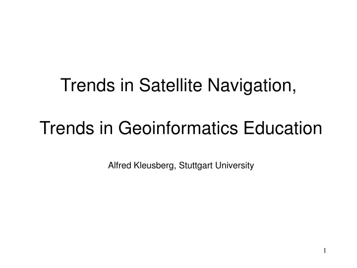
Trends in Satellite Navigation, Trends in Geoinformatics Education Alfred Kleusberg, Stuttgart University
Stuttgart University 10 Faculties Architecture and Urban Planning Civil and Environmental Engineering Chemistry Life Sciences Computer science and Electrical Engineering Aerospace Engineering and Geodesy Mechanical Engineering Mathematics and Physics Philosophy and History Economics and Social Sciences
Stuttgart University • Aerospace Engineering and Geodesy • Common faculty since 2002 (University Reorganisation) • Programmes of Study in 2004 • Aerospace Engineering (full time, 9 Semesters) • Aerospace Engineering (part time) • Geodesy and Geoinformatics Engineering (full time, 9 S.) • Students in Aerospace Engg.: 350 – 200 per year • Students in Geod.&Geoinf. Engg.: 25 – 15 per year • Full time Professors Aerospace Engg.: 14 • Full time Professors Geod.&Geoinf. Engg.: 5
Stuttgart University • Geodesy and Geoinformatics Engineering • Four Institutes (smallest organisational unit) • Geodetic Institute • Institute of Photogrammetry • Institute of Applications of Geodesy in Civil Engg. • Institute of Navigation • responsible for teaching and research in • Navigation • Remote Sensing
Stuttgart University • Employment of • our Geodesy and Geoinformatics Graduates (Dipl.-Ing.) • Land Surveying and Land Administration – 20% • Research Institutions – 15% • Geoinformatics Industry – 30% • Engineering Surveying – 20% • Other – 15% • There are a total of 9 such programmes in Germany • Graduates of other programmes have different priorities when selecting their jobs.
Trends in Satellite Navigation • Navigation, geodesy and surveying before the age • of satellites • History and present status of GPS and Glonass • Future developments of GPS and Glonass • Development of Galileo • Status and trends in user equipment and applications • Future combination of satellite navigation, satellite • communication and satellite remote sensing.
Navigation before the age of satellites • Global terrestrial radio navigation: OMEGA • 8 stations, low frequency signals; marine navigation • Regional terrestrial radio navigation: LORAN-C • Loran-C chains established e.g. in North Atlantic Ocean; • primarily marine navigation • Non Directional Beacon (NDB), VHF Omnidirectional • Range (VOR), TACAN; area navigation of aircraft • Instrument Landing System (ILS) and Microwave • Landing System (MLS); aids to aircraft landing • Inertial Navigation System (INS); air navigation
Geodesy before the age of satellites Triangulation
Geodesy before the age of satellites Triangulation
Geodesy before the age of satellites Photogrammetry Eninger Weide Flughöhe ~1000 m Maßstab ~1:7500
Artificial Satellites: Types of Orbits LEO: Low Earth Orbit H ~500 - 1,500 km MEO: Medium Earth Orbit 2,000 km < H < 36,000 km GEO: Geostationary Earth Orbit H ~36,000 km
Types of Orbits Characteristic Differences LEO/MEO vs GEO Cost of launch low high Signal power requirements low high Dynamic vs static constellation dyn. static Non-directional vs directional antennae Coverage / visibility ~10 Mio sq km vs ~500 Mio sq km Round trip time delay >4 msec ~0.25 s
Geodesy with Balloon Satellites • Passive Geodetic Satellite • (PAGEOS) • 1975 -1980 • balloon satellites 30 m • MEO, H = 5,600 (2,800) km • illuminated by sun light • photographed before stars • satellite triangulation • first global geodetic network • ~45 stations • distances ~4,000 km • accuracy ~ 5 m
Early Satellite Navigation Systems • Transit/NNSS, U.S.A. • 1967 - 1996 • 6 SV constellation • polar orbits • LEO, H ~1,000 km • VHF signals (150/400 MHz) • ~15 position fixes / day • ~20 min / position fix • low dynamic vehicles only • 50 - 100 m accuracy • bulky receivers • (Tsikada, USSR)
Geodesy with the Transit/NNSS • NNSS receivers on geodetic • control network points • distances few 100s km • simultaneous measurements • on all network points • station occupation few days • relative coordinates of stations • accuracy ~0.2 m • Geodetic control networks in • European countries, • Canada, African countries, etc.
The Global Positioning System (GPS) • operational 1995 • 24 (27) SV constellation • 6 planes with 4 SV each • orbits inclined by 55 deg • MEO, H ~20,000 km • UHF signals (~1.2/1.6 GHz) • instantaneous position fix • vehicles of any dynamics • 10 - 30 m accuracy SPS • <10 m accuracy PPS • receiver = chip + antenna • embedded systems
Geodesy & Surveying with the GPS • simultaneous measurements • on network point • cm-accuracy for distances • of <10 km in few minutes • of 500 km in few hours • of 10,000 km in few days • All geodetic networks have • been re-measured with GPS • GPS has revolutionised • geodesy and surveying
Geodesy & Surveying with the GPS Laserscanning (GPS and INS)
GPS Augmentation Systems • Several navigation applications require high level of signal integrity information • The GPS signals do not provide this information • Receiver Autonomous Integrity Monitoring (RAIM) is not always successful and reliable • ==> Additional infrastructure needed to monitor GPS signals and to provide integrity information • ==> Ground based augmentation systems (GBAS) • ==> Space based augmentation systems (SBAS)
Example GBAS: Local Area Augmentation System (LAAS) • Location: vicinity of airports • several GPS signal monitor station • GPS signal processing yields integrity information and GPS signal error mitigation information • integrity info & error corrections transmitted to user via RF link • additional GPS-like ranging signals “pseudolite” • Status: • Cat. I: planned to be operational in 2006 (funding?) • Cat. II / III performance: research and development efforts
Examples SBAS: European geostationary navigation overlay service (EGNOS) Wide area augmentation system (WAAS, North America) • continent-wide networks of GPS signal monitor stations • central signal processing facilities compute continent-wide valid integrity information and GPS signal error mitigation information • integrity info & error corrections transmitted to user via geostationary communication satellites • additional GPS-like ranging signals from comm. sat. • Status: • EGNOS: planned to be operational in 2006 ? • WAAS: partly available 2003, operational ?
GLONASS • was operational in 1996 • 24 SV constellation • 3 planes with 8 SV each • orbits inclined by 65 deg • MEO, H ~19,000 km • UHF signals (~1.2/1.6 GHz) • instantaneous position fix • vehicles of any dynamics • accuracy similar to GPS • Status: • presently <10 SV • commitment to re-build full constellation • future Glonass-M, -K SV: new frequencies & signals
Plans for Galileo • operational >2010? • 27 (30) SV constellation • orbits inclined by 56 deg • MEO, H ~23,600 km • UHF signals (~1.2/1.6 GHz) • instantaneous position fix • vehicles of any dynamics • several levels of service • 1 m < accuracy < 30 m • signal integrity info (CS) • integration of EGNOS • compatibility with GPS
The Future of GPS • New signal structure with existing frequencies • second ranging signal for civilian applications • better separation of “military” and “civilian” signals • IOC in 2008, FOC in 2010 (2001 FRP) • Additional third signal frequency (L5) • third ranging signal for civilian applications • IOC in 2012, FOC in 2014 (2001 FRP)
Main Applications of Satellite Systems Communication Remote Sensing Science Missions Navigation
Example for Sat.-Comm.: Iridium Configuration of 66 LEO satellites Polar orbits, H ~780 km Cross-links between satellites Hand held terminals Omni-directional antennae Voice, fax, messaging Low rate data @2.4Kbps Very small delays ~10 msec
Example for Sat.-Comm.: Globalstar Configuration of 48 LEO satellites 52 deg inclined non-polar orbits Coverage +/- 70 deg latitude 8 planes with 6 satellites each H ~1410 km Voice, fax, messaging Low rate data communication Present service coverage Hand held terminals (L Band)
Example: Inmarsat RGBAN service Regional (Global) Broadband Area Network Using transponders on Thuraya satellites C Band data @144 Kbps Terminal Service coverage in 2003 GBAN service on Inmarsat-4 to start next year (~500 Kbps)
Example for Satellite Remote Sensing Optical System IKONOS
Example for Satellite Remote Sensing Radar System on the Shuttle: Shuttle Radar Topography Mission
Satellite Systems for Desaster Relief Sat. Remote Sensing for Damage Assessment Sat. Communication to Get information to Location Sat. Navigation to get Help And Helpers to Location
Satellite Systems for Science Missions • Champ • Earth Gravity Field • Earth Magnetic Field • Probing the Atmosphere • Altimetry over Oceans • GPS antennae pointing • upwards for navigation • gravity field • magnetic field • backwards for atmospheric probing • downwards to receive GPS signal reflected at ocean
The next steps In 2010 – 2014: three independent interoperable satellite navigation systems: GPS, Glonass, Galileo with external integrity information and with the ability to cross-check between systems. EU White Paper on Space (2003): “Access to broadband communication for every citizen” (www, telemedicine, education, etc.). Space technology solution: Integrate satellite navigation, satellite communication and satellite remote sensing for security, sustainable development, crisis detection and crisis management.
Trends in Geoinformatics Education • Changes in the geoinformation profession • Implication for geoinformatics education • Implications of the Bologna agreement • The Erasmus Mundus Programm of the EU • A preview on geoinformatics education in 10 years.
Changes in the geoinformation profession Geoinformatics here: geodesy, surveying, geomatics • Enabeling technology: Computers • Data acquisition pre-planning • Data acquisition with computerised instrumentation • Data processing (modelling, adjustment, analysis) • Digital presentation of results • Visualisation and display to „customers“
Changes in the geoinformation profession • Enabeling technology: Satellites • „Infrastructure“ Global Positioning System • Optical and micro-wave Remote Sensing • Digital line cameras and laser scanners • Geodesy and geophysics from space • (CHAMP, GRACE, GOCE) • Monitoring and change detection of the environment • on local, regional, national and global scale
Implications for geoinformatics education more new content shorter period of study more application oriented Geoinformatics Curriculum How to react? Remove „unneccessary math“? Remove „unneccessary physics“? Remove „unneccessary applications“?
Implications of the Bologna agreement • „By 2010 have in Universities throughout Europe two consecutive programmes of study (bachelor/master)“ • presently in Germany 9 or 10 semester • programmes leading to the degree „Diplom“ • Legislation on federal political level in place for • implementation of Bologna agreement • Legislation on provincial level expected 1.1.2005 • All programmes will be changed before 2010
Bologna agreement and Geoinformatics • German Geodetic Commission proposal for German universities • Bachelor programme of 6 or 7 semesters • strong in basics (mathematics, physics, computer • science, metrology, methodology) • Master programme of 3 or 4 semesters • proposal to ensure same level of competence at • the bachelor level and to some extend at master level • At master level, at least competence of Dipl.-Ing.
Bologna agreement and Geoinformatics • Bachelor degree acceptable for employment outside the classical geodesy/surveying profession? • Most students expected to do bachelor and master degree • Consecutive programmes of study together longer than present Dipl.-Ing. programme • Allows universities at master programme level to develop unique profile • Bachelor graduates to go universities with programme profile that matches students‘ expectations
Erasmus Mundus programme of the EU • Cooperation of universities from different countries at the master programme level (some EU funding available) • Common curriculum is offered at three universities • Students must study at least at two of the three universities • Stuttgart University is presently in the process of establishing an Erasmus Mundus programme in Aerospace Engineering (with NL and F) Erasmus Mundus in Geodesy and Geoinformatics?!
Geoinformatics education in 10 years? • Bachelor programme of study of comparable level • throughout Europe • For bachelor study, students select university for • economic or other trivial reasons • Universities develop specialised programmes of study • at the master level • For master study, students select university if its • programme profile matches students‘ interest • It is seen as an advantage to have studied at different • universities in different countries!
Geoinformatics education in 10 years Not so long ago it was not unusual in Europe to study at renowened foreign universities! It may again become the practice, at least for a minority of excellent students. Or is this just wishful thinking?