Download
1 / 61
640 likes | 1.03k Views
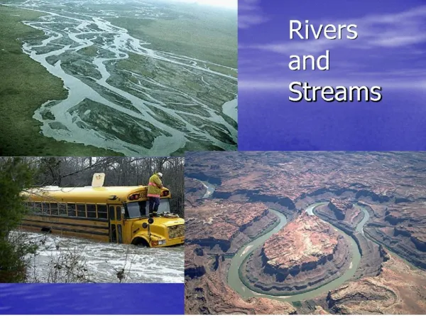
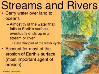
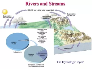
Rivers and Streams. Chapter 18. Hydrologic Cycle. Streams. A stream is a body of water that is confined in a channel and moves downhill under the influence of gravity. This definition includes all sizes of running water from a tiny trickle to the Amazon.

E N D
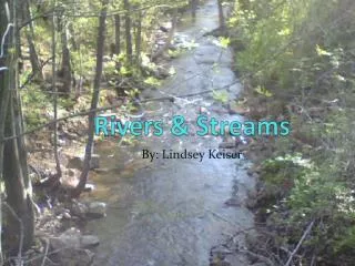
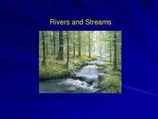
Rivers and Streams Chapter 18
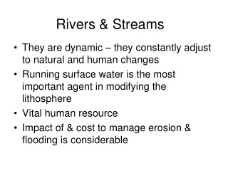
Streams • A stream is a body of water that is confined in a channel and moves downhill under the influence of gravity. • This definition includes all sizes of running water from a tiny trickle to the Amazon. • The total area drained by a given stream is its drainage basin.
The line separating one drainage basin from another is a drainage divide. The Continental Divide separates drainage basins of rivers that flow to the Atlantic and Gulf of Mexico from those flowing to the Pacific and Gulf of Cortez (Gulf of California). Drainage Basins and Divides
Colorado Rivers Colorado Drainage Basins N. Platte S. Platte Steamboat Boulder Leadville Pueblo Arkansas Alamosa Durango Colorado RioGrande
Water falling on Boulder goes down which river system? A. Colorado River to Gulf of California B. North Platte to Missouri River to Mississippi River to Gulf of Mexico at New Orleans C. South Platte to Missouri River to Mississippi River to Gulf of Mexico at New Orleans D. Arkansas River to Mississippi River to Gulf of Mexico at New Orleans E. Rio Grande To Gulf of Mexico at Brownsville, TX Clicker Question
Water falling on Boulder goes down which river system? A. Colorado River to Gulf of California B. North Platte to Missouri River to Mississippi River to Gulf of Mexico at New Orleans C. South Platte to Missouri River to Mississippi River to Gulf of Mexico at New Orleans C. Arkansas River to Mississippi River to Gulf of Mexico at New Orleans D. Rio Grande To Gulf of Mexico at Brownsville, TX Clicker Question
Water falling on Pueblo goes down which river system? A. Colorado River to Gulf of California B. North Platte to Missouri River to Mississippi River to Gulf of Mexico at New Orleans C. South Platte to Missouri River to Mississippi River to Gulf of Mexico at New Orleans D. Arkansas River to Mississippi River to Gulf of Mexico at New Orleans E. Rio Grande To Gulf of Mexico at Brownsville, TX Clicker Question
Water falling on Pueblo goes down which river system? A. Colorado River to Gulf of California B. North Platte to Missouri River to Mississippi River to Gulf of Mexico at New Orleans C. South Platte to Missouri River to Mississippi River to Gulf of Mexico at New Orleans D. Arkansas River to Mississippi River to Gulf of Mexico at New Orleans E. Rio Grande To Gulf of Mexico at Brownsville, TX Clicker Question
Water falling on Alamosa goes down which river system? A. Colorado River to Gulf of California B. North Platte to Missouri River to Mississippi River to Gulf of Mexico at New Orleans C. South Platte to Missouri River to Mississippi River to Gulf of Mexico at New Orleans D. Arkansas River to Mississippi River to Gulf of Mexico at New Orleans E. Rio Grande To Gulf of Mexico at Brownsville, TX Clicker Question
Water falling on Alamosa goes down which river system? A. Colorado River to Gulf of California B. North Platte to Missouri River to Mississippi River to Gulf of Mexico at New Orleans C. South Platte to Missouri River to Mississippi River to Gulf of Mexico at New Orleans D. Arkansas River to Mississippi River to Gulf of Mexico at New Orleans E. Rio Grande To Gulf of Mexico at Brownsville, TX Clicker Question
Snow melting at Leadville goes down which river system? A. Colorado River to Gulf of California B. North Platte to Missouri River to Mississippi River to Gulf of Mexico at New Orleans C. South Platte to Missouri River to Mississippi River to Gulf of Mexico at New Orleans D. Arkansas River to Mississippi River to Gulf of Mexico at New Orleans E. Rio Grande To Gulf of Mexico at Brownsville, TX Clicker Question
Snow melting at Leadville goes down which river system? A. Colorado River to Gulf of California B. North Platte to Missouri River to Mississippi River to Gulf of Mexico at New Orleans C. South Platte to Missouri River to Mississippi River to Gulf of Mexico at New Orleans D. Arkansas River to Mississippi River to Gulf of Mexico at New Orleans E. Rio Grande To Gulf of Mexico at Brownsville, TX Clicker Question
Snow melting at Breckenridge goes down which river system? A. Blue River to Colorado River to Gulf of California B. North Platte to Missouri River to Mississippi River to Gulf of Mexico at New Orleans C. South Platte to Missouri River to Mississippi River to Gulf of Mexico at New Orleans D. Arkansas River to Mississippi River to Gulf of Mexico at New Orleans E. Rio Grande To Gulf of Mexico at Brownsville, TX Clicker Question
Snow melting at Breckenridge goes down which river system? A. Blue River to Colorado River to Gulf of California B. North Platte to Missouri River to Mississippi River to Gulf of Mexico at New Orleans C. South Platte to Missouri River to Mississippi River to Gulf of Mexico at New Orleans D. Arkansas River to Mississippi River to Gulf of Mexico at New Orleans E. Rio Grande To Gulf of Mexico at Brownsville, TX Clicker Question
Snow melting at Steamboat Springs goes down which river system? A. Blue River to Colorado River to Gulf of California B. North Platte to Missouri River to Mississippi River to Gulf of Mexico at New Orleans C. Yampa River to Green River to Colorado River to Gulf of California D. Arkansas River to Mississippi River to Gulf of Mexico at New Orleans E. Rio Grande To Gulf of Mexico at Brownsville, TX Clicker Question
Snow melting at Steamboat Springs goes down which river system? A. Blue River to Colorado River to Gulf of California B. North Platte to Missouri River to Mississippi River to Gulf of Mexico at New Orleans C. Yampa River to Green River to Colorado River to Gulf of California D. Arkansas River to Mississippi River to Gulf of Mexico at New Orleans E. Rio Grande To Gulf of Mexico at Brownsville, TX Clicker Question
Snow melting at Purgatory (Durango) goes down which river system? A. Blue River to Colorado River to Gulf of California B. Animas River to San Juan River to Colorado River to Gulf of California C. Yampa River to Green River to Colorado River to Gulf of California D. Arkansas River to Mississippi River to Gulf of Mexico at New Orleans E. Rio Grande To Gulf of Mexico at Brownsville, TX Clicker Question
Snow melting at Purgatory (Durango) goes down which river system? A. Blue River to Colorado River to Gulf of California B. Animas River to San Juan River to Colorado River to Gulf of California C. Yampa River to Green River to Colorado River to Gulf of California D. Arkansas River to Mississippi River to Gulf of Mexico at New Orleans E. Rio Grande To Gulf of Mexico at Brownsville, TX Clicker Question
Colorado Drainage Basins Steamboat Boulder Leadville Pueblo Alamosa Durango
Links • Colorado River Basin • www.cbrfc.noaa.gov • Colorado River Data • waterdata.usgs.gov/co/nwis/rt • Colorado Water Law • http://www.waterinfo.org/colorado-water/colorado-water-rights
Colorado River Compacts, 1922, 1948 • Divides flow above and below Lee’s Ferry (below Lake Powell) • Upper Basin (“50%”): • Colorado(52%), Wyoming(14%), Utah(23%), New Mexico (11%) • Lower Basin (50%) • California, Arizona, Nevada • Upper Basin states have never used their allocation.
Water Law • Land owners do not own the water. • Prior users have precedent. • You may not restrict flow to deprive prior users downstream.
Floods • Flash floods can occur in a matter of hours as a result of a single storm. • Flash floods are most likely in areas of high gradients. • Annual floods result from snowmelt or annual rain patterns (monsoons).
Gradient • Gradient is the drop per mile (km). • Boulder Creek drops from 8000ft at Nederland to 5600’ in Boulder and has a gradient of 160 ft/mi (~30 m/km). • The Colorado River through Grand Canyon has a gradient of about 10 ft/mi (~2 m/km) • The lower Mississippi has a gradient of less than 0.5 ft/mi (~0.1 m/km). • Gradients usually decrease downstream.
Stream Velocity • Velocity is controlled by both gradient and channel size. • Steep gradients cause high velocities • Constricted channels cause high velocities.
Discharge • Discharge is the total flow in ft3/s (cfs) or m3/s. • 1 m3/s = ~35 ft3/s (cfs). • In a section of stream with no tributaries, the discharge is constant while the velocity and channel size may vary along the bed.
Discharge • Boulder Creek is typically 10-25 cfs, but may be 500 cfs or greater in May and June. • The Colorado at Grand Junction is typically 2000 cfs, but may exceed 30,000 in May and June. • The lower Mississippi is typically 250,000 cfs but exceeded 3 million cfs in 1993 flood.
Load • The loadis the amount of material transported by a stream. • Dissolved load is the material in solution. • Suspended load is the material in suspension. • Bed load is the material on the bed • Saltation load is the material bouncing along the bottom. • Traction load is the material dragged along the bottom.
Deposition and Erosion • The amount of bed load and suspended load vary with velocity. • Where a stream widens and slows, it deposits material. • Where a stream narrows and quickens, it erodes material.
Deposition, Erosion, and Valley Profiles • Actively eroding streams valleys have a charac-teristic V-shape (no flood plain). • Actively depositing stream valleys have flat bottoms (flood plain).
Bars • Bars are material deposited by streams. • A point bar is a bar on the side of a stream. • A channel bar is a bar in the middle of a stream • A braided stream has many channels bars. • The presence of bars indicates that the steam is depositing.
Flood Plain (Yampa) depositional
Flood Plain (Rhône) depositional