Download
1 / 29
310 likes | 537 Views
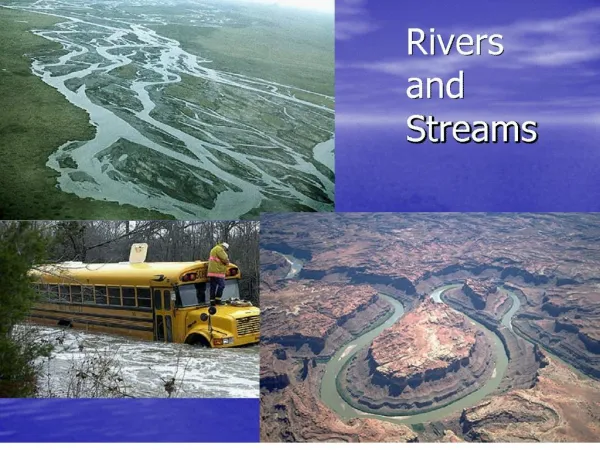
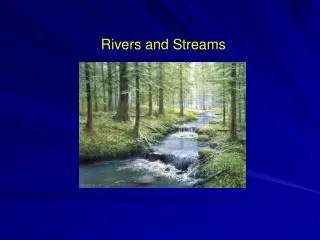
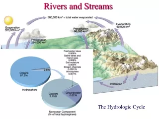
Streams and Rivers. Of all the agents of erosion, rivers are the most important, because they are the most common and widespread - virtually the entire land surface consists of a mosaic of drainage basins, containing channel networks.

E N D
Streams and Rivers. Of all the agents of erosion, rivers are the most important, because they are the most common and widespread - virtually the entire land surface consists of a mosaic of drainage basins, containing channel networks. Harry Williams, Earth Science
A drainage basin is an area that drains into a channel network, delimited by a DRAINAGE DIVIDE. Rivers erode landscapes by carrying away sediment supplied by mass wasting or eroded from slopes by water running over the surface. This causes SHEETFLOW, RILLS and GULLIES. Chris 14.4 Harry Williams, Earth Science
Rills formed from concentrated sheetflow (left); further surface flow concentration results in gullies (below). Cultivation of the field promoted surface runoff Harry Williams, Earth Science
Sediment Transport Once the water enters the channel system, it becomes concentrated and its ability to transport sediment increases. Sediment is supplied from surrounding hill slopes and/or erosion of the stream’s own banks and bed. Scour and fill. Harry Williams, Earth Science
The amount of sediment transported depends mainly on the volume of flow; this is of course related to the size of the drainage basin and will fluctuate according to inputs of precipitation. The volume of streamflow, or discharge, is measured in cubic meters (or feet) per second. A graph showing the fluctuation in discharge through time is a HYDROGRAPH. Harry Williams, Earth Science
The largest particle transported depends on the velocity of flow; the greater the velocity the more turbulent the flow becomes and the greater the lift forces; generally speaking, higher velocities are found at greater discharges and on steeper slopes. Sediment is entrained at its entrainment velocity and then transported until the velocity falls below its settling velocity, when deposition occurs - these vary according to size (weight) of sediment. Flow width, depth & velocity all increase with discharge, which increases downstream or following rain. Harry Williams, Earth Science
MODES OF SEDIMENT TRANSPORT Generally, 3 main sediment transport modes are recognized: 1. Solution load - dissolved rock carried in the flow. 2. Suspended load - finer sediment (usually clay and silt) suspended by turbulence in the flow (does not contact bed). 3. Bed load - coarser sediment (sand + gravel) that slides, rolls or skips along the stream bed. Harry Williams, Earth Science
Example: Mississippi Sediment Loads 1. SOLUTION (200 million tons/year) 2. SUSPENSION (500 million tons/year) 3. BED LOAD (50 million tons/year) Harry Williams, Earth Science
If the river slows down, for example as its gradient decreases downstream, or by entering the sea, then DEPOSITION occurs forming an ALLUVIAL DEPOSIT (Alluvium = river sediment). The photo here is a special case of alluvial deposition - a braided river. This river drains meltwater from glaciers and is choked with sediment that it can’t transport - multiple alluvial bars result. Harry Williams, Earth Science
River Valleys Generally speaking, it is true that river valleys in upper reaches tend to be narrow and steep, while in lower reaches valleys are wider and have more gentle slopes. The steeper slopes in upper reaches promote vertical and headward erosion, rather than lateral erosion. Harry Williams, Earth Science
In lower reaches, 2 important changes usually occur - the river becomes an alluvial channel (begins to flow through its own alluvium); and the channel has a greater tendency to erode laterally, leading to a wider, flat bottomed valley, filled with a layer of alluvium. Lower reaches Upper reaches Harry Williams, Earth Science
Most rivers are MEANDERING - for the most part a single channel that twists from side to side across the valley floor. Meandering rivers also have the ability to migrate from side to side and so cause lateral erosion of the valley walls. Harry Williams, Earth Science
Since flow is faster around the outside of a bend, meanders tend to shift sideways by eroding their outer bank (higher flow > entrainment) forming a cutbank and at the same time depositing sediment on their inner bank forming point bars (lower flow -> deposition). Harry Williams, Earth Science
The resulting plain is the FLOODPLAIN (because it is covered by floods). Floodplains are built from point bar deposits and flood deposits. Bedrock Harry Williams, Earth Science
NATURAL LEVEES - during floods, as the flow overflows the channel and enters the floodplain, it slows down and much of the sediment load (especially coarser, heavier sediment) is deposited on the channel banks; this forms ridges running parallel to the channel. Harry Williams, Earth Science
There are also artificial levees, built to hold back flood waters - although they can fail to do so. A levee breaks in the 1993 midwest floods (Monroe county, Illinois). Harry Williams, Earth Science
OXBOW LAKES - sometimes meanders tighten and form cutoffs; the abandoned meander forms an oxbow lake. These lakes eventually fill with sediment/vegetation, becoming meander scars. A recent cutoff and the beginning of an oxbow lake. Harry Williams, Earth Science
Case study: Denton Creek. Denton Creek drains portions of Montague, Wise and Denton counties in north-central Texas. Clastic sediment sources in the drainage basin include rills, gullies and channel bank and bed erosion. Sediment eroded from the drainage basin is deposited into Grapevine Lake which was created in 1952 by damming Denton Creek. Harry Williams, Earth Science
Drainage basin of Denton Creek (bold black line). Numbers 1-7 refer to field trip sites described below. Blue dashed line separates sandstone bedrock underlying the northern portion of the drainage basin from limestone bedrocks underlying the southern portion. Yellow and orange colors indicate stream floodplain deposits. Harry Williams, Earth Science
Site 1. Gullies and Rills on a Sandstone Hillside. The combination of heavy rain (for example during spring thunderstorms) and sandy ground with low permeability causes surface run-off and erosion in the northern portion of the drainage basin. The erosion creates large gullies and smaller rills. Harry Williams, Earth Science
Sites 2 & 3. Stream Bank and Bed Erosion in an area of Limestone Bedrock. Limestone bedrocks in the drainage basin produce dark clayey soils. The steep banks of small streams at sites 2 & 3 are evidence of bank erosion. Harry Williams, Earth Science
Site 4. Large Gullies on Sandstone Bedrock. Some gullies have grown particularly large in the northern portion of the drainage basin. In some cases multiple gullies form branches of large system of gullies. Gully system Single branch Harry Williams, Earth Science
Site 5. Denton Creek on Sandstone Bedrock. The small streams, rills and gullies all feed into Denton Creek - the main stream of the drainage basin. The channel has steep sandy banks and a flat sandy bed. The steep banks are evidence of ongoing bank erosion (during high stream flows). The flat grassy area in the distance is the creek's floodplain, constructed from sandy stream sediment (alluvium) eroded from upstream (including the gullied area at site 4). This floodplain is one of the areas shown in yellow on Fig. 1. Harry Williams, Earth Science
Site 6. Denton Creek on Limestone Bedrock. Although Denton Creek is underlain by limestone bedrock at site 6, the channel still has steep sandy banks and a flat sandy bed because it is an alluvial channel - the creek runs through its own deposits of sand transported from the northern portion of the drainage basin. Harry Williams, Earth Science
A small earthflow caused by recent heavy rain on the bank of the creek at site 6. This, and the fallen tree just above the earthflow, is evidence of ongoing bank erosion. Harry Williams, Earth Science
Denton Creek at the head of Grapevine Lake appears much the same as in other parts of the drainage basin - steep sandy banks and a flat sandy bed (Fig. 12). As at site 6, the creek is running through its own deposits of sandy sediment. Harry Williams, Earth Science