Download
1 / 54
540 likes | 687 Views
Coastal and Inland Planning for Sustainable Tourism: Information Needs and Gaps. Coastal and Inland Planning???. The entire country of Barbados constitutes a coastal zone

E N D
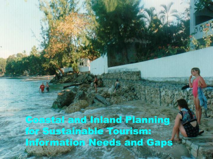
Coastal and Inland Planning for Sustainable Tourism: Information Needs and Gaps
Coastal and Inland Planning??? • The entire country of Barbados constitutes a coastal zone • Observing requirements for inland development can be discussed in the context of groundwater zoning, flooding and watershed management (CIMH)
Sustainable Tourism?? • Caribbean Tourism is coastal • Is it possible to achieve “sustainable coastal tourism?” • A review of countries with coastal tourism worldwide, but focused on SIDS – bleak picture. WHY?
Challenges to Caribbean Tourism as an Industry • Economic and financial crisis • Food and energy crisis • Negative climate change impacts • More intense and frequent natural disasters • All coastal hazards affect tourism
Coastal and Inland Tourism Development Planning and Control – The Government Town Planning Act and NPDP ICZM and MPC Act, CZM Policy, Plan • Specific land use areas for tourism • Sensitive areas for visits by tourists • Control of development pressures on natural assets that support and protect tourism • Control of self-destructive actions in tourism development
Coastal Tourism Development Planning and Control – The Developer • Location of tourism infrastructure for maximum occupancy and revenue • Health of nearby tourist assets • Safety and security of Guests
Limited Interest Issues - Developer • Location of infrastructure to prevent • High water level impacts from hazards • Coastal erosion • Protection of the natural lines of defense • Control of discharges • Carrying capacity
Natural Assets Valued by Caribbean Tourism Sector • Beaches, beaches, beaches!!! • Clean nearshore swimming areas • Healthy barrier and fringing coral reefs for dive tourism • Mature trees and coastal vegetation separate from sunbathing areas!!!
SIDS Consultation Grenada on MSI Implementation “The limited capacities to systematically collect, analyze and apply data and indicators has hampered informed decision-making, effective monitoring and evaluation of the implementation of the Mauritius Strategy”
A Case for ObservingNetworks for Caribbean Coastal Tourism • High resolution bathymetry and coastal topography • Water levels • Wind and other weather parameters • Nearshore wave transformations -models • Beach profile observations • Ecosystem observations • Water quality and discharge observations
Barbados Coastal Planning System • Definition of the coastal zone management area and sub-areas • Coastal Zone Management Plan and Policy and Programme • Protection of the five natural lines of defense • Well-designed shoreline stabilization programmes where policies fail or changes in ocean systems are faster than policy
Coastal Zone Management Area Coastal Zone Management Area
Data requirements for CZMA • Currents, sediment transport models • LIDAR Bathymetry • Digital elevation models for the first five meters above the zero elevation
Coastal Zone Management Plan • Barbados Policy Framework • Management Plan for the • Caribbean Coast • Atlantic Coast
Sub-Areas or Cells • Description of the coast • Current status of economic sectors • Management requirements for the area (setbacks, protected areas, water quality etc) • Roles of different agencies • Community participation
How does the Planning Process work? • Town and Country Planning application to CZMU • Consult the Plan • Conduct site assessment • Internal Roundtable (Engineering, Planning, Marine Research, Hazards) • Final CZMU recommendation • Final approval of all coastal development lies with the Minister
Coastal Planning • Check the storm surge inundation lines • Enforcement of setbacks • Windows to the sea • Beach access (lateral and perpendicular) • Control of discharges • Protection of vegetation and other buffers • Protection of vulnerable sites
Observations for Planning • Coastal Engineering observations – tides, currents, waves, marine weather and climate, erosion rates, sediment transport, storm • Hazard observations • Marine Research Observations – water quality, coral diseases and bleaching,
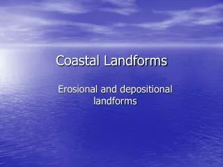
Natural Buffers to High Water Level and Subsequent Inundation
Coastal Hazards • Marine and coastal ecosystems act as natural buffers • Loss of natural buffers turns natural events into • human disasters • “At least 70-90% of the energy from wind generated • waves is absorbed depending on how healthy these • ecosystems are and their physical and ecological • characteristics” (UNESCO State of the World’s • Oceans Report)
Natural Buffers • Mangroves • Beaches and Dunes • Sea grasses and coral rubble • Fringing reefs • Bank reefs
The Message • The wider the beach, the greater is the protection from inundation of important infrastructure and • Wide beaches can lose some of their width and still function to reduce the energy associated with high waves, because of slope and friction • WHY DO TOURISM DEVELOPERS WANT TO BUILD ON THE BEACH?????
What questions should developers be asking? • Where are the sediment sources that feed our beaches; how protected? • What are the processes that widen or narrow a beach? • What human activities narrow or widen a beach in my country?
CORAL REEFS - NATURAL BR EAKWATERS • Allow waves to dissipate 70-90% of their destructive energy offshore • Area covered by: • Bank reefs – 15.9 km • Fringing reefs – 1.53 km • Approx. 80% fringing reefs lost • Bank reefs decreased from 37.3% - 23.2% over a decade
Mangroves - Natural Shock Absorbers • Buffers • Limit floodwater inundation • Mangroves covered almost our entire coastline • Destroyed approx. 95% • Primarily via coastal construction Replaced by
RUBBLE, SEA GRASS • Not much help in a major disaster… BUT • can offer some protection against wave action
When Policies Fail or Ocean Changes outstrip Policies? • Emergency or long-term works to reduce wave energy • Properly designed and modeled coastal engineering • Make the solution as soft and unobtrusive as possible
Criteria for Execution • Planning and legislative controls have failed • The services offered by natural buffers are limited • Natural resilience of the beach is compromised • Significant economic installations are vulnerable
Coastal Engineering • Numerical modeling to predict the behavior of the coast under varying oceanographic conditions • Physical modeling of complex coastal solutions • Building of structures within the coastal zone of Barbados to stabilize the shoreline, control erosion, and protect infrastructure
Barbados Project - Nearshore Wave Modelling • 143 simulations were carried out using M21 NSW • A Two-Stage Modelling Process • Coarse Grids (ΔX=20m ΔY=100m) • Nested Grids (ΔX=4m ΔY=20m) Plan View of Barbados
Select Preferred Concept Final Design Select “Preferred” Concepts & Focus Final Design Efforts on Preferred Concepts B A C Design Process
Final Design Efforts Physical Modeling Construction