Download
1 / 42
420 likes | 642 Views
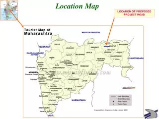
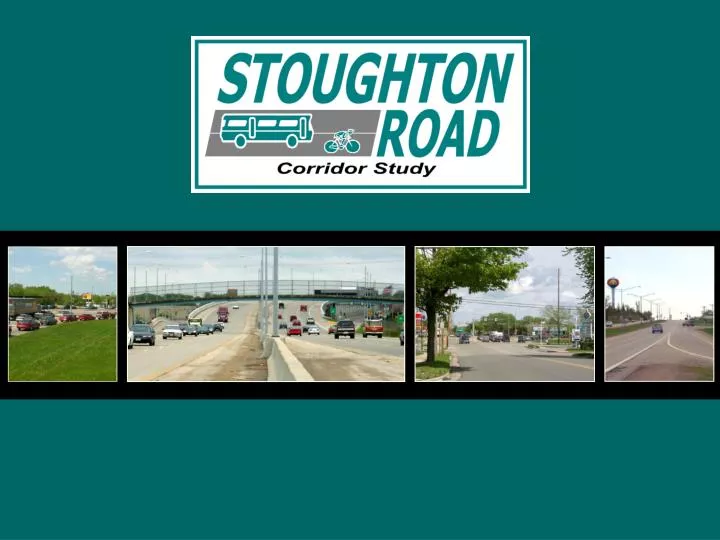
Project Location. Project ID 5410-05-00 Stoughton Road ( US 51) Corridor Study Voges Road to WIS 19 Dane County. Study Background – Needs Assessment. Initiated in 2001 to identify corridor deficiencies and needs Significant growth anticipated on Madison’s East Side

E N D
Project Location Project ID 5410-05-00 Stoughton Road ( US 51) Corridor Study Voges Road to WIS 19 Dane County
Study Background – Needs Assessment • Initiated in 2001 to identify corridor deficiencies and needs • Significant growth anticipated on Madison’s East Side • Several high crash locations along corridor • Significant gaps in bicycle and pedestrian facilities along corridor • Completed in June 2003
Study Background – Safety and Operations Study • Initiated in 2004 to develop solutions to issues identified in the Needs Assessment • Identified full range of alternatives to: • Improve Safety • Reduce Congestion • Improve bike and pedestrian facilities • Reduce diversion to neighborhood streets • Support economic development
Study Background – Safety and Operations Study • Alternative Concepts – 3 levels of improvements examined • Alt A – Transportation System Management (TSM) • Adds capacity to intersections and improves mobility without additional traffic lanes or interchanges. • Alt B – Enhanced Expressway • Adds interchanges at major intersections along corridor • Alt C – Freeway Conversion • Provides a free flow movement for traffic through the corridor
Study Background – Safety and Operations Study • Public Involvement Summary • Committees • Technical Advisory Committee • Policy Advisory Committee • Stoughton Road Revitalization Project (SRRP) • Focus Group Workshops • Business Interviews • Public Involvement Workshop – May 2004 • Local Business Workshop – November 2006 • Public Information Meetings – March 2006 & October 2007
Where We Are Today • Transportation Projects Commission (TPC) approved the corridor for an Environmental Impact Statement (EIS) study in November 2011 as part of the Majors program • The purpose of the study is to: • Improve Safety • Reduce congestion/investigate capacity expansion • Improve bike and pedestrian facilities • Reduce diversion to neighborhood streets • Support economic development
EIS Process Gather data Determine and evaluate alternatives Document impacts Gather public input Select preferred alternative FHWA must approve EIS Where We Are Today
Where We Are Today • Build off of the Safety and Operations Study • Reacquaint public with what has been done to date • Update traffic modeling with latest land use/traffic count data • Take a fresh look at the alternatives – refine as needed • Update impacts and cost estimates for each alternative • Select a preferred alternative – Could be a combination of Alternatives A, B, or C
Public Involvement Approach • Initial information blitz • Media contacts • Project newsletters • Focus group workshops • Local official meetings • Social Media – Project website, Email distribution list • Public information meetings – Summer 2012 & January 2013 • Public hearing of draft EIS – July 2013
Alternative A – Transportation System Management (TSM) • At-Grade intersections remain • Broadway relocated • Frontage roads at Pflaum / Buckeye relocated • Connect Anderson Street to East Washington Avenue
Alternative A (TSM) - Beltline through Broadway • Broadway overpass • Jughandle intersections located farther north on US 51 • Bicycle Pedestrian Path connection from Broadway to the north
Alt. B (Enhanced Expressway) - Beltline to Broadway • Free-flow ramps to/from west leg of Beltline • Ramp intersections and Broadway stay in place • Bicycle Pedestrian Path connection from Broadway to the north
Alt. C (Freeway) - Beltline to Broadway • Free-flow ramps to/from west leg of Beltline • Free flow for through movements on Stoughton Rd via overpass • Ramp intersections and Broadway stay in place • Bicycle Pedestrian Path connection from Broadway to the north
Alternative A (TSM) - Pflaum to Buckeye Area Frontage roads moved away from intersections Turn lanes extended/added Bicycle path connection to east frontage road from Broadway Bicycle and Pedestrian crossing structures at Tompkins Dr. and Helgeson Dr.
Alt. B (Enhanced Expressway) – Pflaum Road Area • Bike/pedestrian connection across on Tompkins Drive. • Split diamond interchange – south ramps at Pflaum, north ramps at Buckeye • One-way frontage roads and ‘Texas u-turns’ • Connection across at Helgeson • Southbound on-ramp south of Helgeson Frontage roads upgraded for increased traffic volumes
Alt. B (Enhanced Expressway) – Buckeye Road Area • Split diamond interchange - north ramps at Buckeye • One-way frontage roads and ‘Texas u-turns’ • Connection across at Helgeson Drive • Northbound on-ramp south of Buckeye Road • Move Blossom/ Buckeye Intersection Frontage roads upgraded for increased traffic volumes
Alt. C (Freeway) – Pflaum & Buckeye Area • Bike/pedestrian connection across on Tompkins Drive & Helgeson Drive • Full diamond interchanges at both Pflaum and Buckeye • Relocate frontage roads • Move Blossom/ Buckeye Intersection
Alternative A (TSM) – East Washington Avenue • Reconstruct Stoughton Road to improve intersection angle and increase turn-lane lengths • Connect Anderson St. to E. Wash. at Lien Rd. • Connect Macarthur Rd. to Mendota St. • Add/extend turn lanes on Anderson Street. • Bike and pedestrian overpasses at Larson Court and E. Wash. intersection
Alt. B (Enhanced Expressway) – East Washington • Reconstruct East Washington Avenue intersection to a single point urban interchange • Anderson Street overpass • Extend Anderson Street to the east; connect to E. Wash. at Lien Road • Bike/ped overpasses at intersection and Larson Ct. • Add frontage road south from Anderson Street to provide access to properties east of Stoughton Road between East Washington Avenue and Anderson Street
Alt. C (Freeway) – East Washington Avenue • Reconstruct East Washington Avenue intersection to a single point urban interchange • Anderson Street overpass • Extend Anderson Street to the east; connect to E. Wash. at Lien Road • Bike/ped overpasses at intersection and Larson Ct. • Add frontage road south from Anderson Street to provide access to properties east of Stoughton Road between East Washington Avenue and Anderson Street
Other Estimated Impacts * Subject to result of 4(f) evaluation.
Estimated Project Costs • Alternative A • $135 - $155 Million • Alternative B • $225 - $245 Million • Alternative C • $355 - $375 Million Includes construction and real estate estimated costs (2009 $)
Currently no funding is allocated for improvements as a whole Once the EIS is completed WisDOT can forward the preferred alternative to the Transportation Projects Commission for Majors funding for design and construction Funding and Scheduling
Study Schedule • Begin Study – June 2012 • Public information meeting – August 2012, January 2013, & August 2013 • Draft EIS adopted and files with EPA – April 2013 • Public hearing on draft EIS – May 2013 • Final EIS adopted and filed with EPA – December 2013 • Draft Record of Decision (ROD) – March 2014 • Final ROD issued - May 2014
Alternative A (TSM) – Cottage Grove Rd. Area Extend acceleration and deceleration lanes on northbound Stoughton Road ramps. Extend deceleration lane on southbound Stoughton Road ramps. Reconstruct structures.
Alternative A (TSM) – Milwaukee St. to STH 30 • Restrict NB Milwaukee Street entrance ramp traffic from making left turns at WIS 30. Reconstruct EB off-ramp to eliminate free-flow right-turn and add triple left turn lanes. Reconstruct WB off-ramp to add triple left turn lanes. Dual-left turn lanes on Lexington and Commercial. Bike and pedestrian connection across WIS 30 at Walsh Road
Alt. B (Enhanced Expressway) – Cottage Grove Rd. to STH 30 • Same as Alternative A. • Extend acceleration lane on NB Cottage Grove Road ramp and deceleration lanes on NB and SB ramps. • Reconstruct Cottage Grove Road structures. • Restrict NB left turns at WIS 30. • Reconstruct WIS 30 EB off-ramp to eliminate free-flow right-turn and add triple left turn lanes. • Reconstruct WIS 30 WB off-ramp to add triple left turn lanes. • Bike and pedestrian connection across WIS 30 at Walsh Rd.
Alt. C (Freeway) – Cottage Grove Rd. to STH 30 • Extend acceleration lane on NB Cottage Grove Road ramp and deceleration lanes on NB and SB ramps. • Reconstruct Cottage Grove Road structures. • Reconstruct interchange ramps to meet higher design speed.
Alt. B (Enhanced Expressway) – Railroad Crossing through Lexington/Commercial Interchange over Lexington/Commercial Avenue and Railroad with jughandle-type loop ramps.
Alt. C (Freeway) – STH 30 through Lexington/Commercial • Three-level interchange/overpass of WIS 30. • Free flow for through movements on Stoughton Road via overpass from Milwaukee Street through Lexington Avenue/Commercial Avenue, including railroad crossing. • Bike and pedestrian connection across WIS 30 at Walsh Road. across Stoughton Rd. at Larson Ct.
Alternative A (TSM) – E. Wash. to STH 19 Pierstorff Street –Bike/pedestrian connection across Stoughton Rd, off-road path to Anderson Road. Hoepker Road - Signalize intersection, and extend turn lanes. CTH CV / Anderson Road – Bike/ped connection across IH 39/90/94. IH 39/90/94 - Remove truck stop accesses from ramps. Extend acceleration and deceleration lanes for IH 39/90/94 ramps to/from US 51.
Alt. B (Enhanced Expressway) – Kinsman Blvd. through Reider Road Kinsman Blvd. remains signalized intersection • Additional through lane NB and SB on Stoughton Road. • Double-left turn lanes on Stoughton Road Pierstorff Street remains right-in/out • Bike and pedestrian connection across Stoughton Road, off-road path to Anderson Road. • No access from driveway (Leo Circle) on the east side of Stoughton Road. Rieder Road • Restricted to right-turn only (remove southbound Stoughton Road left-turns). • Left-turns have access from Kinsman Boulevard to Bartillon Drive connection.
Alt. C (Freeway) – Kinsman Blvd. through Pierstorff Street • Interchange at Kinsman Boulevard. • Pierstorff Street overpass. • Bike and pedestrian off-road path to Anderson Road.
Alt. C (Freeway) – Rieder Road and Amelia Earhart Drive • Split interchange between Rieder and Amelia Earhart. • NB Stoughton Road exits at Rieder, enters at Amelia Earhart. • SB Stoughton Road exits and enters at Amelia Earhart.
Alt. B (Enhanced Expressway) – Hanson Road / Hoepker Road / CTH CV • Hanson Road movements right in/out only. • Tight urban diamond interchange at Hoepker Road. • Hoepker Road becomes CTH CV west of the interchange. • Local road connections from Hoepker Rd. to Hanson Rd., old CTH CV, and Anderson Rd. • CTH CV / Anderson Road overpass. • Bike and pedestrian connection across IH 39/90/94 at Anderson Road.
Alt. C (Freeway) – Hanson Road / Hoepker Road / CTH CV • Hanson Road cul de sac. • Tight urban diamond interchange at Hoepker Road. • Hoepker Road becomes CTH CV west of the interchange. • Local road connections from Hoepker Rd. to Hanson Rd., old CTH CV, and Anderson Rd. • CTH CV / Anderson Road overpass. • Bike/ped connection across IH 39/90/94 at Anderson Road.
Alt. B (Enhanced Expressway) – IH 39/90/94 • Remove truck stop accesses from ramps. • Token Creek Park Road/ Metro Drive intersection reconfigured to left-in from NB Stoughton Road, right-in/out SB Stoughton Road. • Extend acceleration and deceleration lanes for IH 39/90/94 ramps to/from US 51.
Alt. C (Freeway) – IH 39/90/94 • Remove truck stop accesses from ramps. • Token Creek Park Road / Metro access from WIS 19. • Extend acceleration and deceleration lanes for IH 39/90/94 ramps to/from US 51. • Metro Drive overpass IH 39/90/94 to connect to Daentl Road. • Convert WB IH 39/90/94 to cloverleaf. • Remove EB IH 90/94/39 left turn movement – turn at WIS 19.
Terminal Drive/Voges Road • 4-Lane Voges Road east of US 51 for approx. 1000 feet • Relocate Triangle St. & S. Dutch Mill Road access to the east