Download
1 / 48
480 likes | 636 Views
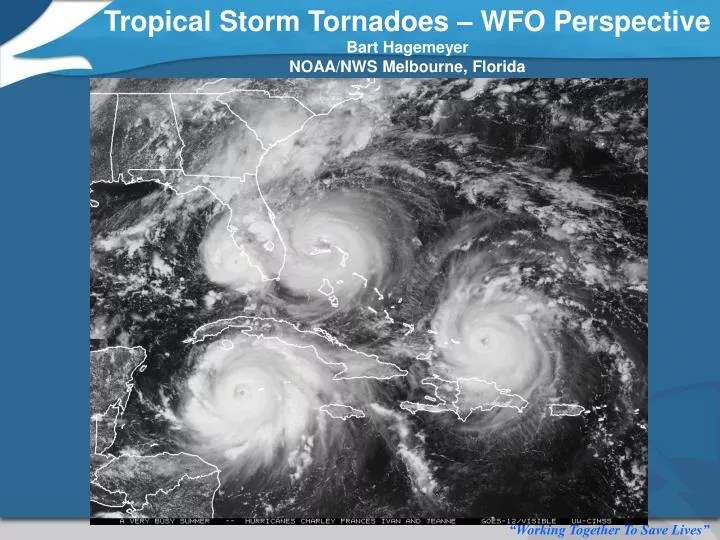
Tropical Storm Tornadoes – WFO Perspective Bart Hagemeyer NOAA/NWS Melbourne, Florida. (* Compare total of 7 direct wind-related deaths from Charley). 2004 Tornado Producing Tropical Cyclones. Bonnie – Charley – Frances – Ivan - Jeanne Record Season with 74 Florida Tornadoes

E N D
Tropical Storm Tornadoes – WFO Perspective Bart Hagemeyer NOAA/NWS Melbourne, Florida
(* Compare total of 7 direct wind-related deaths from Charley)
2004 Tornado Producing Tropical Cyclones Bonnie – Charley – Frances – Ivan - Jeanne Record Season with 74 Florida Tornadoes 54 F0, 17 F1, 3 F2
Virtually all Tropical Systems produce tornadoes
Tropical Cyclone Destructive Wind Forecast and Preparedness Challenges are: -Tornadoes Associated With Dominant Outer Rainbands in the Right Front Quadrant. -Extreme Winds of the Eyewall and Innermost Rainbands at Landfall.
Ivan Charley All Significant Tornado Cases Began Well Before Landfall
Differences in Gulf and Atlantic Pre-Storm Environment Ivan Pre-Landfall Jeanne Pre-Landfall
Hurricane Opal 10/4/95 F2 Tornado 1 Dead
Tropical Storm Gordon 11/15/94 F2 Tornado 1 Dead
The Central Characteristic of a Tropical Cyclone is not a Reliable Indicator of Tornado Potential – It is the Mesoscale Environment of the Dominant Outer Rainbands, Often 100 or More Miles Away That Determines Tornado Potential. Tornadoes are Typically the First Threat to Arrive
Hurricane Agnes June 1972 (Category 1) Tropical Cyclone Tornado Archetype
Hurricane Agnes June 1972 Deadliest Tropical Cyclone Tornado Outbreak in Florida History...28 Tornadoes in 26 hours... (2 F3, 9F2, 11 F1, 6 F0). 10 killer/injury tornadoes.
Experiences From 2004 Hurricane Season Ivan Images – Irv Watson, SOO, WFO TLH
Ivan – Agnes Clone – Missed Peninsula! 3 Killer Tornadoes - 2 F2 and 1 F1 – 6 Dead
0208 UTC 9/16/04 Blountstown Killer F2
20 Hours of Severe Weather Signatures
Note: Ivan also produced a tornado outbreak in VA and MD a day later!
Ivan Tornado Stats Summary TLH CWA POD 0.913 FAR 0.846 CSI 0.152 AVG Lead Time 11.2 Minutes Warnings in Effect for Killers (MLB also had high FAR for Charley and Frances) *includes Georgia and Alabama Tornadoes
Hurricane Charley 8/13/04 – Late Morning Classic Situation
Friday Evening 8/13/04 Primary Outer Rainband 2+ Million People EyeWall
BULLETIN - EAS ACTIVATION REQUESTED TORNADO WARNING *AT 642 PM EDT...THE NATIONAL WEATHER SERVICE HAS ISSUED A TORNADO WARNING FOR DESTRUCTIVE WINDS OVER 100 MPH AND TORNADOES IN THE EYE WALL AND INNER RAIN BANDS OF HURRICANE CHARLEY. * THE LEADING EDGE OF HURRICANE CHARLEYS DESTRUCTIVE WINDS IS EXPECTED TO MOVE INTO THE KISSIMMEE AND GREATER ORLANDO AREA BY 715 PM.
Costliest Severe Storm in Orlando area history! No Direct Lives Lost! Customers Responded And requested we issue “eyewall” warning again for Frances and Jeanne. LP1 station liked EAS
The Eyewall and innermost rainbands of landfalling hurricanes are extremely dangerous mesoscale phenomena that produce very localized devastation! Charley – Metro Orlando
BULLETIN - EAS ACTIVATION REQUESTED TORNADO WARNING NATIONAL WEATHER SERVICE MELBOURNE FL 858 PM EDT SAT SEP 25 2004 THE NATIONAL WEATHER SERVICE IN MELBOURNE HAS ISSUED A * TORNADO WARNING FOR... MARTIN COUNTY ST. LUCIE COUNTY IN EAST CENTRAL FLORIDA * UNTIL 1000 PM EDT * AT 855 PM EDT...THE NATIONAL WEATHER SERVICE HAS ISSUED A TORNADO WARNING FOR MARTIN AND ST LUCIE COUNTIES MAINLY FOR THE ONSET OF EXTREME HURRICANE WINDS AND EMBEDDED TORNADOES ASSOCIATED WITH THE INNER CORE OF HURRICANE JEANNE AS THE CENTER NEARS THE COAST. WINDS TO 100 MPH WITH GUSTS TO 120 MPH ARE EXPECTED...ALONG WITH TORNADOES.
We are not attempting to warn for the individual enhanced convective features within the eyewall – They are ephemeral and moving at 100 mph. • We are warning prior to the impact of the eyewall and/or innermost rainbands
Survey results -Jeanne One Lucky Row of Manufactured Homes – Barefoot Bay
Eyewall “Mini-swirls” And Some Not so Fortunate
Extreme Hurricane Winds • Eyewalls and innermost rainbands are dangerous mesoscale phenomena. • Damage gradient extreme, destruction localized – county scale and lower. • Historic severe weather events where they occur. • Hurricane Warnings may have been out for 24 hours or more.
Power may be out and information lacking just before the worst hits (NWR, TV Re-broadcast). • Citizens need final warning – last chance to save lives ~ 1-2 Hours. Need EAS. • Not talking about track – but impact! • WFO mission is suited for this role.
Concluding Thoughts – TC Tornadoes We Now Know a Lot About Tornadoes and Tropical Cyclones...but Major Issues Remain. There is no reason to believe that in the future, a TC tornado outbreak could not kill more people than the February 1998 Extratropical Outbreak (42). Remembering Agnes, and now Ivan, is useful as a planning metric – The outer rainband tornado archetypes – to realize what is really possible.
Forecast ability has improved significantly: Tornado Watches are put up for most tropical cyclones. Tornado Warnings must be taken seriously, but potential for false alarms can be high in some cases. In other cases tornadoes can spin up rapidly with little warning. Extended threat period with lengthy periods of inactivity followed by brief periods of strong tornadoes – hard to keep guard up that long - desensitizing risk is high. The ability to separate the typical TC tornado from the truly dangerous outbreaks is improving. High resolution models and continued research provide our best chance for improvement.
Local Analysis and Diagnostics Hurricane Charley Significant Tornado Parameter CAPE, 0-6 km Shear, 0-1 km SRH, LCL hgt (From SPC: Thompson et al., 2004)
T.S. Gabrielle September 2001 ARPS Radar Reflectivity Simulation
Concluding Thoughts – Preparedness Evacuation and Sheltering - Evacuate mobile -manufactured homes in threat area? - This could be 200 miles from landfall and 24 to 36 hours before landfall? Safe Rooms in homes built for hurricanes will perform well for about 99% of Florida Tornadoes. Shelters in manufactured home parks would be beneficial. Shelters don’t exist in most cases. But there are recent success stories: Gulfstream Harbor Manufactured Home Park – Orange Co. Florida Warning & Information Network Grant 700 Weather Radios for all residents Hardened Community Club House Comprehensive Plan
Thank You! Bart Hagemeyer bart.hagemeyer@noaa.gov