Download
1 / 30
300 likes | 306 Views
This document discusses the design and implementation of climate change adaptation measures in Guyana, with a focus on the Guyana Conservancy Adaptation Project. It provides an overview of Guyana's drainage and irrigation system, as well as the challenges and initiatives related to climate change adaptation.

E N D
SHARING EXPERIENCES IN DESIGN AND IMPLEMENTATION OF CLIMATE CHANGE ADAPTATION MEASURES Lima, Peru, 22-23, January, 2009
Guyana Conservancy Adaptation Project(Lionel Wordsworth)Chief Executive Officer,National Drainage And Irrigation AuthorityChairman, East Demerara Water Conservancy Board(Guyana)
Agenda • Country Profile • Overview of Guyana’s Drainage and Irrigation System • Climate Change and Guyana • Guyana Floods in 2005 • Initiatives towards adaptation/mitigation of climate change. • Conservancy Adaptation Project
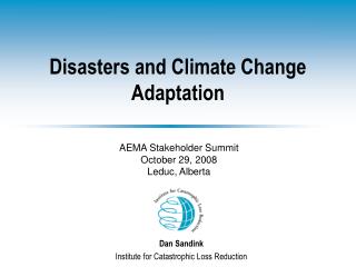
Guyana: Geographical Location GUYANA Venezuela Suriname Brazil
Country Profile • Land Mass: 83,000 Sq. Miles • Population: 750,000 • Natural Rainforest: 61,776 Sq. Miles • Guyana Economy is well endowed with: - Fertile agriculture lands; - Available fresh water; - Range of diversified mineral deposits - Rich and exclusive economic fishery zone
OVERIEW OF GUYANA’S DRAINAGE AND IRRIGATION SYSTEM • The D&I system has its origin during Guyana’s Dutch Colonial period some 200 years ago an consist of an intricate network of drainage, irrigation, sea and river defence infrastructure and this can be considered the primary foundation for the country’s economy. • Some of our main physical infrastructure along the Coast of Guyana includes 4 water conservancies, namely MMA, EDWC, BWC and Itirbisi and the water storage and transport system to facilitate the Skeldon Expansion Project, the Link Canal which is almost completed • The drainage system comprises of 136 drainage sluices along the sea coast and our main river banks. This system allow drainage by gravity tidally, and are augmented with 85 drainage pumps along the costal corridor. • The gravity drainage discharge window from low tide to mean tide is shrinking due to sea level rise.
CHALLENGES • The rapid rate of siltation of rivers and outfall channels results in decrease efficiency in gravity based drainage. • The most serious weather-related challenge affecting the agriculture sector is the management of low and high rainfall. Water is distributed to agricultural lands by a system of drainage and irrigation canals and therefore the proper functioning of these systems is one of the most important adaptation measures
Drainage Sluice Drainage Pump & Sluice Drainage Canal
Maintenance of Key Drainage and Irrigation Facilities Dredging Equipment (Maintenance of Outfall Channels) • In 2008, GOG expended 2.5 M US in maintenance of D& I Infrastructure.
CLIMATE CHANGE AND GUYANA • Guyana’s Coastal Plain is about 1.4 metres below mean high tide level and approximately 2.1 metres below the flood and water control dams inland • The Costal Plain is bordered by natural and man-made sea defences measuring 430 km long in the North and flood control dams and dykes in the South that allows for the settlement of 90% of the country's population and consists of the most fertile lands in the country OBSERVED CHANGES: • Sea- Level Rise :Guyana’s Initial National Communication in Response to its Commitments to the UNFCCC (2002) projected sea-level to rise by about 40 cm to 60 cm by the end of the twenty-first century due to Global Warming
Analysis of tide gauge records from 1951-1979 shows the trend in sea-level rise for Guyana to be in excess of 10mm/year, which implies a net change in sea-level of 0.9 feet over the 28 yr period • Sea-level rise will have significant negative socio-economic and bio-physical implications on Guyana if systems are not put in place to adopt to it • Climate change has already resulted in significant damage to the current Sea-Defence system by eroding mangrove ecosystems through increased wave activities, loss of infrastructure and salt water intrusion that result in abandonment of land.
Temperature Rise:The records in Guyana suggest an increase by 1.0°C of the mean annual temperature within the last century (TFIR, 2005). • Changes in Rainfall Patterns: Prior to 1960, annual rainfall amounts were generally above or about normal. From 1960 and onwards, there has been a tendency for below normal rainfall and an increase frequency of short duration above normal rainfall (TFIR, 2005).
GUYANA’S FLOODS IN 2005 • From the 14th to 22nd of January 2005, the coastal regions of Guyana received some 1108.2 mm or 43.6 inches of rain. The heaviest rainfall record since 1888 and resulted in the country's worst flooding. • Most of the rainfall occurred over the Coastal Plain in Guyana and the Water Conservancies, EDWC and BWC. • These areas are considered the most important natural regions in the country since 90 % of the population, as well as economic and administrative activities are concentrated. • The torrential rains and subsequent flooding resulted in severe physical damage and economic loss to the country. Extensive flooding lasted from 1 to over 3 weeks in some areas in the administrative Regions 3, 4 and 5 including the capital city, Georgetown, where over 62% (463,300) of the nation’s population reside
Flood condition in Mon Repos • The magnitude of the damage caused by the floods is estimated to be equivalent to G$92.2 billion or 59% of current GDP for the year 2004. The agriculture sector was the hardest hit with severe damage to the two principle crops, Rice and Sugar. • This event resulted in loss of 34 lives, disease outbreak, loss of crops, livestock, population displacement and infrastructural damage. Flood condition in Mahaicony Creek Flood condition in Good Hope
Georgetown, Region No. 4 Mahaica, Region No. 4 Mahaicony, Region No. 5 Flood Hit Regions, 2005
Failure of the EDWC dams in January 2005 did not occur. However significant overtopping did occur, thus compounding the flood situation . Comparison of flood levels with a crest level survey undertaken by the GLSC in 2005 suggests that 10 % of the length of the dam was overtopped [TFIR, 2005].
Initiatives towards Adaptation/Mitigation of Climate Changein D&I Sector • Conservancy Adaptation Project • Institutional Measures; Maintenance of D&I System • Introduction of more Mechanical Means of Drainage (GDRP) • New Dredging Technology • Rip Rap Designs (Flexible Wall), 9th European Development Fund • Improved Design of D&I Infrastructures (Relevant Data) • Construction Criteria
East Demerara Water Conservancy • Background of the EDWC: The EDWC was constructed over 150 years ago by damming the Lama and Maduni creeks, a number of water courses and tributaries. • The EDWC functions as a flood control structure during the rainy periods and simultaneously store water for irrigation in the dry season. • Raw water is also tapped from the EDWC, treated and supply the city with potable water. • Data on EDWC: Surface Area: 130 sq.miles Catchment Area: 200 sq.miles Length of Perimeter Dam: 45 Miles Full Storage Level: 57.5 GD Dead Storage Level: 53.5 GD
Relief Structures: Lama Relief Sluices: Discharge into Mahaica Creek Maduni Relief Sluice: Discharge into Maduni Creek Land of Canan Sluices: Discharge into Demerara River Cunia Relief Sluice: Discharge into Demerara River Friendship (Kofi) Sluice: Discharge into Demerara River • Areas Provided with Water Sugar Cane: 13,000 hectares Rice: 2,500 hectares Vegetables: 500 hectares Orchards/Coconuts: 2,000 hectares
Conservancy Adaptation Project: EDWC • Project Objective: To reduce vulnerability of catastrophic flooding in low-lying costal areas by developing technical master plan for future investment in improving and upgrading the drainage system. • Deliverables (Medium & Long Term): a) Development of a Hydraulic engineering foundation for flood control and water management. b) Recommendation on 10 key drainage projects/regime aimed at improving or upgrading the drainage system. c) Improved discharge capacity of the EDWC by 30%-35%. d) Strengthening of the GOG institutional capacity in flood control and water management.
Project Components: • Component 1- Pre-investment studies for engineering design of works ( US 2.1 m, GEF). Objective; Develop the hydrologic baseline, detailed elevation model, mapping of the local water shed characteristics and drainage regimes for future engineering interventions will be achieved through: - Detailed topographic and land use mapping - Hydrologic/hydraulic modeling of EDWC and costal lowlands - Assessment of EDWC structural integrity - Operational Capacity building within the GOG agencies - Pre-feasibility studies for costal lowlands interventions
Component 2- Investments in specific adaptation measures ( US 2.9 m, US1.7 GEF, US1.2 m from GoG). Objective; Improve the overall discharging capacity of the EDWC during rainfall and to counteract the effects of sea level rise: - 2.1 Widening of key drainage relief canals - 2.2 Improvement of Water flow system within EDWC - 2.3 Upgrading of Water control Structures - 2.4 Selected equipment purchase and installation
Lma Sluice Land of Canaan Sluice Maduni Sluice Strengthen of embankment
Component 3- Institutional Strengthening and Project Management ( US 0.1 m, GEF,). Objective; Strengthen the institutional framework of the national emergency management sector, Civil Defense Commission: - 3.1 Contingency plan for flood events - 3.2 Consolidation of flood control actors - 3.3 Monitoring and evaluation of project progress - 3.4 Project management
Expected Impact: Components 1& 3 • The development of engineering data and models, will result in the preparation of future works & bidding packages for future execution through the GOG and Donor Agencies. • Improving the government’s ability to protect over 75% of population in Guyana and its capital from flooding associated with drainage system and failure of the EDWC dam. • Development of an engineering tool to be used as a foundation for determining the environmental impacts of follow-on interventions. Expected Impact: Component 2 • Investment in specific adaptation measures; rehabilitation of relief drainage structures. • Increasing the discharging capacity (30-35%) by rehabilitating the Cunha relief channel and associated structures, less need to operate the eastern reliefs.
Lessons learned and reflected in Project Design • Loss of Information: Analytical output of CAP will be distributed to GOG agencies who will be trained in data management and analysis. • Implementation delays at procurement stage: Due to re-biding, high bid cost, too big contract package, etc. Tenders under this project is divided in 3 package. • Lack of expert firms to undertake specific service: Tender criteria developed to attract both local and international expert firms.
Conclusion: • The effects of climate change will only get worst in the years ahead especially in small developing countries such as Guyana. Therefore, it remains a priority to intensify our efforts in adaptation/mitigation measures by working with our Caribbean and international partners. In this regard, the development and implementation of CAP will seek to upgrade the functioning of the EDWC and recommend mitigation projects for implementation in highly vulnerable low costal region in Guyana to safeguard some 300,000 acres of agricultural land.
Thank you. Hope (07/01/09)