Download
1 / 18
180 likes | 305 Views
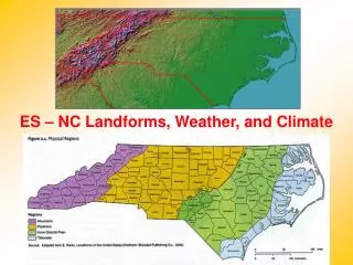
DIGIMAP 10 TH BIRTHDAY THE FUTURE OF GEO : MARINE & COASTAL Dr Mike Osborne SeaZone Solutions Ltd. CONTENTS A History of Marine Data The Creation of SeaZone HydroSpatial Marine Reference Information and SDI HydroSpatial Development Plan The Future of Marine Digimap ?.

E N D
DIGIMAP 10TH BIRTHDAY THE FUTURE OF GEO : MARINE & COASTAL Dr Mike OsborneSeaZone Solutions Ltd
CONTENTS • A History of Marine Data • The Creation of SeaZone HydroSpatial • Marine Reference Information and SDI • HydroSpatial Development Plan • The Future of Marine Digimap?
A HISTORY OF MARINE DATA Offshore Power Crown Estate Electricity CEFAS Fisheries & Aquaculture SFA EA / SEPA Water Waste Disposal Local Gov. Mineral Extraction BERR BGS CCO Oil & Gas Coastal Protection NOC Security & Communication University BODC Science & Discovery MOD Port Transportation MCA UKHO BC 3000 0 1000 1500 1800 1900 1950 2000
ALL REQUIRE ACCESS TO COMPREHENSIVE FIT FOR PURPOSE DATA AND INFORMATION
CREATION OF SEAZONE HYDROSPATIAL • UKHO ignores or archives 20+ times more data than it uses to produce navigational charts and products • In 1995 SeaZone (then Metoc) started the process of ‘unlocking’ UKHO and other authority marine data • Mission is to create an accurate comprehensive digital marine mapping which is: • - Based on source data from Responsible Authorities- Application neutral and multi purpose- Comparable to digital land mapping- Suitable as reference information for SDI development
NAUTICAL CHARTING VS HYDROSPATIAL • Charting is designed solely for navigation • Charts are individually compiled - varying in scale and projection with inconsistent & discontinuous content • Charts depict an abstract safety bias view of the real-world e.g. water depths are generalised and deliberately conservative (known as ‘shoal bias’) • No or very little interoperability with other datasets • Electronic charting is a copy of the paper equivalent and is intended for display only (in ECDIS) • Content unsuitable as input to GI service creation without change in approach and major re-engineering
THE CHALLENGE – SOURCE FROM PRODUCT Source: GB ENC Source: SeaZone HydroSpatial For many feature types the paper chart is the definitive source
SEAZONE HYDROSPATIAL • Launched in 2005, only commercial off the shelf marine map of its kind • Established user base across public and private sectors including ‘Marine Digimap’ • Collaborative working with like minded reference providers e.g. BGS, OS etc • Includes marine themes and marine based feature types from INSPIRE • Committed development plan to improve content, interoperability and delivery
SDI COMPONENTS Management Framework Technical Standards Geographic Content Information Services Geographic Content
SDI COMPONENTS Management Framework Technical Standards Geographic Content Information Services Geographic Content Reference Information Application Information Business Information
MARINE REFERENCE INFORMATION • Common CRS Framework • Coastline / Tidal Surfaces • Elevation (Bathymetry) • Coastal /Sea Bed Geology • Offshore Infrastructure • Shoreline Constructions • Shipwrecks • National Boundaries • Managed Areas • Protected Sites • Marine Gazetteer
Licensed Areas THE FUTURE OF MARINE GEO? A Marine Data Policy reflecting modern user needs and legislative and Government drivers Organisational objectives that mandate best practice data management and wider use An Information Strategy for the Marine Management Organisation incorporating SDI principles Identified responsible authorities maintaining data as themed layers (not product silos!) Interoperability and referencing between similar and adjacent datasets Protected Sites Wrecks Habitat Geology Bathymetry
SOA Model for Data Management and Sharing Government SDI Users Value Added Products End Users Shared ICT Services ApplicationInformation Habitat NMR Cefas EH ReferenceInformation Bathymetry Geology Infrastructure Managed Areas SZ / UKHO BGS SZ / UKHO DECC / TCE Data providers e.g. CHP
HYDROSPATIAL DEVELOPMENT • Collating and capturing survey data from archive to create high resolution accurate bathymetry model • Harmonising HydroSpatial with land topography and height to create seamless data across coastal zone • Developing new generation of Sea Bed Geology datasets in collaboration with BGS • Unifying disparate datasets for wrecks and infrastructure to remove duplicates & inconsistency • Identifying and collaborating with responsible authorities to create definitive linked source data • Extending geographic coverage overseas
BATHYMETRY IMPROVEMENT • High resolution and accurate bathymetry model of the UK Continental Shelf • Uses ‘best available’ hydrographic data from UKHO archive, ports etc including data captured from 400+ survey sheets • Input to BGS / SeaZone collaborative ‘Sea Bed Geology’ initiative • Supports detailed habitat mapping essential for designation of MPAs • Working with Ordnance Survey to integrate depth and height data
COASTAL MAPPING IMPROVEMENT • Integrates HydroSpatial with OS MasterMap Topography Layer • 60% of effort is re-engineering UKHO source data to create comparable data either side of Mean High Water • SeaZone unique topology model and editing tools specially developed for purpose • Eight major port sites delivered to contributing customers with planned GB roll out • Technology exportable overseas
THE FUTURE FOR MARINE DIGIMAP? • Benefit from developments in SeaZone HydroSpatial • Single service platform for reference information to encourage and deliver interoperability • Service architecture which allows users to build on HydroSpatial foundation • Conduit for SeaZone data to be used for education and research • Collaborative promotion and bench testing • Phase out inappropriate use of Charted Raster
Thank you! SeaZone.com