Download

1 / 47
470 likes | 732 Views
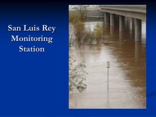
San Luis Rey Profile. 560 Square miles; 342 below Henshaw Dam; Third largest watershed in San Diego County; 242 tributaries adding up to 759 miles of perennial and intermittent stream; Primary land uses: agriculture, urban, tribal lands and some recreation. Assessment Questions.

E N D
San Luis Rey Profile • 560 Square miles; 342 below Henshaw Dam; • Third largest watershed in San Diego County; • 242 tributaries adding up to 759 miles of perennial and intermittent stream; • Primary land uses: agriculture, urban, tribal lands and some recreation.
Assessment Questions • History / status of steelhead trout populations; • The condition of natural watershed and stream processes; • Land use impacts on these processes; • Steelhead trout habitat conditions; • Conditions limiting steelhead (LFA); • Recommendations for improvement activities
Barriers Poor Water Quality
Non-Native Plants (Arundo donax) Homeless Encampments Exotic Fish Species and Anaerobic Conditions
Southern California Coast Steelhead (adult) in SLR River, May, 2007
Fish History and Status • Documented and anecdotal accounts report of steelhead runs in the SLR River and tributaries; • Prior to May 2007 observation, last sighting in 1997; • Pauma Creek - A healthy population of native rainbow trout. Genetic sampling performed in (1999) concluded that “it seems more than likely that these fish are part of a native coastal O. mykiss lineage.” • WF San Luis Rey River contains resident native trout.
Areas Surveyed • San Luis Rey River • 35 miles (18 miles in Coastal Subbasin; 12 miles in Southern Subbasin; and 5 miles in Middle Subbasin) • Tributaries surveyed • Pauma Creek – 3 reaches covering approximately 1.2 miles, located in the upper, middle and lower middle sections of the creek; • Keys Creek – approximately 2 ½ miles in the lower reach of the creek; • Small reaches (less than 1000 feet) of Ostrich Creek, Gopher Creek, Live Oak Creek, Gomez Creek, Wigham Creek, and Prisoner Creek.
Current Habitat Conditions • Stream Flow • The Basin is not hydrologically connected; • Stream flows in tributaries have been reduced through extraction for anthropogenic use; • Dry or intermittent reaches prevent connectivity with the estuary and thus the ocean.
Current Habitat Conditions cont. • Water Quality • Total Dissolve Solids and fecal coliform are constituents of concern, particularly in the Coastal Subbasin (Weston Solution 2007); • Stream bioassessments performed in 2005 & 2006. SLR River urban sites had Index of Biotic Ratings of Very Poor Reference site was the highest rated site in the county program (Weston Solutions 2007); • The SLR estuary’s health was assessed at poor to fair; • 2005 Ambient Bay and Lagoon Monitoring Program (Weston Solutions 2007), the SLR River estuary scored good for toxicology, fair for biology and good for chemistry.
SLR River Coastal Subbasin
SLR River Middle Subbasin
Pauma Creek Gomez Creek Northern Subbasin
SLR River – Wilderness Gardens Co. Park a Summer SLR River - Southern Subbasin Spring Winter
Instream Habitat Conditions • Spawning Gravels • Limited areas containing suitable spawning gravels in mainstem; • Spawning gravels more abundant in Pauma Creek and most likely in other tributaries in the Northern Subbasin including: Gomez Creek, Agua Tibia Creek, Frey Creek and Pala Creek; • Canopy Coverage • majority of the mainstem reaches and tributary reaches (70%) met or nearly met the 80% target value;
Instream Habitat Conditions cont. • Pools • Quality pool structure is generally lacking in mainstem throughout the basin; • Pool Depth - only one reach surveyed met standards for pool depth; • Pool Shelter – lacking throughout surveyed areas.
Habitat Summary • Northern Subbasins - Best habitat in the watershed but mostly inaccessible; • Middle Subbasin -Potential habitat but also inaccessible; • Coastal Subbasin -habitat restoration could provide critical instream and estuarine rearing habitat; • Southern Subbasin - Little to no flow therefore no habitat. Little habitat potential; • Upper Subbasin - Inaccessible but contains some trout habitat
Factors Limiting Steelhead Recovery • Lack of hydrologic connectivity and inadequate stream flows in the mainstem and tributaries; • Presence of temporal and/or complete barriers on the mainstem and important tributaries; • Loss of estuarine habitat; • High levels of fine sediments in the mainstem and tributaries, thus, limited areas of suitable spawning gravels; • Displacement of native riparian vegetation with exotic vegetation; • Competition with warm water gamefish, crayfish, and bullfrogs;
Barriers to Fish Passage Pauma Creek Oceanside Escondido Canal Diversion Dam Southern Subbasin
Present SLR River Estuary
Non-Native Species Mosquito fish Bluegill Largemouth bass Crayfish Green sunfish Black bullhead Bullfrog
Why Restore Steelhead? • Steelhead’s high genetic diversity and their remarkable capacity to persist in unfavorable environments; • Indicator of good water quality; • Interconnection between steelhead and riverine/riparian areas in southern California; • The bigger picture.
Flow and Water Quality Improvement Activities • Determine proper seasonal flow releases through Henshaw Dam and Escondido Canal Diversion; • Flushing flows would allow natural hydrologic processes occur creating and improving instream and riverine habitat; • Enforce maximum irrigation efficiency with both agricultural and urban users; • Identify potential pollution sources and address problematic areas; • Establish conservation easements, particularily along or near riverine habitats.
Fish Passage • Work with public agencies to modify existing fish passage barriers on the SLR River and key tributaries; • Meet with private landowners to discuss modifying/removing barriers located on their property
Riparian and Instream Habitat Improvement Activities • Continue eradication of Arundo, Tamarisk, and other invasive plant species; • Combine natural physical processes, i.e. flood dynamics, and riparian revegetation projects for the recovery of native natural communities and species; • Prioritize locations within the estuary where vegetation can be returned to salt tolerant species.
Erosion and Sediment Delivery Reduction Activities • Continue to encourage the use of Best Management Practices for nutrient runoff, pesticide management, and erosion control for homeowners and agricultural and industrial uses; • Existing sediment production problem sites that have potential to deliver sediments to streams should be evaluated and mitigated.
Education, Research, and Monitoring Activities • Continue to build upon current educational outreach to the community concerning the elimination of exotic flora and fauna; • Promote water conservation throughout the watershed; • Efforts to examine water quality have been ongoing and should continue throughout the watershed; • Perform water quality, water chemistry, and biological studies in the estuary; • Conduct instream and fish inventories on streams of the Northern Subbasin – Gomez, Aqua Tibia, Frey, and Pala Creeks
The End • Coastal Watershed Planning and Assessment Program website: http://coastalwatersheds.ca.gov/