Download
1 / 4
40 likes | 151 Views
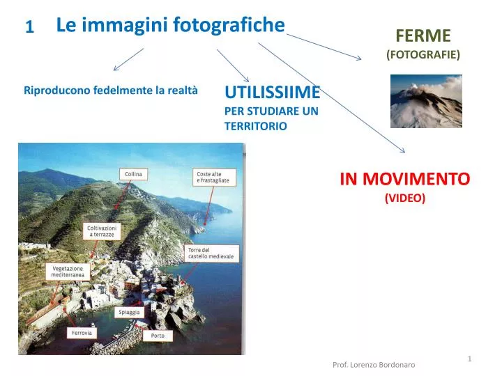
1. FERME (FOTOGRAFIE). UTILISSIIME PER STUDIARE UN TERRITORIO. Riproducono fedelmente la realtà. Le immagini fotografiche. IN MOVIMENTO (VIDEO). 2. Riprende ampie porzioni di territorio. Consente la realizzazione di. La fotografia aerea. Carte geografiche sempre più precise.

E N D
1 FERME (FOTOGRAFIE) UTILISSIIME PER STUDIARE UN TERRITORIO Riproducono fedelmente la realtà Le immagini fotografiche IN MOVIMENTO (VIDEO) Prof. Lorenzo Bordonaro
2 Riprende ampie porzioni di territorio Consente la realizzazione di La fotografia aerea Carte geografiche sempre più precise Foto aerea carta Prof. Lorenzo Bordonaro
3 I satelliti artificiali Con scanner e radar Le immagini satellitari Raccolgono moltissime informazioni le rielaborano al computer e le trasformano in immagini Prof. Lorenzo Bordonaro
4 Geographic Information System Il GIS Mette insieme I dati rilevati dai satelliti I dati del territorio elaborati dai computer GPS Carte geografiche aggiornate Prof. Lorenzo Bordonaro