Download
1 / 25
350 likes | 1.23k Views
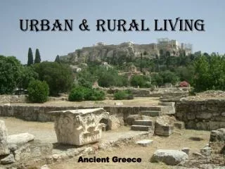
Rural to Urban Migration Urban development was created as a consequence of industrialization in the developed world… ‘urban pull’… industry then the city. Urban development was created by pop growth and migration to urban centres in developing countries….city first then industry… ‘rural push’

E N D
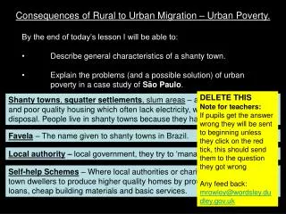
Rural to Urban Migration • Urban development was created as a consequence of industrialization in the developed world… ‘urban pull’… industry then the city. • Urban development was created by pop growth and migration to urban centres in developing countries….city first then industry… ‘rural push’ • Move from poverty and hunger to employment, services & water supply. • Impact of rural to urban migration in developing countries: • Migrants mostly young adults…> high fertility rate & so high rate of natural pop increase…. cities expand rapidly. • Young pop accounts for over 60% of urban pop growth. • Megacities… pop over 10m. E.g.. Calcutta, Lagos. • Squatter settlements called shanties & bustees (India) dev. on edge of city as city grows too quickly & cannot support jobs & housing.
Children forced to become beggars, labourers & prostitutes at a very young age…. family structures break down due to poverty. • Males more likely to migrate leaving an imbalance in gender. Case study: Bustees in Calcutta & Bombay • Over 60% of Calcutta’s pop live in bustees and over half a million are homeless, (pavement dwellers) sleeping on the street, live under bridges or along the canal. • Permanent slum dwellers are protected by law in Calcutta. 77% of families have only one room to live in. • Pavement dwellers have no rights. • Open sewers common & disease widespread. • Warm monsoon weather creates malaria. • Girls are restricted in the education they can receive • Child labour common & employ. prospects without education is poor
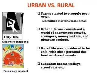
Impact of rural to urban migration in developed world: ‘Urban sprawl’… rapid spread of urban regions into countryside. Consists of large housing estates on edge of city…. quality housing with front & rear garden… contrast to bustees. Restrict urban sprawl by creating growth boundaries & with dev. of growth centres (with leisure & work facilities) some distance from city. E.g. Leystas & Almere in Holland away from Randstad. • Depop of rural areas due to migration to city…E.g. West of Irl • Young leave farms & rural areas lack pop & services. • Ethnic zone & ghettos in inner city as large groups move there. • Redev of inner cities (Dublin Docklands) and new apartments keeps pop there…. Mainly young single, close to work. • Counter-urbanization… people move away from city due to high cost of housing & poor quality of life, traffic, crime, lack of space.
Industry reluctant to set up in rural region due to lack of services & skilled workers • Daily movement of rural dwellers to & from work creates traffic chaos. Environmental impact caused by urban expansion: Industry, homes & cars producing greenhouse gases… atmosphere overheat---> global warming. Smog, a mixture of smoke & fog, builds up…. respitory problems Urban waste… up to 30% untreated and goes directly into rivers.
Site: the actual ground on which settlement is located. Situation: the location of settlement in relation to its surroundings, like other settlements, rivers, uplands. Location: combined description of site & settlement. Factors for location of settlement: Water supply: Constant, clean supply essential… close to rivers & lakes. Avoid flooding: dry sites at selected crossing points on rivers. Food supply: Sloping fertile land for farming… lowland areas. Defence: at bridging points or harbour entrances. Resources: tap into natural resources such as minerals E.g.. Silvermines in Tipperary. Harbours & bays: protection & trade.
Locations of historical settlements First settlers Earliest settlers about 9,000 yrs ago were hunters, gatherers & fisherfolk…. Middle stone age Lived close to rivers & lakes… water supply. Temporary coastal settlements found with mounds of sand, animal & fish bones called middens…. found on OS map near high tide levels on the coast. First farming settlements 7,000 yrs ago… new stone age. Chose sites in upland or raised, dry or hilly lowlands…. gritty soils, easier to till than lowland heavy clays. Main regions were the Burren, drumlin area from Dundalk to Sligo & west Cork where copper ore was found.
Buried the dead in stone tombs called megaliths. Bronze age people around 4,000 yrs ago. Evidence of stone circles, cairns, cist graves, fulacht fiadh indicate their sites. Celtic Settlements Iron age.. 650BC to 250AD… Celts with a structured society of royals, druids, judges, freemen & farmers. Introduced iron working into Irl Lived throughout farming lowlands in a dispersed pattern. Divided the country into tuaths. Built ring forts, crannógs, hill forts & promonotory forts on cliffs on elevated sites. Names like rath, dun & cashel identify Celtic settlements.
Small monastic settlements Early missionaries chose scattered, isolated sites. Remains found include stone churches & bee-hive huts. Settlements near a lake or river for food & water. Map evidence shows ch in red or place names with “cill”
Historic development of towns Large early Christian settlements. Monasteries built at route centres E.g. Clonmacnoise, Co Offaly. on fertile plains & river valleys E.g. Kells. Centres of religion & education. Monastery, church & round towers were central to the settlement all enclosed by circular stone wall. Identified on OS map by “cill” & “manistir” E.g Kilkenny. Towns grew around these and other functions like trade & metal work developed. These became a focus for route ways, creating a radial pattern.
Viking settlements Built at defensive sites on river estuaries. Acted as trading bases, providing safe anchorage for longboats. Examples… Dundalk, Limerick, Waterford. Norman settlements Came in 1169… built castle for protection & took over best farmland Built motte & bailey on defensive sites like bridging points, elevated sites. E.g. Cahir castle. As functions grew towns dev. around the castles, with high defensive walls & gateways. Abbeys & friaries built outside town walls… monastic land called granges. Centres of education, accommodation, hospitals & alms. Towns dev. into market centres & milling & tanning ind. dev. here… towns thrived & survived. Found on OS map in red… motte, castle, friary, grange.
Coastal Towns Defensive site controlling deep harbours. The meeting point of inland & coastal routeways….linear pattern Viking, Norman or plantation towns serving as ports & markets. Provided services & functions like milling, brewing, manufacturing & admin. centres. E.g. Limerick, Sligo, Galway. Canal Towns Rivers like the Barrow, Shannon & Liffey were deepened & widened & connected by canals in C18th & C19th. Allowed for movt. of goods & people & for trade to dev. Towns dev. along the canals such as Athy, Mullingar & Tullamore. Grain & timber was carried along the canals & mills flourished.
Planned plantation towns Built as part of plantations of Laois/Offaly, Munster & Ulster (1609) plantations. Purpose: defend settlers, create business by having a market, intro. Protestant faith. Have parallel or evenly wide streets with centrally placed protestant churches. Central diamond or square for markets & fairs & a market house. Later planned towns had wider streets (18th & 19thC) Birr & Durrow. Tall multi-storey buildings. Estate or demesne on edge of town surrounded by stone wall, for local landlord, with a manor.
Railway towns Railways built in C19th… brought increased trade in goods + passengers - hotels & markets dev. E.g.. Thurles, Mallow, Athlone. Trains faster & cheaper than canals so new towns dev. & canal towns into decline. Trains safer, faster & easier than sitting in traffic jams. Seaside towns Dev. as railways were built. Join towns to nearby cities… E.g. Bray & Tramore. Hotels & services dev. to cater for tourists. Wealthy people built holiday homes in these towns.
Expansion of large towns & cities C18th & C19th dev. during Georgian period. Suburbs with wide streets, squares & parks. Four storey red brick terraced mansions…. Many now changed into flats & business premises. E.g.. Merrion Sq & Stephen’s Green, Dublin. New Towns Shannon….. Meet the needs of pop working in industrial estates & airport. Tallaght…. Cater for surge in pop of Dublin as an overspill town.
Rural Settlement Patterns Dispersed: Pattern where home are scattered in an area. Associated with farmhouses & dev. When farms were enclosed after commonage farming was abandoned. 1960’s single houses built in countryside…. added to the pattern. Clustered: Group of houses dev. together. Dev. from ‘Clocháin’ system (group of farms owning separate parcels of land surrounding the houses) in the west. Farms also built in clusters in sth east. Dev. at road junctions around a shop or post office. Ribbon: Since 1960’s house dev. along roads leading into towns on individual sites. Encouraged by provision of services like water, electricity & money to be made from sale of sites. Now discouraged as it is unsustainable
Planning Strategies in Rural Areas • Sustainable dev. needed to plan for present & future needs. • Planners promote orderly dev to: • Ensure land is use for common good of all • Meet the needs of society housing, food, employ & leisure. • Support regional dev., social integration, urban renewal & maintain strong rural communities. • Protect the environment. This planning succeeds by: • Controlling transport dev, natural resources & efficient energy use. • Careful location of any buildings & their size. • Protecting natural environment & habitats. • Promote growth of towns & villages, socially & economically.
Councils must: Have a policy for planning & dev. Implement the National Development Plan Achieved by: Controlling & enforcing planning decisions Ensuring rural dev. respect natural environ & habitats. Encourage public participation & openness in planning decisions Responsive to change & reviewing developments every 5 yrs. Environmental issues: Growing demand for house in countryside by people working in urban centres…. Unsustainable because: Removed from services..work , schools & involve transport & road costs Individual septic tanks may pollute groundwater City boundaries become ill defined & create suburban dev.
Disputed as rural housing: Creates a healthier environment than a city Supports rural community life & services. Tend to have lower crime rates. Environmental Impact Assessment compulsory for: Major developments like roads or large forests (over 70 hectares) Location of waste disposal sites If a project might impact negatively on the environment. Strategic Environmental Assessment examines polices, plans & programmes of environmental impact assessments.
Urban Hierarchy, Hinterland & Central Place Theory • Settlements classified according to size, function & pop density. • Vary from a hamlet, village, town, city. Function is to provide services for their inhabitants & the surrounding hinterlands. • Central Place Theory tries to explain the relationship between the space & size of settlements. • Idea based on an isotropic landscape… flat plain with equal transport in all areas & no competition between areas. • Three Basic Concepts of Central Place Theory: • Range of goods: high, middle & low order. • Low order… bread, milk.. Not prepared to travel far to get them • Middle order… supermarket, doctor… travel a little further • High order… furniture, jeweler, university… willing to travel.
2. Frequency of demand: how often the service is needed…daily, weekly & this declines from low to high order services. 3. Threshold…. Min. pop. required to sustain a service. Supermarket requires higher threshold than a local shop. First order Second Order Hinterland or Trade Area Area served by a central place is called its hinterland. Distorted in shape with barriers like mountains or rivers…. reduce the ideal circular shape. Hinterlands vary in size but in high density pop lowlands a large number of villages may be viable. Hinterland is dependant the functions of a central place E.g.. Market town larger than a seaside town as its functions are greater.
Modern changes effect size & number of functions Decrease in services in smaller & increase in larger settlements. Due to: Transport (cars) so travel to purchase various order goods. Deep freezer & convenience foods reduce need for local shops Large settlements more competitive & so lower prices…attract more customers. Rural depop results in closure of some services. Criticism of Central Place Theory: Designed for a featureless plain… does not exist Modern transport like motorways & tunnels favour some centres. Pop is not evenly dispersed & people have preferences for areas. Settlements compete with each other to enlarge their hinterland.
Functions & services change over time Cities & towns are dynamic… in constant state of change of size, shape & plan… initial foundation now overshadowed by another function. Limerick.. Founded by Vikings as a defensive settlement & captured by Normans & then English in 1691. Today a university & industrial city & a commercial centre. Wexford… a port… this function no longer of major importance.
Changing Urban Land Use Patterns Land use has changed over time in response to economic & social conditions. Models & theories to explain this. Concentric zone theory: City divided into circular bands. Oldest at centre (1) CBD with some old industries (2) Oldest housing… also ghetto communities & light industries. (3) Band of new inter-war housing or middle class with green belt & parks. (4) Suburban housing 1960’s & older industrial estates (5) Suburban fringe, newest housing & dormitory towns. Heavy manuf. ind. on industrial estates & office services in business parks.
Multi-nuclei theory: Includes concentric theory but sees dev. around growth centres like hospitals, shopping centres & univ. Sector theory: land use attracted similar land use (ind., low-income housing) and formed a wedge shape as it expanded. CBD: Heart of city, major dept stores & specialist shops. Highest land values… competition for space & intensive land use-- tallest buildings. Financial & commercial land use most common. Industrial Zone: Industry in C19th located close to city centre… mills, steel works… near workforce. Now move out to edge & site replaced by shops offices & apartments. New ind. locate in industrial estates in suburbs… land cheaper Heavy ind. move to coast/ports. Modern light ind & offices move to business & technology parks
Shopping centres dev. on cheap land on edge of city…. capture wealthy mobile customers…. attract offices, hotels, ind. parks…. E.g. Liffey Valley. …. attract residents & CBD becomes less important. These centres become suburban downtowns. Land use zone in Developing world cities CBD… business, employment & entertainment centre. central square with govt. departments becomes focus of the city A spine of commercial land use radiates from the CBD with high class housing, offices, theatres & shops. Zone of maturity with best housing dev. as a sector around the core. Sectors of moderate & derelict housing also dev. Sectors of squatter settlements & shanty towns with hard working pop. surrounds the city. E.g. Latin American cities like Colombia.