Download
1 / 11
110 likes | 122 Views
Quantitative evaluation of regional precipitation forecasts for Belgium using multi-dimensional remote sensing observations (QUEST-B) Nicole van Lipzig a , Laurent deLobbe b , Susanne Crewell c a Physical and regional geography group, K.U.Leuven, Belgium

E N D
Quantitative evaluation of regional precipitation forecasts for Belgium using multi-dimensional remote sensing observations (QUEST-B) Nicole van Lipziga, Laurent deLobbeb, Susanne Crewellc a Physical and regional geography group, K.U.Leuven, Belgium b Royal Meteorological Institute of Belgium (RMI) c Meteorologisches Institut, Universität Köln Kwinten Van Weverberg (PhD project) Ingo Meirold-Mautner (PostDoc project)
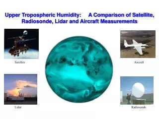
Multi-dimensional remote sensing satellite MSG ~ 5km; 15min • Cloud Mask • Cloud top pressure MODIS ~ 1km; 1day • Cloud Mask • Optical thickness LE IPT / Micro-wave GPS Ceilometer Radar 17 stations;Germany; 1min; ranges up to 4km • Cloud base height • Cloud cover (<4km) DX radar composite; 1km; 5min • Rain rate Polarimetric radar (DLR) 147 stations; Germany; 30min • IWV 1D vertical; Lindenberg (and Cabauw) • temperature profile • humidity profile • LWC
Radar of Wideumont • C-band Doppler Radar • Gematronik • Tower : 46 m • Antenna height : 592 m • Antenna diameter : 4.2 m • Measurements range: • 240 km for reflectivity • 120 km for velocity
Radar of Zaventem (Brussels) • C-band Doppler Radar • Radtec/Sigmet • On the top of Brucargo . ... building • Antenna diameter : 4.2 m • Measurements range: • 250 km for reflectivity • 120 km for velocity
Atmospheric models: • Lokal-Modell: LMK (LMKürzestfrist) (Δx=2.8 km) • Aladin (Δx=7 km; Δx=4 km) used for operational weather forecasting in Belgium: based on French AROME modeling system • Advanced Regional Prediction System: ARPS (Δx=3 km) LMK domain
Phase I: Model evaluation • Phase II: Compilation of precipitation distribution for two contrasting summer seasons • Improve understanding of causes for these differences in precipitation characteristics • Input for soil erosion models and crop models
Soil erosion in Flanders (Belgium) (Verstraeten et al. 2003) Orography of Belgium
Amount of precipitation is important for soil erosion Verstraeten and Poesen, 2006 Rain erosivity for a rain event Timeseries for the Belgian station Ukkel P (mm) per rain event
Sensitivity of the precipitation distribution for climatic changes • Temperature forcing at the lateral boundaries of the model domain (surrogate climate scenarios) • Effect of changes in atmospheric circulation (classification into weather types)
Summary • Evaluation of QPF for Belgium using different atmospheric modeling systems • Identify weaknesses and strengths of the different modeling systems (for regions, weather types, precipitation regimes …) • Insight in precipitation changes on a small scale for climatic changes • Interaction between different disciplines (meteorology, geography, agriculture) with respect to atmospheric branch of hydrological cycle