Download
1 / 23
230 likes | 243 Views
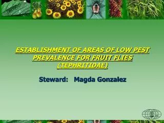
PROCEM Program of Control and Eradication of Fruit Flies. Applications of GIS (Geographical Information System). MENDOZA ARGENTINA. Medfly Campaigns 1990 to 1992 Objective: Diagnosis Activity: Trapping Number of traps: 1527. First attempts in the use of geographic coordinates.

E N D
PROCEM Program of Control and Eradication of Fruit Flies Applications of GIS (Geographical Information System) MENDOZA ARGENTINA
Medfly Campaigns 1990 to 1992 Objective: Diagnosis Activity: Trapping Number of traps: 1527
First attempts in the use of geographic coordinates Use of cartographical maps Use of graph generators
Medfly Campaigns 1992 to 2001 Objective: Eradication Activities: Monitoring Trapping Fruit sampling Control SIT Chemical Control Cultural control
FRUIT SAMPLING North Oasis: 18,891 East Oasis: 11,283 Central Oasis: 6,810 South Oasis: 15,099 TOTAL : 52,173 SIT CONTROL Total mumber of male medfly realeased: 4.591 bilions. Weekly average (Under release period): 104 milions Aerial release:90% of the area. Land release 10% of the area. Distribution: Over preestablished blocks on the North, East and South Oasis. In the Central Oasis: preventive releases on urban areas CHEMICAL AND CULTURAL CONTROL F.T.D RURAL AREAS OASIS FTD NORTH 0,00397 EAST 0,00207 CENTRAL 0,00010 SOUTH 0,00074 PROCEM - MENDOZA Field Data. Medfly Campaign 1999/2000 TRAPPING North Oasis:Jackson: 803 Mc Phail: 332 % of traps monitored: 96 East Oasis:Jackson: 880 Mc Phail: 260 % of traps monitored: 98 Central Oasis:Jackson: 712 Mc Phail: 204 % of traps monitored: 99 South Oasis:Jackson: 1.105 Mc Phail: 335 % of traps monitored: 99 Total number of traps on duty: 4.631 Total number of trap readings : 228.151
FRUIT SAMPLING North Oasis: 8,861 East Oasis: 5,069 Central Oasis: 6,810 South Oasis: 8,359 TOTAL : 28,683 SIT CONTROL Total mumber of male medfly realeased: 2.668 bilions. Weekly average (Under release period): 102 milions Aerial release:90% of the area. Land release 10% of the area. Distribution: Over preestablished blocks on the North, East and South Oasis. In the Central Oasis: preventive releases on urban areas F.T.D RURAL AREAS OASIS FTD NORTH 0,00023 EAST 0,00017 CENTRAL 0,00000 SOUTH 0,00011 PROCEM - MENDOZA Field Data. Medfly Campaign 2000/2001 (up to week 31, over 52 weeks) TRAPPING North Oasis:Jackson: 803 Mc Phail: 332 % of traps monitored: 97 East Oasis:Jackson: 880 Mc Phail: 260 % of traps monitored: 98 Central Oasis:Jackson: 712 Mc Phail: 204 % of traps monitored: 99 South Oasis:Jackson: 1.105 Mc Phail: 335 % of traps monitored: 99 Total number of traps on duty: 4.631 Total number of trap readings : 228.151 CHEMICAL AND CULTURAL CONTROL
Geographic Information System (G.I.S) GIS technology is aimed to understand facts which occur on earth using digital images on a computer
Geographic Information System (GIS) EACH DATA POINT IS AN ELEMENT SET UP IN THE SPACE THROUGH A PREDEFINED SYSTEM OF COORDINATES
IMPLEMENTATION • . Rearrangement of existing data bases and set up of new ones • . Election of a system of geographic projection • . Compilation and generation of cartography and digital images • . Election of a GIS system. • . Generation of program rutines to link the different data bases
APLICATIONS FRUIT SAMPLING TRAPPING HOST CENSUS. CHEMICAL AND CULTURAL CONTROL SIT
TRAPPING . Exact location of each trap . Spatial distribution in routes . Dispersion of fly catches . Additional information on individual traps
FRUIT SAMPLING . Coverage and distribution of fruit sampling . Exact place of each sampled location . Additional information of each fruit sample
CENSUS . Host distribution . Location and quantity of each species . Planification and coverage of Chemical and Cultural Control
SIT . Planification of the areas to be released . Control of plane releases . Information about each flight . Analysis of the sterile insect dispersal
Aerial releases Area under SIT: 160,000 ha Strain: TSL Sterile males released per week: 80.000.000 Density : 400- 800 males/ha Type of release: aerial in paper bags Flies per bag: 2,600 males Bags per week: 38,500 Number of blocks: 36 Area of each block: 4,000 – 4,500 ha Frequency: - weekly in 17 blocks - twice a week in 19 urban blocks Airports under operation: 4 Planes under operation: Cessna 172, Cessna 182 Capacity of planes: 700 bags (1,820,000 males) Weekly flights: 55 Average time of each flight: 50 minutes Weekly flight hours: 45 Total flight hours: 2000 Flight conditions: - Altitude: 1.000 feet - Mean speed: 100 miles/hour - Distance between bands: 300 m - Frequency between bags: 4-5 seconds
GIS IS AN EFFICIENT TOOL . For Administration . For Analysis . For Interpretation . For Diagnosis . For Planification . For Execution . For Control Useful on any program of pest control
ING. AGR. OSCAR DE LONGO - COORDINATOR PROCEM MENDOZA SR. EDGARDO ARLANDI, SR. ALBERTO TOBARES - SYSTEM DESIGNERS Http:www.iscamen.com.ar E-mail:procem@iscamen.com.ar AUTHORS: