Download
1 / 32
320 likes | 481 Views
Geospatial Technology and Data for Volunteer-based Wilderness Search and Rescue. GEOG 596A Capstone Peer Review Loren Pfau, MGIS Candidate Justine Blanford , Faculty Advisor 22 September 2011. Agenda. Introduction Objective Methodology Timeline Acknowledgements Questions .

E N D
Geospatial Technology and Data for Volunteer-based Wilderness Search and Rescue GEOG 596A Capstone Peer Review Loren Pfau, MGIS Candidate Justine Blanford, Faculty Advisor 22 September 2011
Agenda • Introduction • Objective • Methodology • Timeline • Acknowledgements • Questions “I have never been lost, but I will admit to being confused for several weeks.” – Daniel Boone
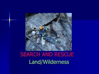
Search and Rescue Locating people/objects in • Urban settings (e.g. EMS, law enforcement) • Water (e.g. lost boats/ person USCG) • Land (e.g. lost aircraft (Civil Air Patrol, DND)) • Confined space (e.g. collapsed buildings, mines) • Wilderness – focus of my study
Primary Search & Rescue (SAR) Activities Search–looking for lost person. Rescue – extricating a person. Recovery – location and transport of a deceased.
Wilderness SAR? • National Park Service – paid professionals • VOLUNTEER based – Everywhere else • In most Western States SAR is responsibility of the County Sheriff • Many SAR teams are members of the Mountain Rescue Association and are funded by donations and fundraising, not tax dollars
SAR Incidents in USA, 1992-2007 • USA National Parks • Approximately 65,439 SAR missions • Approximately 4,090 per year Source: Heggie, 2009 • Colorado between 1995-2009 • Approximately 20,672 SAR Missions • Approximately 1,378 per year Source: CSRB, 2009
How is a lost/missing person successfully rescued/recovered in the wilderness?
SAR Mission Process SEARCH – RESCUE - RECOVERY
Search Preparation - Information Gathering Variety of sources, formats Paper: USGS 7.5" topo maps, 1:24,000 scale, various publication dates Smaller-scale topo maps, 1:50,000 and 1:100,000, various publication dates Park/NFS trail maps, scale varies by source, various publication dates Digital: Electronic topo maps (e.g. US National Map, Delorme Topo North America),variable scale and publication dates Aerial/Satellite Imagery, variable scale and publication dates Digital Elevation Models, National Elevation Dataset at 30, 10 and 3 meters GPS units with topo maps (e.g. Garmin MapSource) Volunteered Geographic Information (VGI). (e.g. OpenStreetMaps, 14ers.com)
Performing Search • Two step process • Hasty Search and containment - Landscape (e.g. vegetation, terrain) - Activity (e.g. hiking, running) • Local knowledge of area (SAR Team) • Detailed Search • Search Theory (originally developed during WWII) • Lost Person Behaviour (Koester, 2008) • Survival rates over time (Koester, 2008) unsuccessful
POS Probability of Success (chance of finding the person) POA Probability of Area (chance the person is in the search area) x = POD Probability of Detection (chance the person will be detected if in the search area) Search Theory From Ferguson, 2008
Lost Person Behavior • ISRID (International search and rescue incidents database) • SAR mission data from around the world (e.g. Australia, USA, UK) • information on subject type (e.g. age, mental state), search time (i.e. time it took to find the person), distance traveled, weather conditions etc. • Used to determine survival rate in different settings Hikers (all weather, terrain, N=3013) 4-6 year old child (all weather, terrain, N=205) Source: Koester, 2008
Post-Mission • Documentation for training and analysis purposes
Summary of SAR Need to Visualize, Analyze, Model, Manage and Document mission • Fundamentally a Geospatial Activity • Time-sensitive • 50% searches completed < 3 hours • 81% are over within 12 hours • 93% are complete within 24 hours Source: Koester, 2008
GIS and Emergency Management • US Coast Guard • Civil Air Patrol • Urban Fire and EMS • Wildland Firefighting • Natural Disasters • Avalanche Forecasting & Mitigation • Social Media (Facebook, Twitter)
Applying GIS technologies for wilderness SAR • MapSAR (Not released and is currently under development) – extension for ESRI ArcGIS • National Park Service GIS tools • Mountaineer Area Rescue Group
Limited use of GIS for wilderness SAR? • SAR teams mainly volunteer • Lack of GIS expertise within SAR teams to use GIS and maintain databases • Lack of Funding – training, cost software
SAR Information is Changing Traditionally: a telephone call and a topo map Now: e911 Phase II, social media, smartphone apps, mapping GPS units, GIS, etc. A wealth of geospatial data becoming available but understanding of how to access and use this data is in early stages of development • Moving from “Search For” to “Go To” environment in real-time at the click of a button
Location Information • AccuTerraOnDemand • Geotagged iPhone photo
Tracking • APRS tracking • Google Latitude • SPOT Satellite Messenger
Alternative Baselayer Sources • OpenStreetMap trails • Avalanche paths near Loveland Ski Area, CO
Some Examples • 14ers.com route and trip reports • Wireless e911 Call
Objective Challenges facing SAR teams is understanding • what information is available and how to access • how reliable is the data/information • how the data may be utilized, managed and integrated during time-sensitive missions. Purpose: To evaluate what data and technology may be effectively used in wilderness SAR missions
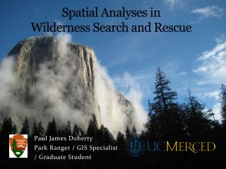
Methodology • Data Gathering • Assessment of Data and Technology Study Area: Colorado
Methodology – Data Mission Data Gathering and Analysis • Current mission data is logged in paper format - Data for 2-5 years of mission will be digitalized • Data will be used for part II: Assessment of Data and Technology • Interviews and short survey Data Needs: Critically assess data needs within current SAR group Alpine Rescue Team and two external SAR groups
Methodology – Technology Technology Assessment: Critically assess a variety of Geospatial tools • Identity a wide variety of Geospatial technologies that will include: full GIS, on-line mapping tools, smartphone apps • Develop assessment criteria Testtechnology (1-3 apps (1 Full GIS, 1 online mapping, 1 Smartphone App)) during real SAR mission
Some criteria that may be used to critique Geospatial tools (still to be determined) • Easy to learn • Ease of use • Ability to integrate data • Analytical capabilities • Accuracy • For smartphones – coverage (is coverage reliable) • For smartphone apps – accuracy of tracks, coordinates • How useful was the application during a mission? (e.g. quick to get information)
Expected Results/Outcomes • Summary of data needs (type of data and scale, human expert knowledge, historical missions) • Summary of data sources and strengths and weaknesses • Summary of Geospatial Software strengths and weaknesses and how rated/ranked based on criteria • Summary of how each of the 1-3 selected software apps performed in a real SAR operations
Timeline • Mission Data • Compile – 2 Months • Analyze – 1 Month • Survey of SAR Team Use of Geospatial Data and Technology – 4 Months • Create • Compile • Analyze • Assess Technologies – 4 Months • Test Technologies – 2 Months • Target Presentation: Mountain Rescue Association Spring Meeting – June/July 2012
Acknowledgements • Justine Blanford • Members of the Alpine Rescue Team and Rocky Mountain Rescue Group